Nana
Posted: Tue Sep 01, 2020 4:13 pm
Tuesday Evening Update
Nana heading toward Belize
The Weather Situation
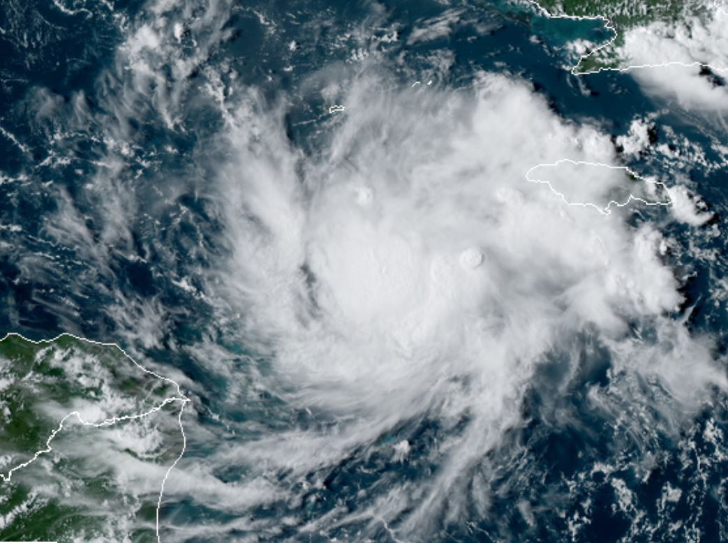
Per my tweet this morning, it was obvious from the satellite imagery that the disturbance was at least a tropical depression if not stronger. Nana was classified at 11 am as a tropical storm after the recon confirmed.
For more frequent updates: Twitter: https://twitter.com/richjohnsonwx
Current tropical weather
As of 5:00 PM EDT Nana was centered at 16.8 N / 79.3 W or about 425 miles east of Limon, Honduras. It was moving west 18 mph. Officially top sustained winds are estimated at 50 mph. Pressure was estimated at 1002 hPa (mb).
Tropical Weather Forecast:
Nana may become a hurricane before landfall Wednesday night in Belize. Rush to complete all necessary hurricane prepartions.
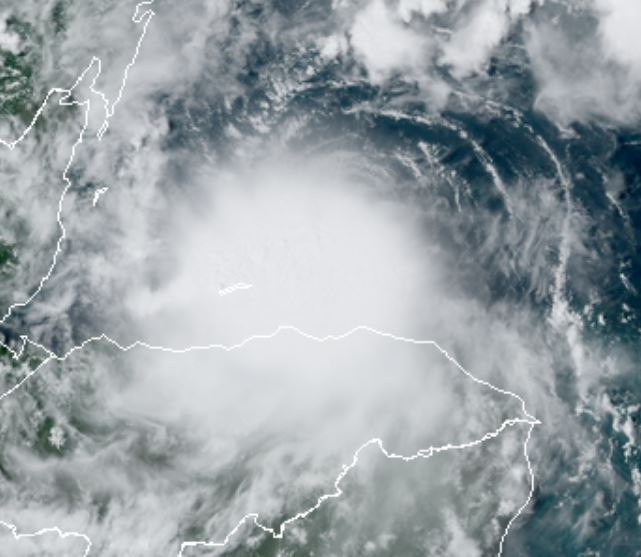
Tropicast: Visible Satellite
Nana heading toward Belize
The Weather Situation
Per my tweet this morning, it was obvious from the satellite imagery that the disturbance was at least a tropical depression if not stronger. Nana was classified at 11 am as a tropical storm after the recon confirmed.
For more frequent updates: Twitter: https://twitter.com/richjohnsonwx
Current tropical weather
As of 5:00 PM EDT Nana was centered at 16.8 N / 79.3 W or about 425 miles east of Limon, Honduras. It was moving west 18 mph. Officially top sustained winds are estimated at 50 mph. Pressure was estimated at 1002 hPa (mb).
Tropical Weather Forecast:
Nana may become a hurricane before landfall Wednesday night in Belize. Rush to complete all necessary hurricane prepartions.
Tropicast: Visible Satellite