Omar
Posted: Tue Sep 01, 2020 8:01 am
Tuesday morning Update
TD 15 east of North Carolina
The Weather Situation
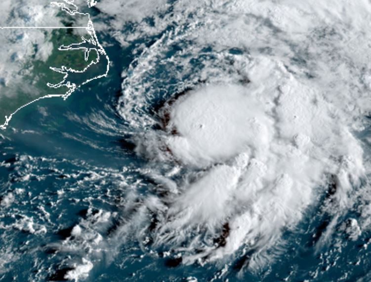
TD 15 has a central dense overcast that is small, but is sheared. It does appear to be expanding.
For more frequent updates: Twitter: https://twitter.com/richjohnsonwx
Current tropical weather
As of 5:00 AM EDT TD 15 was centered at 34.1 N / 74.4 W or about 100 miles SE of Cape Hatteras, NC. It was moving NE 13 mph. Officially top sustained winds are estimated at 35 mph. Pressure was estimated at 1008 hPa (mb).
Tropical Weather Forecast:
TD 15 is now expected to remain a tropical depression. IMO there is still a chance for it to become a minimal tropical storm over the Gulf Stream. No effects are expected on land.
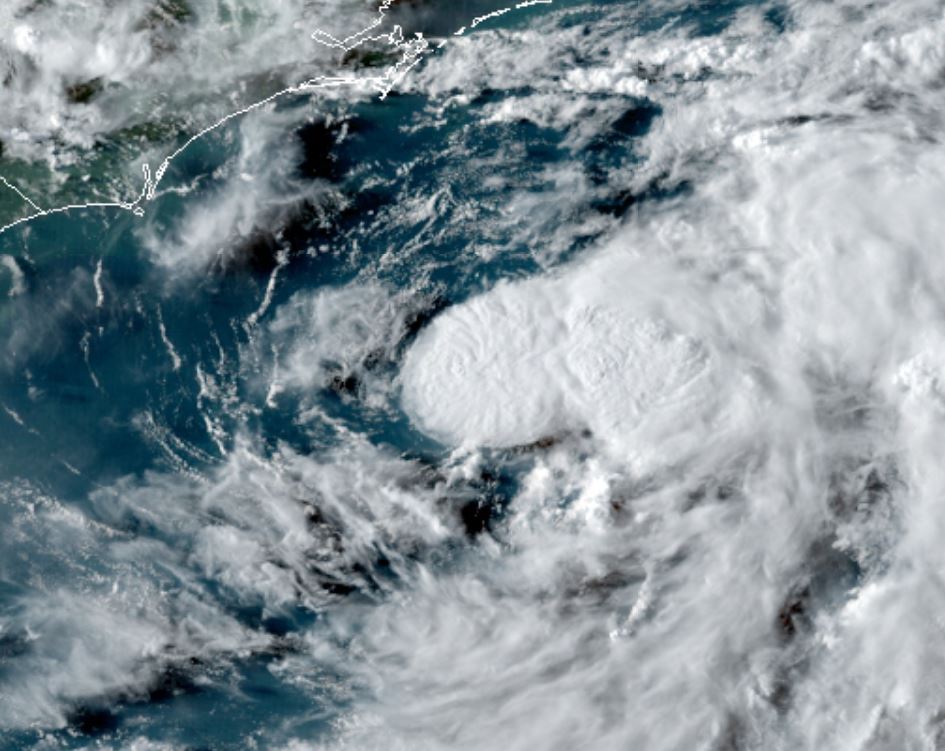
Tropicast: Visible Satellite Monday Evening
Tropicast: Visible Satellite Tuesday Morning
TD 15 east of North Carolina
The Weather Situation
TD 15 has a central dense overcast that is small, but is sheared. It does appear to be expanding.
For more frequent updates: Twitter: https://twitter.com/richjohnsonwx
Current tropical weather
As of 5:00 AM EDT TD 15 was centered at 34.1 N / 74.4 W or about 100 miles SE of Cape Hatteras, NC. It was moving NE 13 mph. Officially top sustained winds are estimated at 35 mph. Pressure was estimated at 1008 hPa (mb).
Tropical Weather Forecast:
TD 15 is now expected to remain a tropical depression. IMO there is still a chance for it to become a minimal tropical storm over the Gulf Stream. No effects are expected on land.
Tropicast: Visible Satellite Monday Evening
Tropicast: Visible Satellite Tuesday Morning