Josephine
Posted: Fri Aug 14, 2020 8:21 am
Friday Morning Update
Wind shear continues
The Weather Situation
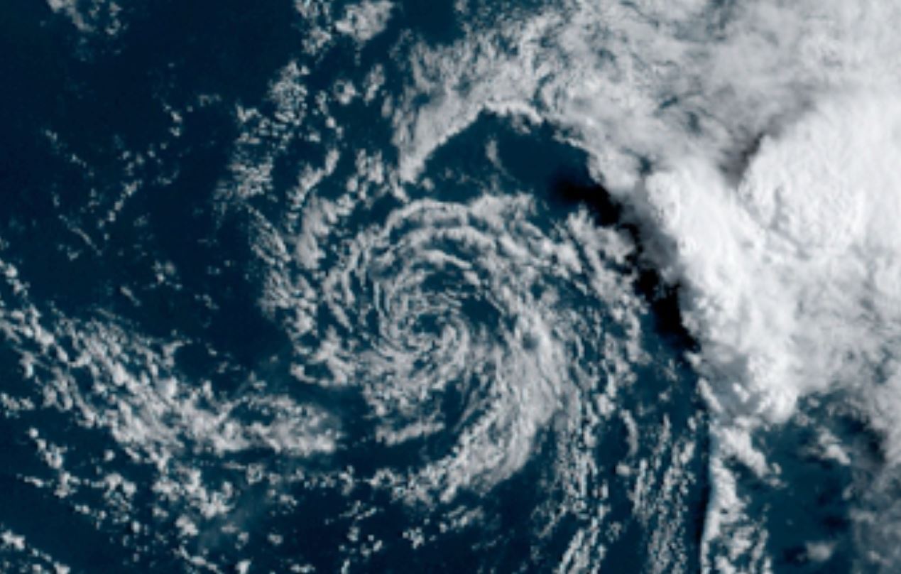
Josephine continues to fight wind shear despite having some impressive bursts of convection. This has been the story of the whole life cycle of Josephine even before it was classifed as a tropical cyclone.
For more frequent updates: Twitter: https://twitter.com/richjohnsonwx
Current tropical weather
As of 5:00 AM EDT Tropical Storm Josephine was centered at 15.3 N / 53.3 W or about 680 miles ESE of the Leeward Islands. It was moving WNW 17 mph. Officially top sustained winds are estimated at 40 mph. Pressure was estimated at 1006 hPa (mb).
Tropical Weather Forecast:
Josephine will move NE of St. Martin / St. Maarten in the northeastern Leewards on Saturday. It will face increasing wind shear and weaken as it changes course to the northwest.
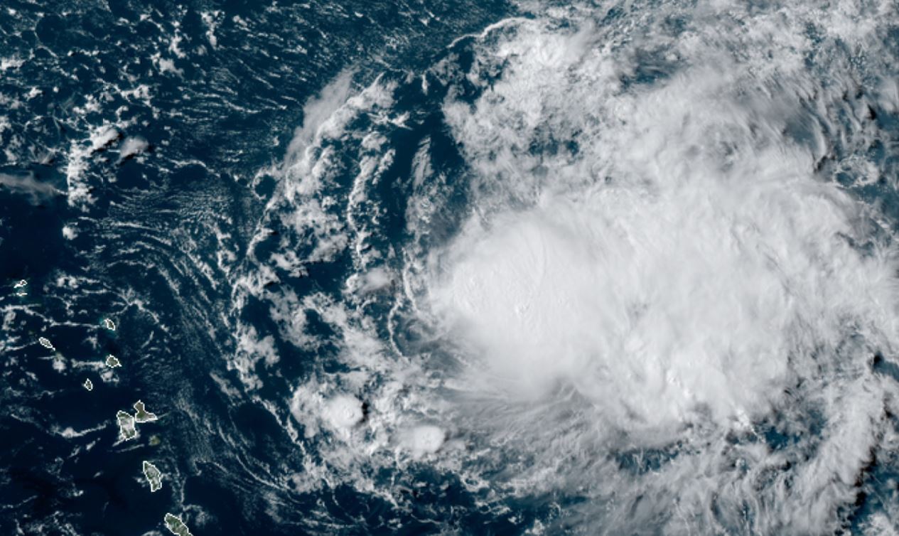
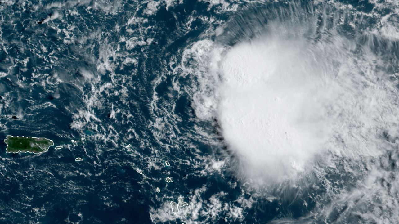
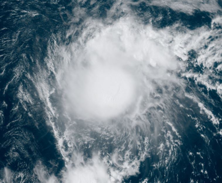
Tropicast: Visible Satellite several days ago
Tropicast: Visible Satellite several days ago
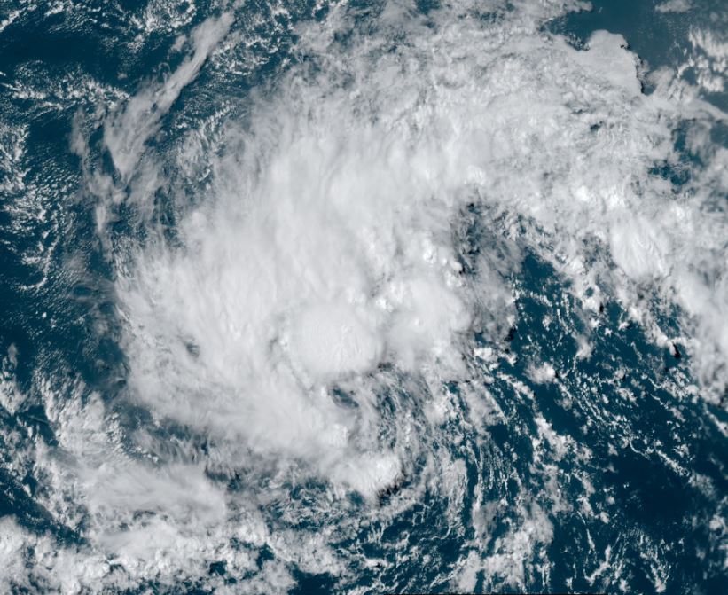
Tropicast: Visible Satellite yesterday
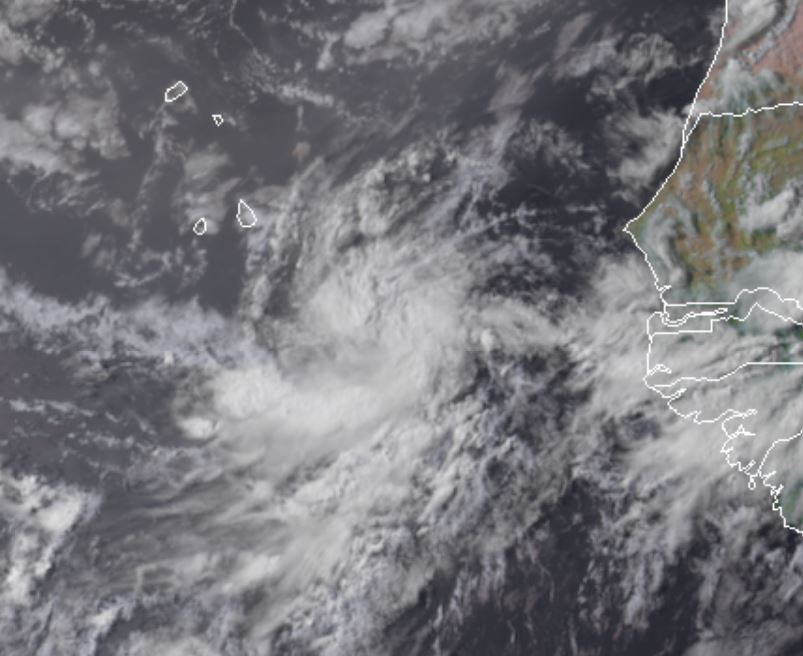
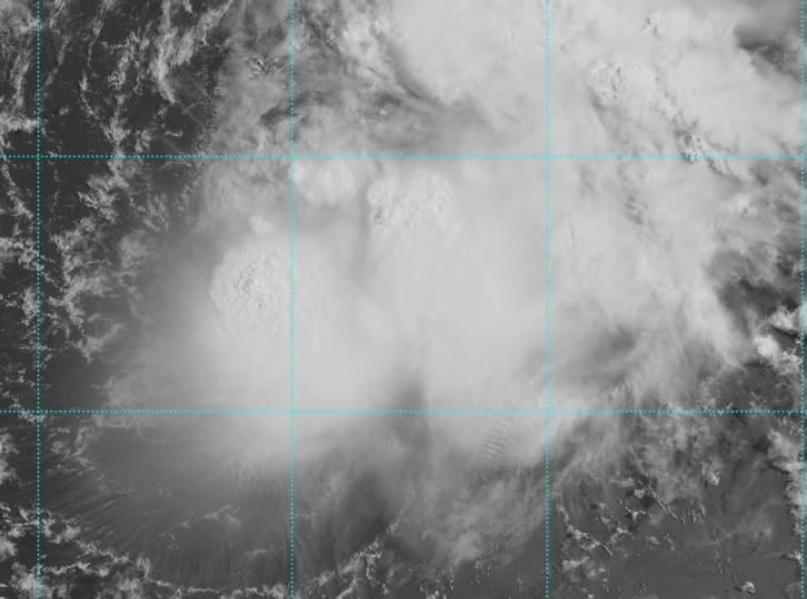
Tropicast: Visible Satellite Friday AM
Wind shear continues
The Weather Situation
Josephine continues to fight wind shear despite having some impressive bursts of convection. This has been the story of the whole life cycle of Josephine even before it was classifed as a tropical cyclone.
For more frequent updates: Twitter: https://twitter.com/richjohnsonwx
Current tropical weather
As of 5:00 AM EDT Tropical Storm Josephine was centered at 15.3 N / 53.3 W or about 680 miles ESE of the Leeward Islands. It was moving WNW 17 mph. Officially top sustained winds are estimated at 40 mph. Pressure was estimated at 1006 hPa (mb).
Tropical Weather Forecast:
Josephine will move NE of St. Martin / St. Maarten in the northeastern Leewards on Saturday. It will face increasing wind shear and weaken as it changes course to the northwest.
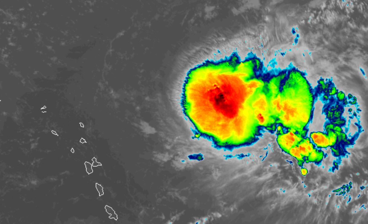
Tropicast: Visible Satellite several days ago
Tropicast: Visible Satellite several days ago
Tropicast: Visible Satellite yesterday
Tropicast: Visible Satellite Friday AM