Nestor
Posted: Fri Oct 18, 2019 7:59 pm
Friday Night Update
Nestor Moving toward north Florida
The Weather Situation
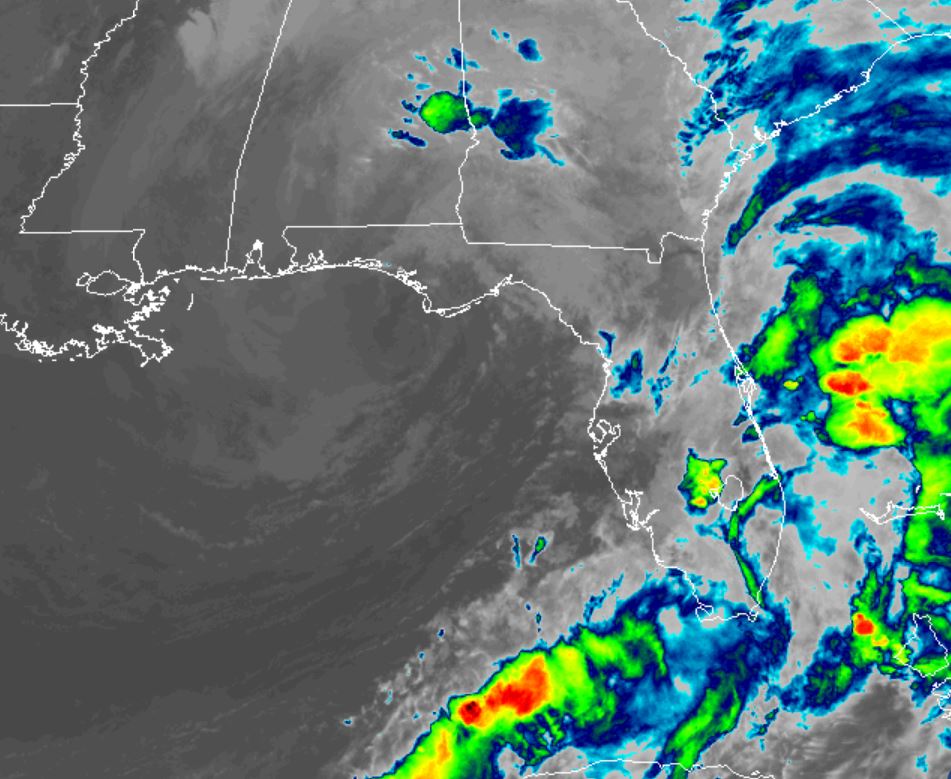
The main effect to be concerned about with tropical storm Nestor will be storm surge flooding. The area of most concern will be the coastal Big Bend of Florida. Several inches of rainfall, winds in the tropical force range and isolated tornadoes are also possible.
For more frequent updates: Twitter: https://twitter.com/richjohnsonwx
Current tropical weather
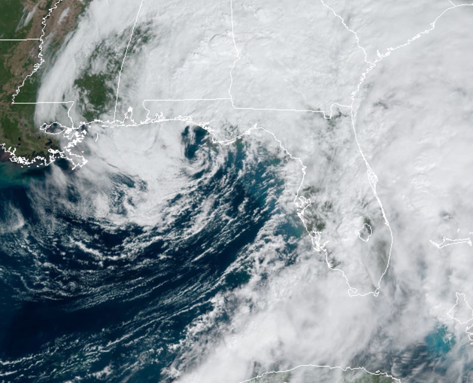
As of 7:00 PM CDT Lorenzo was centered at 27.6 N / 87.6 W or 215 miles SW of Panama City, Florida. It was moving NE at 22 mph. Top sustained winds are estimated at 60 mph. Pressure was estimated at 999 hPa.
Tropical Weather Forecast:
Nestor will make landfall by tomorrow morning on the Florida Panhandle. The worst effects will be to the east of the low center - near the coastal Big Bend of Florida.
Tropicast: Visible Satellite Friday Afternoon
Tropicast: IR Satellite Friday Night 9 pm edt
Nestor Moving toward north Florida
The Weather Situation
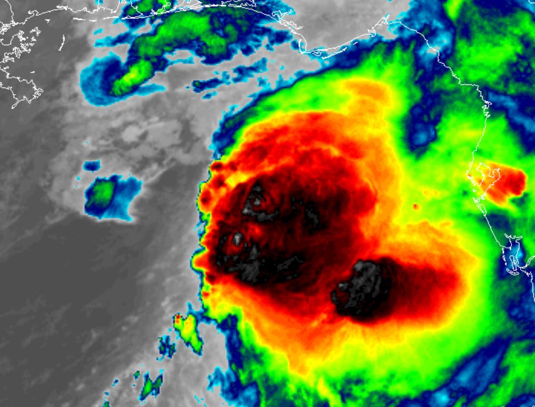
The main effect to be concerned about with tropical storm Nestor will be storm surge flooding. The area of most concern will be the coastal Big Bend of Florida. Several inches of rainfall, winds in the tropical force range and isolated tornadoes are also possible.
For more frequent updates: Twitter: https://twitter.com/richjohnsonwx
Current tropical weather
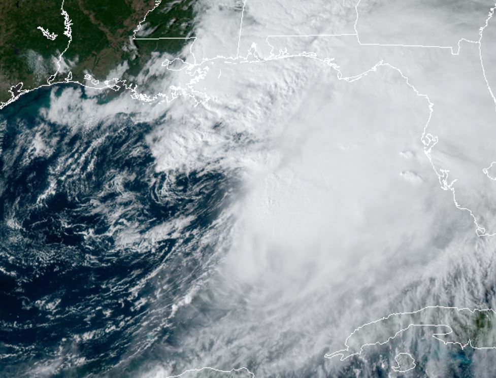
As of 7:00 PM CDT Lorenzo was centered at 27.6 N / 87.6 W or 215 miles SW of Panama City, Florida. It was moving NE at 22 mph. Top sustained winds are estimated at 60 mph. Pressure was estimated at 999 hPa.
Tropical Weather Forecast:
Nestor will make landfall by tomorrow morning on the Florida Panhandle. The worst effects will be to the east of the low center - near the coastal Big Bend of Florida.
Tropicast: Visible Satellite Friday Afternoon
Tropicast: IR Satellite Friday Night 9 pm edt