Matthew
Moderator: Florida Beach Gal
- Tropical Inspector
- Site Admin
- Posts: 3682
- Joined: Tue Feb 20, 2007 2:28 pm
- Antispam: no
- Location: Under a palm tree
- Contact:
Matthew
Friday Evening Update
Matthew rapidly strengthened today
The Weather Situation
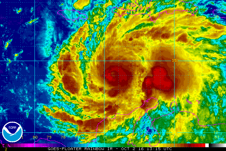
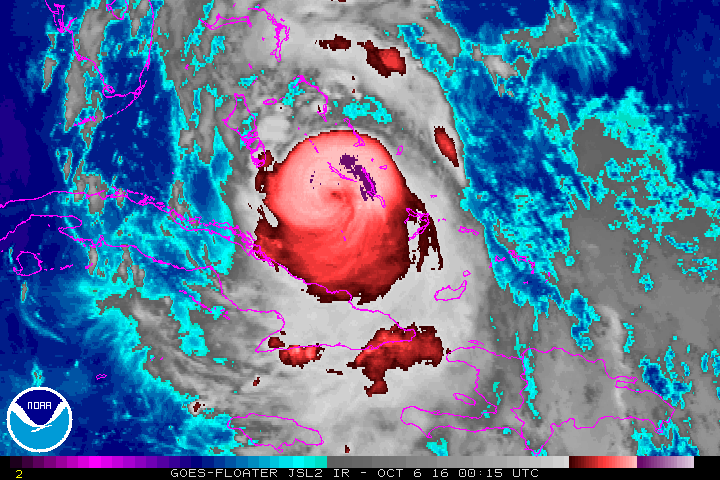
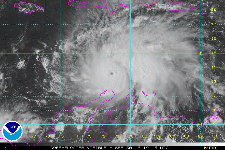
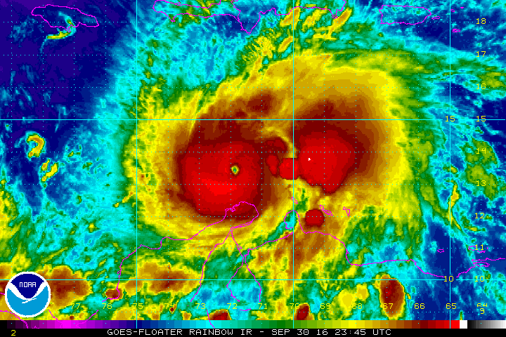
Matthew has undergone a rapid deepening phase over the past 24 hours. It is a category 4 hurricane. Interests in Jamaica, Haiti and eastern Cuba as well as the Bahamas should make preparations for hurricane conditions. IR satellite imagery shows a very impressive eye. Matthew is unusually far south and some effects are being felt on the northern coast of Venezuela.
Current Tropical Weather
As of 8 PM EDT Hurricane Matthew was centered at 13.5 N / 72.9 W or 440 miles SE of Kingston, Jamaica. It was moving WSW at 9 mph. Top sustained winds are estimated at 150 mph. Pressure was estimated at 945 mb.
Tropical Weather Forecast:
Matthew will turn to the north over the weekend toward eastern Jamaica by Monday. Models vary after this. The Euro stalls Matthew just east of the Florida east coast for a number of days. The GFS takes Matthew close the eastern seabord from Florida up to New England over the next seven days. In any case, persons living along any of the eastern seaboard should follow the progress of Matthew for next week.
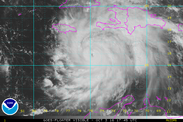
Tropicast: Afternoon Visible Satellite
Tropicast: Current IR Satellite
Rich Johnson
Twitter: https://twitter.com/richjohnsonwx
Certified Broadcast Meteorologist - Hurricane Expert
Twitter: https://twitter.com/richjohnsonwx
Certified Broadcast Meteorologist - Hurricane Expert
- Tropical Inspector
- Site Admin
- Posts: 3682
- Joined: Tue Feb 20, 2007 2:28 pm
- Antispam: no
- Location: Under a palm tree
- Contact:
Re: Matthew
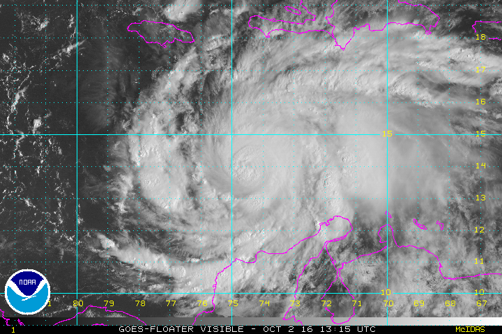
Sunday Morning Update
Matthew starting to turn
The Weather Situation
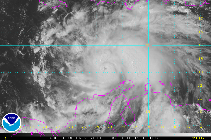
Matthew was a category 5 hurricane at 160 mph for six hours overnight Thursday night. Since then there have been some fluctuations in wind speed. Jamaica, Hispaniola (especially Haiti) and eastern Cuba will see storm surge, strong winds, and heavy rainfall that will cause mudslides and flooding.
Current Tropical Weather
As of 8 AM EDT Hurricane Matthew was centered at 14.1 N / 74.3 W or 315 miles SSE of Kingston, Jamaica. It was moving NW at 5 mph. Top sustained winds are estimated at 150 mph. Pressure was estimated at 947 mb.
Tropical Weather Forecast:
Forecast models are becoming more consistent in the track of Matthew. Matthew will move northward affecting the eastern coast of Cuba, Jamaica and Hispaniola, then into the Bahamas and Turks and Caicos. Toward the end of the week Matthew may affect the mid Atlantic coast and Northeast coast. It is too early to tell if there will be a landfall or if most of the worst effects will remain offshore. Now is the time to prepare on the east coast of the U.S.
Tropicast: Saturday Visible Satellite
Tropicast: Current Visible Satellite
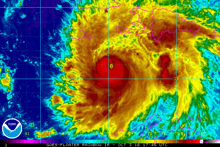
Tropicast: Current IR Satellite
Rich Johnson
Twitter: https://twitter.com/richjohnsonwx
Certified Broadcast Meteorologist - Hurricane Expert
Twitter: https://twitter.com/richjohnsonwx
Certified Broadcast Meteorologist - Hurricane Expert
- Tropical Inspector
- Site Admin
- Posts: 3682
- Joined: Tue Feb 20, 2007 2:28 pm
- Antispam: no
- Location: Under a palm tree
- Contact:
Re: Matthew
Monday Afternoon Update
Matthew heading toward northern Caribbean Islands
The Weather Situation
Satellite imagery continue to show Matthew as a very dangerous hurricane as it is moves north toward western Haiti, extreme eastern Cuba and Jamaica during the next 24-36 hours. Heavy rainfall inducing mudslides are likely in mountainous regions along with damaging winds and storm surge.
Earlier the eye of the hurricane passed directly over a buoy, but winds were only measured to 80 knots (92 mph). Pressure was measured at 943 mb.
Current Tropical Weather
As of 2 PM EDT Hurricane Matthew was centered at 15.9 N / 74.8 W or 195 miles SE of Kingston, Jamaica. It was moving north at 6 mph. Top sustained winds are estimated at 140 mph. Pressure was estimated at 940 mb.
Tropical Weather Forecast:
Forecast models have shifted west on the latest runs today. Both the Euro and GFS now take Matthew toward the US coast. It will be just east of the Florida coast Thursday / Friday and east of the Carolinas by this Saturday.
Tropicast: Buoy report from Monday Morning
Tropicast: Visible Satellite
Tropicast: IR Satellite
Rich Johnson
Twitter: https://twitter.com/richjohnsonwx
Certified Broadcast Meteorologist - Hurricane Expert
Twitter: https://twitter.com/richjohnsonwx
Certified Broadcast Meteorologist - Hurricane Expert
- Tropical Inspector
- Site Admin
- Posts: 3682
- Joined: Tue Feb 20, 2007 2:28 pm
- Antispam: no
- Location: Under a palm tree
- Contact:
Re: Matthew
Tuesday Morning Update
Matthew over the southern peninsula of Haiti
The Weather Situation
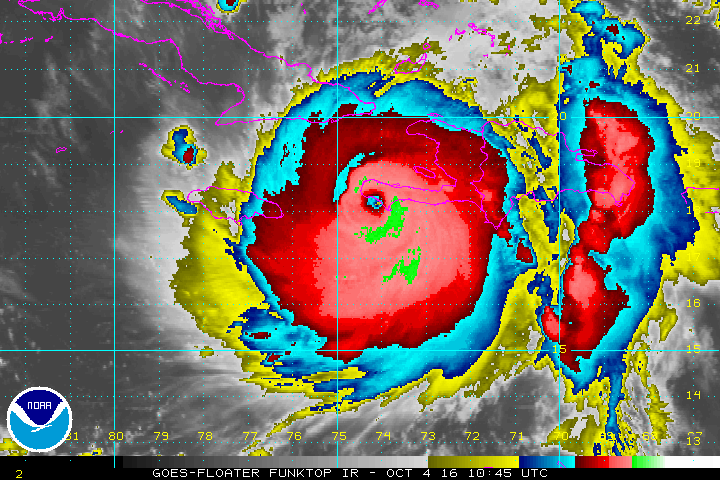
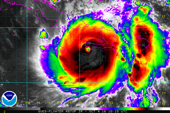
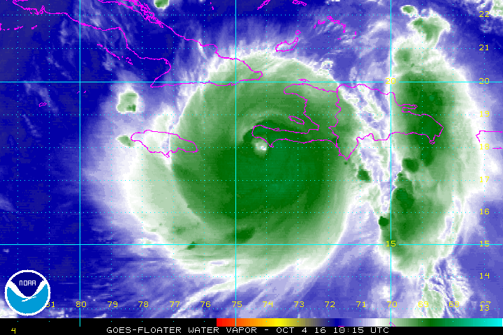
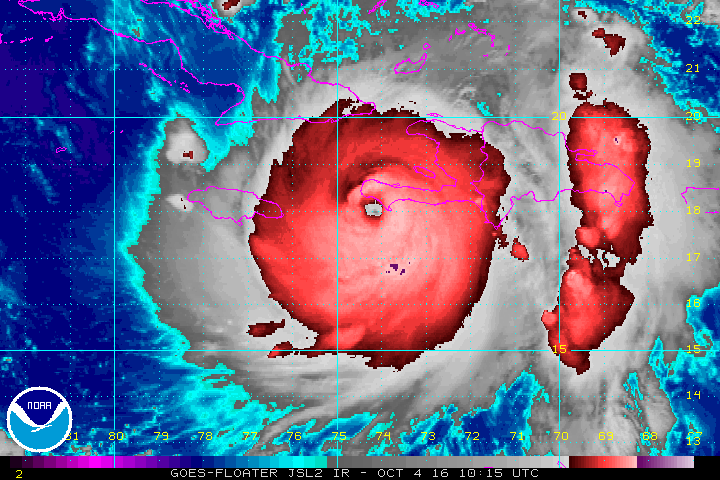
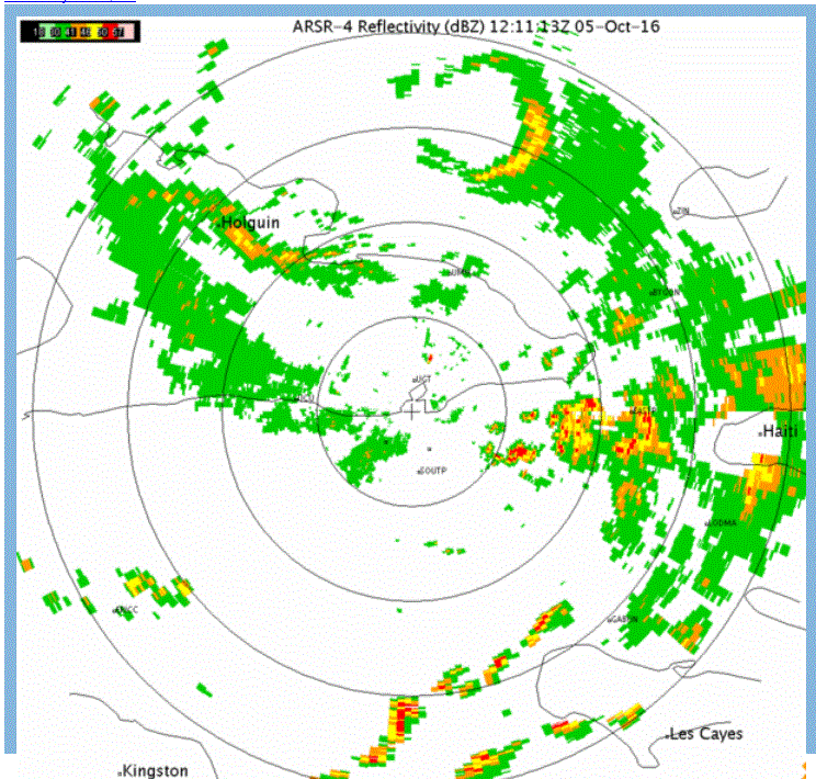
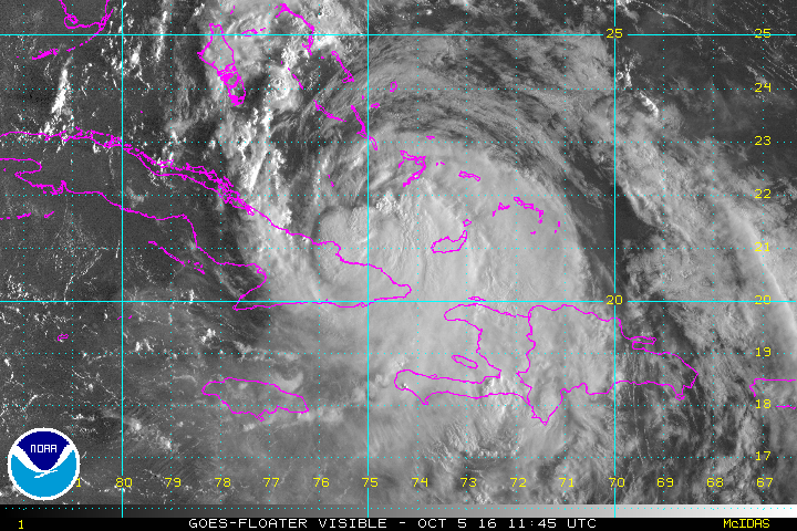
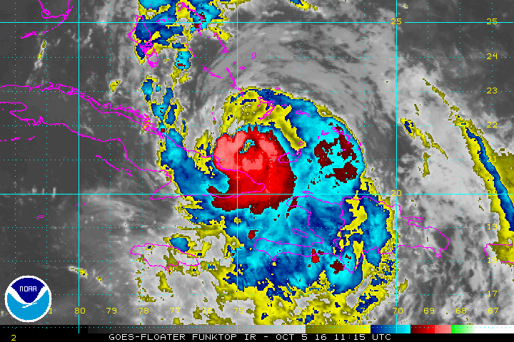
Matthew has made landfall on the southern peninsula of Haiti at 7 AM EDT at Les Anglais. Compared to a few days ago, the CDO or central dense overcast containing the strongest winds has expanded. The slight eastern wobble during yesterday has allowed Matthew to spare Jamaica from the worst effects. The eastern end of the island still may see some damage from strong wind gusts.
Haiti is faring much more poorly. The strongest part of the hurricane is now just east of the eye over the southern peninsula. Port Au Prince will soon see strong winds and torrential rains. Serious damage will be experienced over Haiti today as Matthew passes over the area. See the official NHC advisory for the official estimates of rainfall and storm surge. Effects from Matthew will spread into extreme eastern Cuba today.
Current Tropical Weather
As of 8 AM EDT Hurricane Matthew was centered at 18.4 N / 74.2 W or 10 miles east of Tiburon, Haiti. It was moving north at 9 mph. Top sustained winds are estimated at 145 mph. Pressure was estimated at 934 mb.
Tropical Weather Forecast:
The Euro and GFS are now in good agreement. Matthew will move into the south central Bahamas Tuesday night / into Wednesday and turn more northwest. It then should be east of SE Florida on Thursday and pass just east of the east central and NE coast Thursday night and Friday morning. Matthew continues north, just east of the Georgia coast on Friday and be near Charleston, SC Friday evening. A more northeasterly turn will take Matthew up the SC coast near Myrtle beach on Saturday morning and along the NC coast on Saturday. It will then accelerate farther offshore off of the Mid-Atlantic and New England coast during Sunday, making landfall either in Nova Scotia or eastern Maine.
Keep in mind even though the models are now more consistent, the forecast track / speed can change especially several days out. Now is the time to complete hurricane preparations in the Bahamas and eastern Florida.
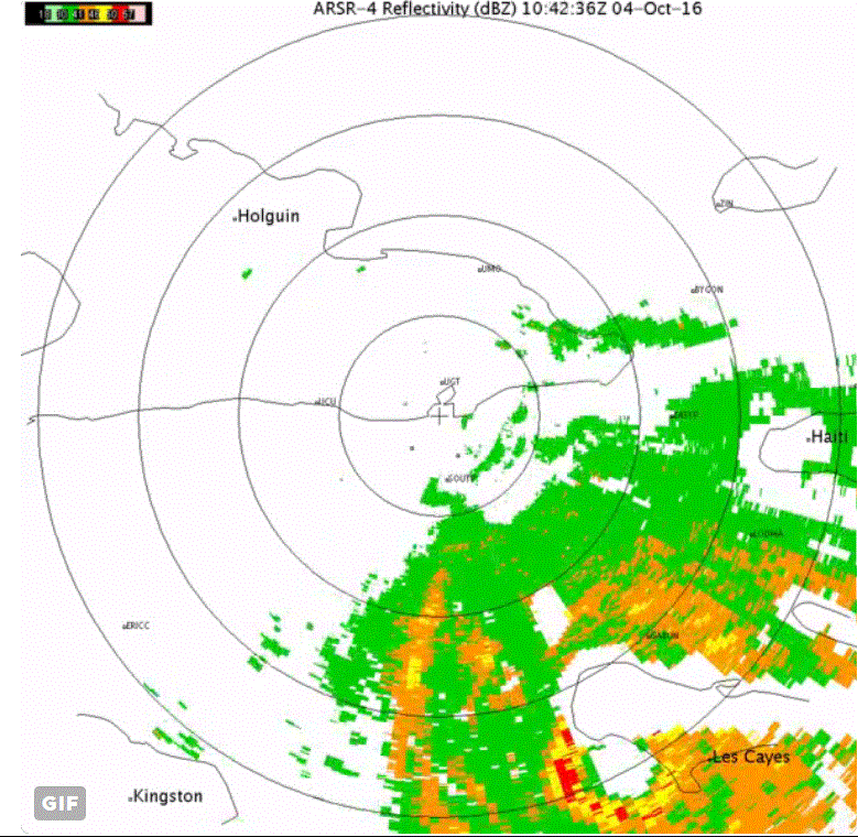
Tropicast: Guantanamo Bay, Cuba Radar
Satellite Imagery
Tropicast: IR Satellite
Tropicast: IR - Water Vapor Satellite
Tropicast: IR Satellite
Rich Johnson
Twitter: https://twitter.com/richjohnsonwx
Certified Broadcast Meteorologist - Hurricane Expert
Twitter: https://twitter.com/richjohnsonwx
Certified Broadcast Meteorologist - Hurricane Expert
- Tropical Inspector
- Site Admin
- Posts: 3682
- Joined: Tue Feb 20, 2007 2:28 pm
- Antispam: no
- Location: Under a palm tree
- Contact:
Re: Matthew
Wednesday Morning Update
Matthew moving into Bahamas
The Weather Situation
Matthew has weakened considerably after being affected by the terrain of Cuba and Hispaniola. It still remains a major hurricane. Satellite imagery shows heavy rainfall moving into the southern Bahamas and Turks and Caicos. Heavy rain continues over Hispaniola and southeastern Cuba. The southern end of the eyewall remains over southeastern Cuba with hurricane force conditions still likely there.
Current Tropical Weather
As of 8 AM EDT Hurricane Matthew was centered at 21.5 N / 74.9 W or 115 miles south of Long Island, Bahamas. It was moving NNW at 10 mph. Top sustained winds are estimated at 115 mph. Pressure was estimated at 964 mb.
Tropical Weather Forecast:
The models have changed drastically over the past 24 hours. This is a classic example of how one feature in the atmosphere can greatly alter a forecast track. The subtropical ridge is building farther west than previously expected. Now both the GFS and Euro stall Matthew near the South Carolina coast by around Saturday night. With the strong ridge in place the models now turn Matthew back south. It is possible that Matthew will continue back toward Florida sometime next week.
Please refer to official National Hurricane Center advisories and local officials for direction on evacuations and other pertinent information
Tropicast: Guantanamo Bay, Cuba Radar
Tropicast: Visible Satellite
Tropicast: IR Satellite
Rich Johnson
Twitter: https://twitter.com/richjohnsonwx
Certified Broadcast Meteorologist - Hurricane Expert
Twitter: https://twitter.com/richjohnsonwx
Certified Broadcast Meteorologist - Hurricane Expert
- Tropical Inspector
- Site Admin
- Posts: 3682
- Joined: Tue Feb 20, 2007 2:28 pm
- Antispam: no
- Location: Under a palm tree
- Contact:
Re: Matthew
Wednesday Night Update
Matthew starting to organize again
The Weather Situation
Although a recent report from the Hurricane Hunters showed some weakening, the latest satellite imagery show that the the eye wall is expanding again, especially on the northern side. This is a sign of more organization and new strengthening which is about to commence.
Current Tropical Weather
As of 8 PM EDT Hurricane Matthew was centered at 23.0 N / 76.0 W or 170 miles SSE of Nassau, Bahamas. It was moving NW at 12 mph. Top sustained winds are estimated at 115 mph. Pressure was estimated at 962 mb.
Tropical Weather Forecast:
The models have changed again. The GFS moves Matthew a little farther north again before turning it east of South and North Carolina. It continues to loop a much weakened tropical cyclone back toward south Florida next week. The Euro now takes Matthew up the Florida coast to South Carolina coast as the GFS does. It now does not loop Matthew, but stalls it and takes it east into the Atlantic next week.
Please refer to official National Hurricane Center advisories and local officials for direction on evacuations and other pertinent information.
Tropicast: IR Satellite
Rich Johnson
Twitter: https://twitter.com/richjohnsonwx
Certified Broadcast Meteorologist - Hurricane Expert
Twitter: https://twitter.com/richjohnsonwx
Certified Broadcast Meteorologist - Hurricane Expert
- Tropical Inspector
- Site Admin
- Posts: 3682
- Joined: Tue Feb 20, 2007 2:28 pm
- Antispam: no
- Location: Under a palm tree
- Contact:
Re: Matthew
Thursday Late Afternoon Update
Matthew very dangerous
The Weather Situation
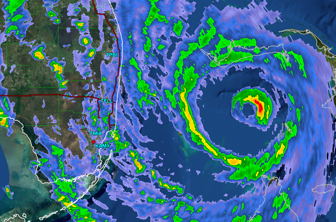
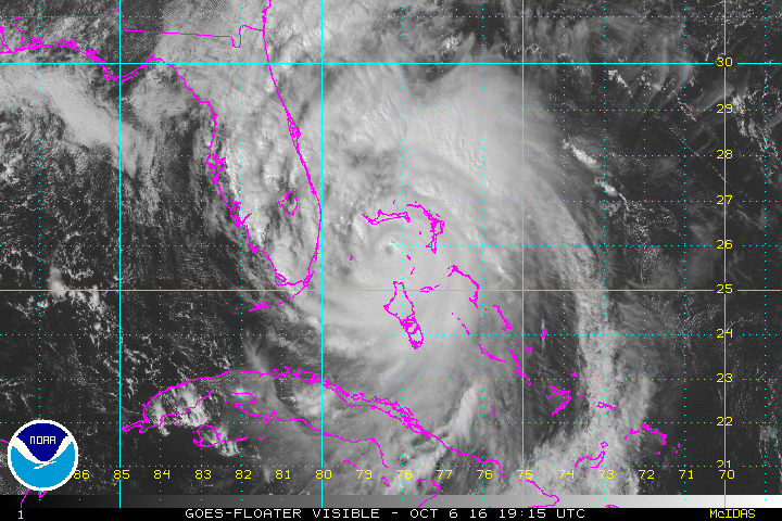
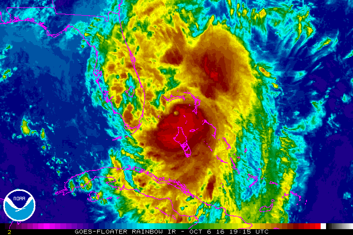
Matthew moved just west of Nassau this morning and just west of Chub Cay this afternoon. Winds of 97 mph were measured in Nassau as the eye wall moved over the island today. Last night an unconfirmed report of a wind gust to 144 mph was received from Great Exuma in the central Bahamas.
Matthew is tracking northwest and is due to cross the western end of Grand Bahama this evening. Matthew has shown two eyewalls today with the strongest winds with the inner smaller eyewall
Current Tropical Weather
As of 5 PM EDT Hurricane Matthew was centered at 26.2 N / 78.6 W or 25 miles SSE of Freeport, Bahamas. It was moving NW at 13 mph. Top sustained winds are estimated at 140 mph. Pressure was estimated at 938 mb.
Tropical Weather Forecast:
The forecast Models take Matthew on the Florida coast or just offshore tonight. Matthew is still forecast to move northward then offshore of the GA SC coast before turning out to sea this weekend.
Please refer to official National Hurricane Center advisories and local officials for direction on evacuations and other pertinent information.
Tropicast: South Florida Radar
Tropicast: Visible Satellite
Tropicast: IR Satellite
Rich Johnson
Twitter: https://twitter.com/richjohnsonwx
Certified Broadcast Meteorologist - Hurricane Expert
Twitter: https://twitter.com/richjohnsonwx
Certified Broadcast Meteorologist - Hurricane Expert
- Tropical Inspector
- Site Admin
- Posts: 3682
- Joined: Tue Feb 20, 2007 2:28 pm
- Antispam: no
- Location: Under a palm tree
- Contact:
Re: Matthew
Friday Late Afternoon Update
Matthew brings in storm surge
The Weather Situation
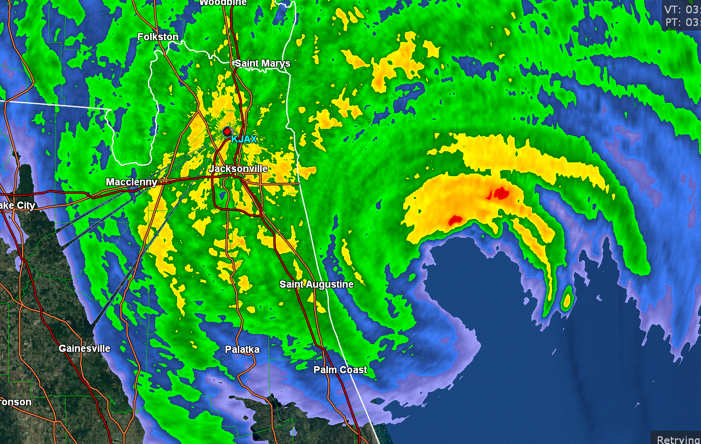
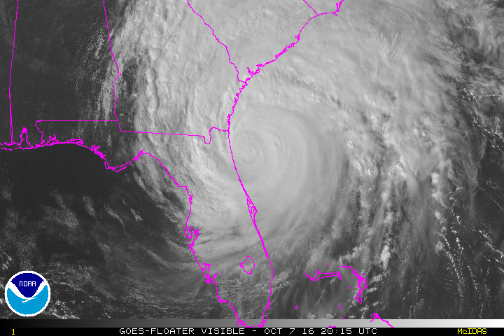
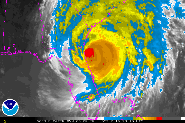
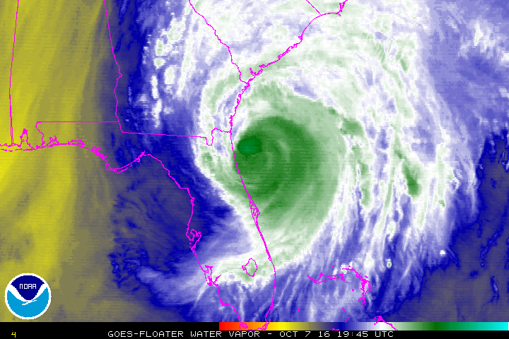
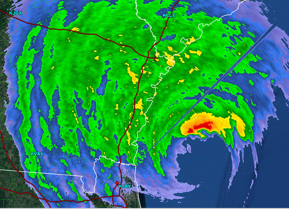
The space coast and 1st coast of Florida - roughly from south of Cape Canaveral to the Georgia border and to the Georgia coast are experiencing Matthew's storm surge. Severe flooding is occurring and has already washed out roads and flooded homes and businesses in this area. Storm tides are running 3-5 feet above average with waves on top of the surge to cause serious inland flooding.
Even though Matthew is now officially not a major hurricane any longer, expect life threatening storm surge and strong winds on the NE Florida coast and Georgia coast this evening. Water levels will continue to increase on the South Carolina coast through tonight. Do not take this situation lightly!
Current Tropical Weather
As of 5 PM EDT Hurricane Matthew was centered at 30.2 N / 80.7 W or 135 miles south of Savannah, GA / 40 miles east of Jacksonville, FL. It was moving north at 12 mph. Top sustained winds are estimated at 110 mph. Pressure was estimated at 948 mb.
Tropical Weather Forecast:
Matthew will move along the Georgia coast off shore tonight. It will then move more northeasterly Saturday near the South Carolina coast and farther offshore Sunday of Wilmington, NC as it weakens. It will then turn toward the southwest and possibly revisit the Bahamas early next week in a weakened state....possibly still as a tropical storm.
Please refer to official National Hurricane Center advisories and local officials for direction on evacuations and other pertinent information.
Tropicast: Northeast Florida Radar
Tropicast: Visible Satellite
Tropicast: IR Satellite
Tropicast: IR Water Vapor Satellite
Rich Johnson
Twitter: https://twitter.com/richjohnsonwx
Certified Broadcast Meteorologist - Hurricane Expert
Twitter: https://twitter.com/richjohnsonwx
Certified Broadcast Meteorologist - Hurricane Expert
- Tropical Inspector
- Site Admin
- Posts: 3682
- Joined: Tue Feb 20, 2007 2:28 pm
- Antispam: no
- Location: Under a palm tree
- Contact:
Re: Matthew
Saturday Evening Update
Matthew bringing heavy rainfall to North Carolina
The Weather Situation
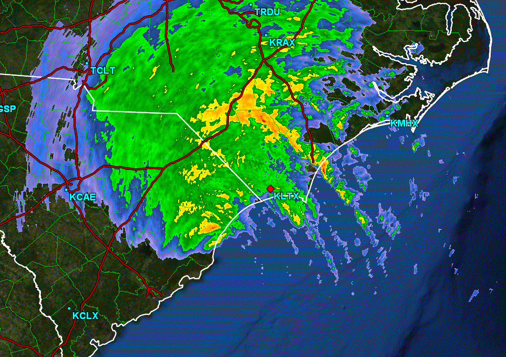
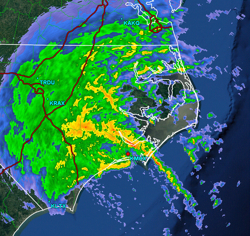
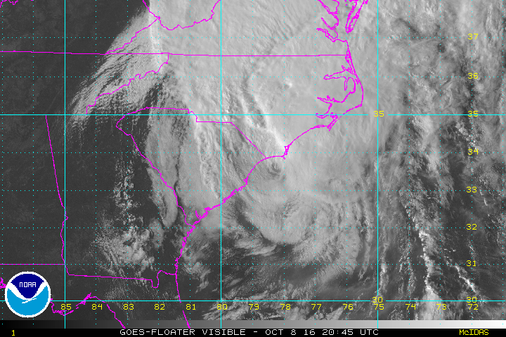
Since Friday evening Matthew has moved inland near McCellanville, South Carolina this morning at 11am edt. The worst effects have been storm surge and inland flooding. Tides have been 3-5 feet above normal causing flooding from near Savannah, Georgia to Charleston South Carolina. There have been many reports of damaged, homes and businesses as well as roads washed out.
Extremely heavy rainfall from the Georgia coast, South Carolina Low Country has now moved over the eastern half of North Carolina. Rainfall amounts over ten inches have been measured in these areas. Isolated tornadoes were experienced west of Myrtle Beach, South Carolina. Winds have been measured from 80-90 mph in wind gusts from Hilton Head, SC this morning.
Current Tropical Weather
As of 5 PM EDT Hurricane Matthew was centered at 33.8 N / 78.2 W or 15 miles WSW of Cape Fear, NC. It was moving ENE at 1e mph. Top sustained winds are estimated at 75 mph. Pressure was estimated at 977 mb.
Tropical Weather Forecast:
Matthew will move off of the North Carolina coast and gradually weaken during the next 24 hours.
Please refer to official National Hurricane Center advisories and local officials for direction on evacuations and other pertinent information.
Tropicast: Georgia Radar - Friday Evening
Tropicast: South Carolina Radar - Saturday Late Morning
Tropicast: Eastern North Carolina Radar - Saturday Evening
Tropicast: Visible Satellite
Rich Johnson
Twitter: https://twitter.com/richjohnsonwx
Certified Broadcast Meteorologist - Hurricane Expert
Twitter: https://twitter.com/richjohnsonwx
Certified Broadcast Meteorologist - Hurricane Expert
Who is online
Users browsing this forum: No registered users and 1 guest