Danielle
Posted: Sun Jun 19, 2016 5:16 pm
Sunday Evening Update
TD 4 forms
The Weather Situation
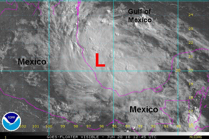
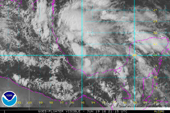
A new tropical depression has formed just east of the Mexican coast over the northwestern Bay of Campeche / southwestern Gulf of Mexico. It will have a short lifespan as it will move inland tomorrow.
Current Tropical Weather
As of 5 PM EDT Tropical Depression 4 was centered at 19.9 N /94.7 W or 190 ESE of Tuxpan. It was moving west at about 8 mph. Top sustained winds are estimated at 35 mph (NHC). Pressure was estimated at 1009 mb.
Tropical Weather Forecast:
Tropical depression 4 will encounter weaker shear as it moves westward. This will give it a brief window to become a minimal tropical storm by landfall around midday Monday. The main threat will be heavy rainfall over northeastern Mexico.
Tropicast: Visible Satellite
TD 4 forms
The Weather Situation
A new tropical depression has formed just east of the Mexican coast over the northwestern Bay of Campeche / southwestern Gulf of Mexico. It will have a short lifespan as it will move inland tomorrow.
Current Tropical Weather
As of 5 PM EDT Tropical Depression 4 was centered at 19.9 N /94.7 W or 190 ESE of Tuxpan. It was moving west at about 8 mph. Top sustained winds are estimated at 35 mph (NHC). Pressure was estimated at 1009 mb.
Tropical Weather Forecast:
Tropical depression 4 will encounter weaker shear as it moves westward. This will give it a brief window to become a minimal tropical storm by landfall around midday Monday. The main threat will be heavy rainfall over northeastern Mexico.
Tropicast: Visible Satellite