Page 1 of 1
98L - Bay of Campeche low
Posted: Wed Jul 21, 2010 8:05 pm
by Tropical Inspector
We have been following a weak low pressure system over the past several days. It has moved across the western Caribbean and recently over the Yucatan peninsula. Winds aloft are favorable for development, but the disturbance may reach land in northeastern Mexico before significant strengthening occurs.
BTW, the hurricane center finally has picked up on this system on their 8 pm update.
Re: 98L - Bay of Campeche low
Posted: Thu Jul 22, 2010 7:20 am
by Tropical Inspector
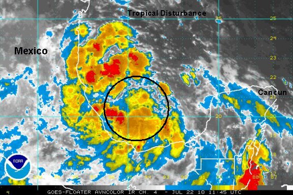
Thursday Morning Update
Tropical disturbance more organized this morning
After studying ship reports it appears that this disturbance could be classified as a tropical depression. Deep convection surrounds a broad area of low pressure in the Bay of Campeche. The limiting factor will be time over water as this tropical feature will be moving toward the coast of Mexico in the next 24-36 hours.
Tropicast: I.R. Floater Satellite
Re: 98L - Bay of Campeche low
Posted: Thu Jul 22, 2010 1:10 pm
by Tropical Inspector
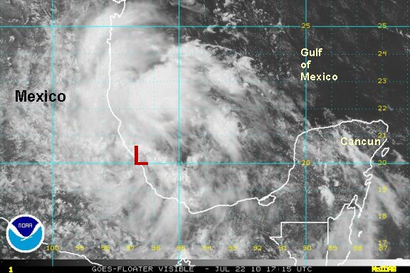
Thursday Afternoon Update
Tropical disturbance moving inland
So much for 24 or more hours to move inland. A circulation organized today and is now near the coast of Mexico. Heavy rain will move across eastern Mexico with the potential of flash flooding. No additional development is expected as the low is moving inland.
Tropicast: Visible Floater Satellite