Saturday Afternoon Update
Flooding and wind damage in eastern North Carolina
Most people don't realize the power of a tropical cyclone. In reality Irene is probably a strong tropical storm. Maximum winds have been in the 60 mph range with gusts to 70-80 mph. Damage starts to occur at about 50 mph, less than that if the winds are sustained for a while. There have numerous reports of water being pushed up the rivers and sounds bringing inland flooding. Power outages with fallen power lines and trees are also common. If Irene came in as the advertised 90 mph or stronger damage would have been far worse.
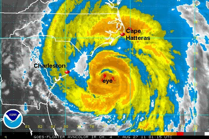
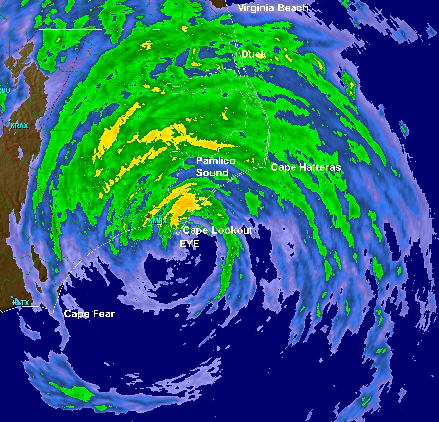
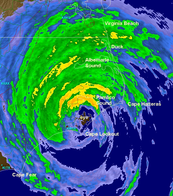
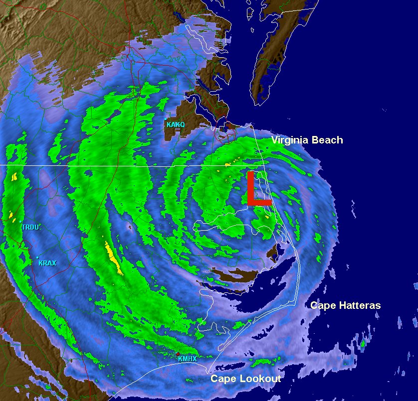
It appears that Irene has lost no strength over eastern NC.
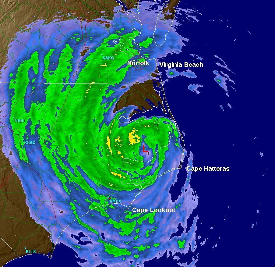
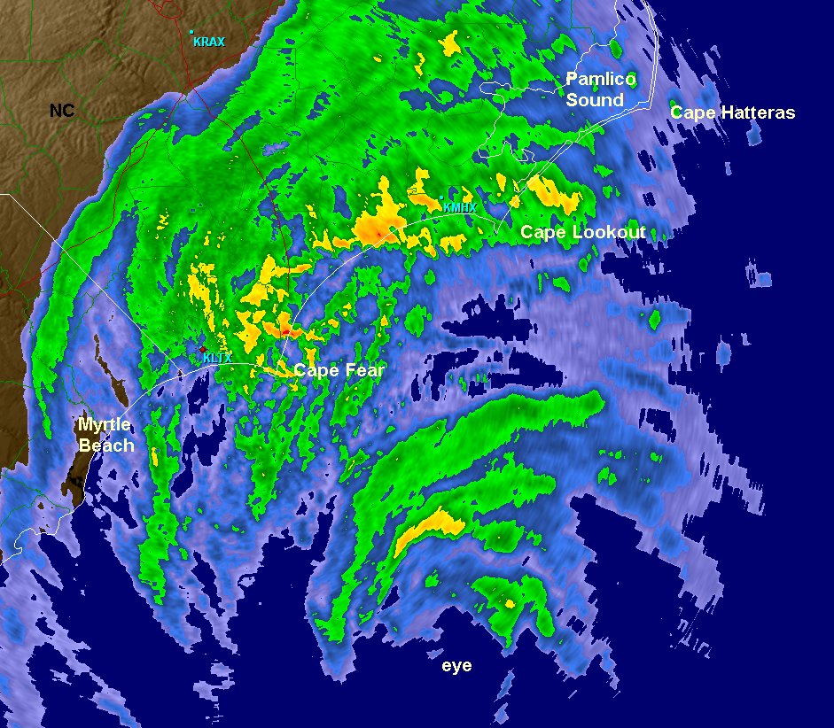
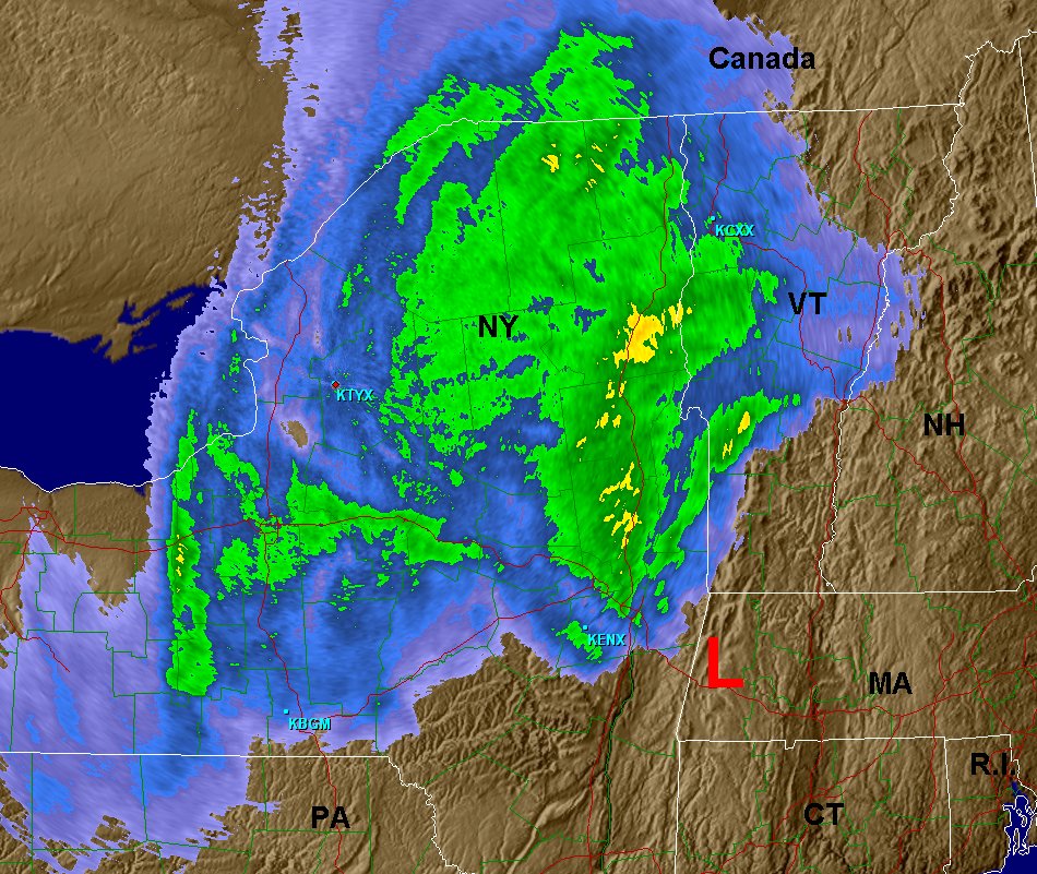
Doppler radar has estimated a large area of rainfall 3"+ from eastern Delaware to all of eastern North Carolina. Totals near 10" are estimated west of Norfolk and near Pamlico sound where a bulls eye of nearly 15" has been estimated.
Wind reports 2 pm: Greenville, NC - 36 mph, gust to 56 mph / Norfolk, VA - 33 mph, gusting to 52 mph / Hatteras, NC - 43 mph, gusting to 74 mph / Manteo, NC - 35 mph, gusting to 51 mph / Currituck, NC - 25 mph, gusting to 40 mph / Chesapeake, VA - 29 mph, gust to 39 mph / Langly AFB, VA - 44 mph, gusts to 51 mph
The highest gusts seen so far have been 79 mph at Hatteras, NC at 5:36 am & 78 mph at Cape Lookout around 4 am.
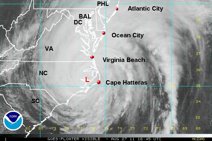
As of 2 pm edt / ast Irene was centered near 35.5 N / 76.3 W or 10 miles north of swanquarter, NC / 95 miles south of Norfolk, VA. It is moving nne at 13 mph. Top sustained winds are estimated at 75 mph / gusts to 85 mph (NHC 85 mph last advisory). Pressure is estimated at 950 mb.
Forecast:
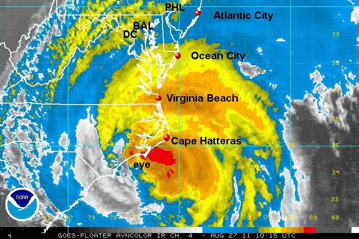
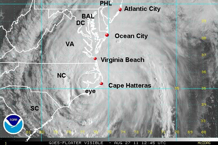
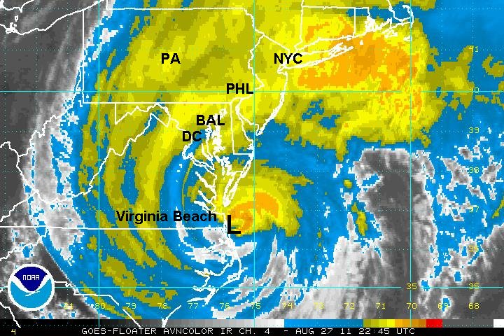
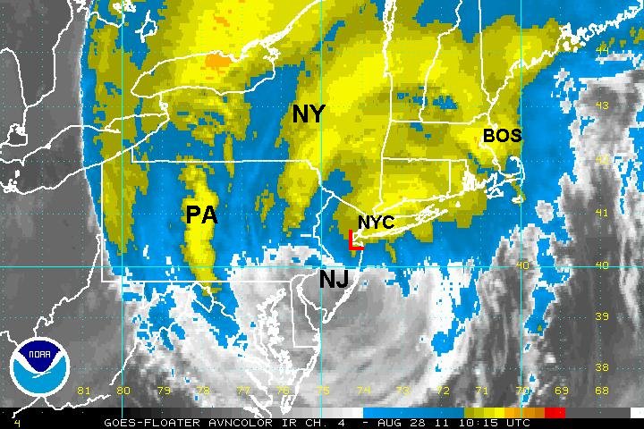
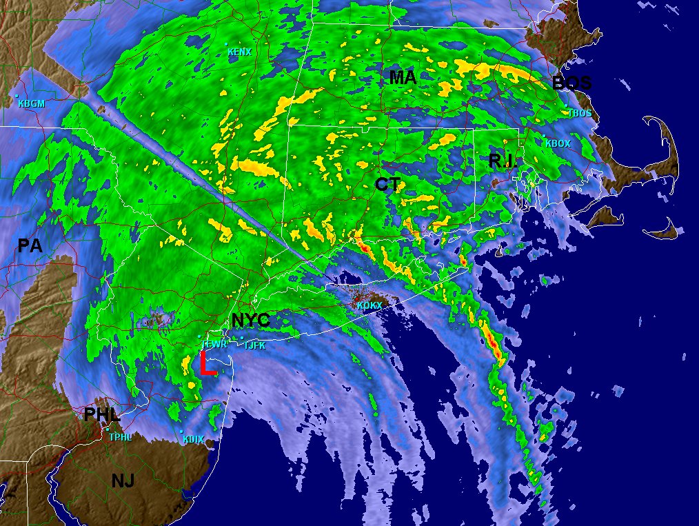
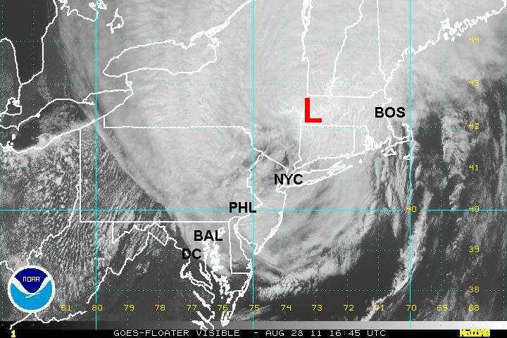
Forecasts take Irene over Pamlico sound today and back offshore to near Virginia Beach late this afternoon to early evening. Sunday morning Irene will be east of Atlantic City, NJ. and move inland over Long Island Sunday morning to possibly midday......continuing inland into New England Sunday.


Interests in Nova Scotia, Canada, and U.S. coastal states, North Carolina to New England should follow this tropical cyclone closely.
This will not only be a coastal event! The big cities of the Northeast, Washington, D.C., Baltimore, Philadelphia, New York City, and Boston will likely see very heavy rainfall and strong winds. Flooding is also likely. This is an unusual event, so don't take this situation lightly!
Tropicast: Visible Satellite
 Tropicast: North Carolina Radar