Page 2 of 2
Re: Dorian
Posted: Wed Sep 04, 2019 3:58 pm
by Tropical Inspector
Wednesday Evening Update
Dorian slightly stronger
The Weather Situation
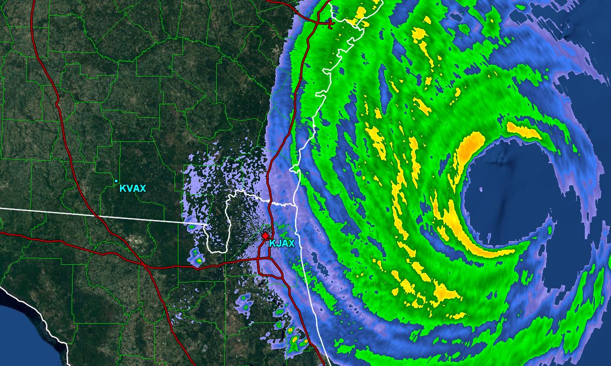
Recon reports today have shown a slight pressure drop and better organization to the eye structure. Winds today have mostly been in the 25-35 mph range on the northeast Florida coast. Some gusts were to 45-60 mph. Overall, Florida and Georgia has been spared from Dorian
For more frequent updates: Twitter:
https://twitter.com/richjohnsonwx
Current Tropical Weather
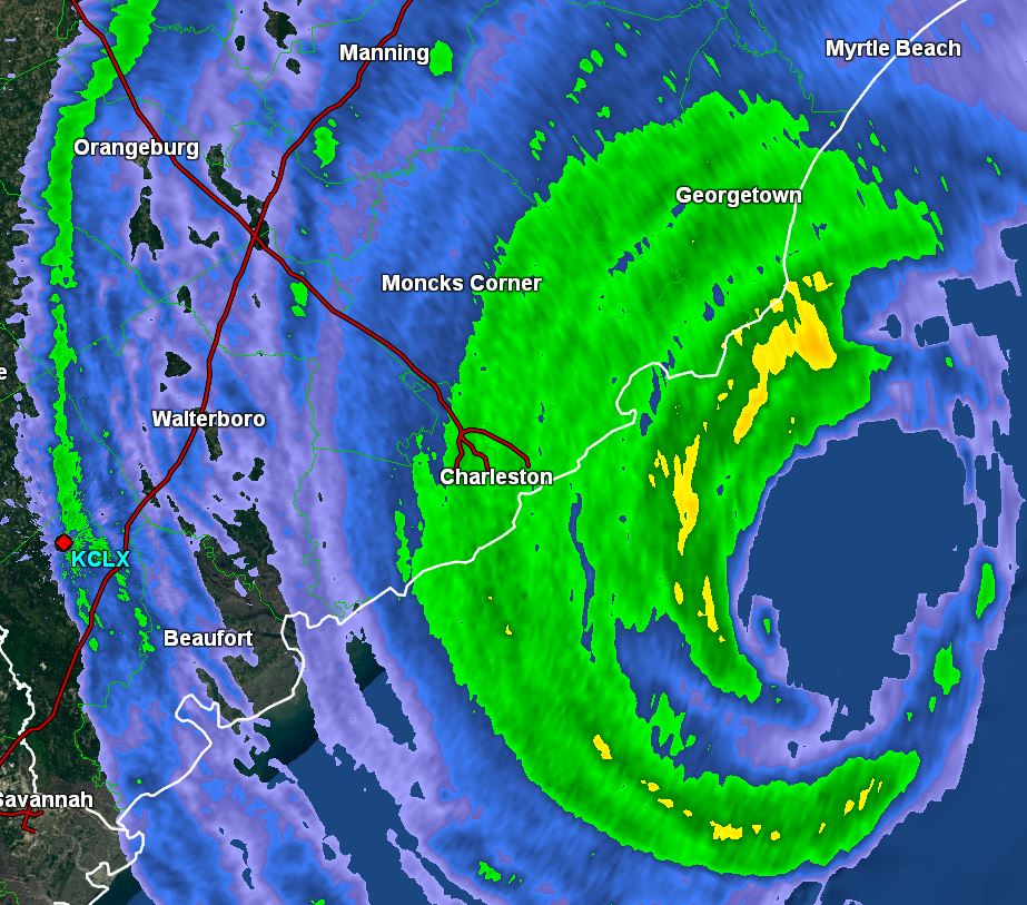
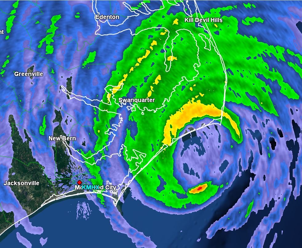
As of 5:00 PM EDT Dorian was centered at 30.6 N / 79.8 W or 150 miles south of Charleston, SC / 275 SSW of Wilmington, NC. It was moving NNW at 8 mph. Top sustained winds are estimated at 110 mph. Pressure was estimated at 961 MB.
Tropical Weather Forecast:
Forecast models now appear to have Dorian close to landfall on the North Carolina coast tomorrow into Friday morning before heading back out to sea. Stay vigilant of any additional changes. Any slight change to the west could bring significantly worse conditions inland.
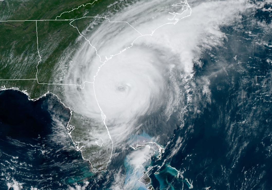
Tropicast: Visible Satellite
 Tropicast: Radar Wednesday 4:30 PM EDT
Re: Dorian
Posted: Thu Sep 05, 2019 6:49 am
by Tropical Inspector
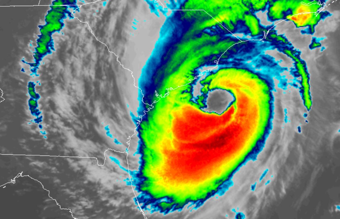
Wednesday Night Update
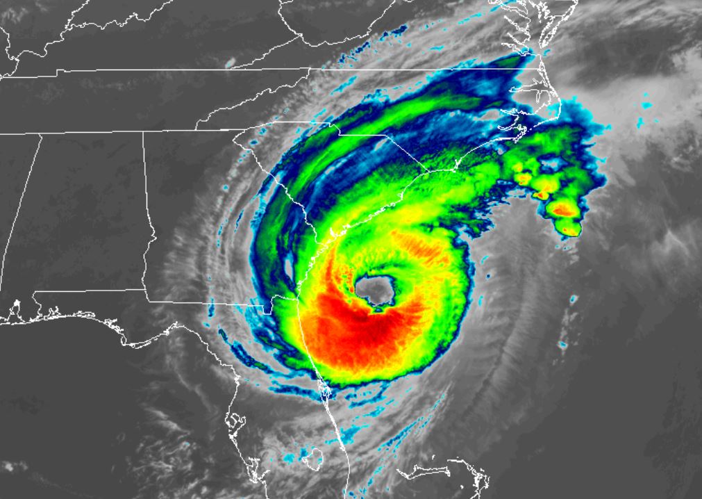
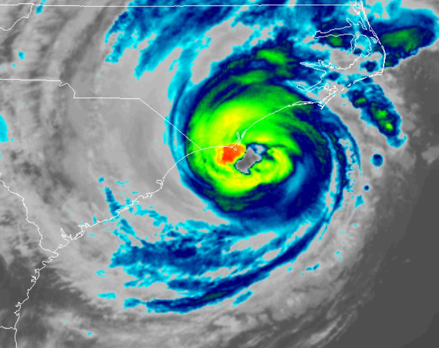
Tropicast: IR Satellite
 Tropicast: Radar Wednesday Evening
Re: Dorian
Posted: Thu Sep 05, 2019 6:50 am
by Tropical Inspector
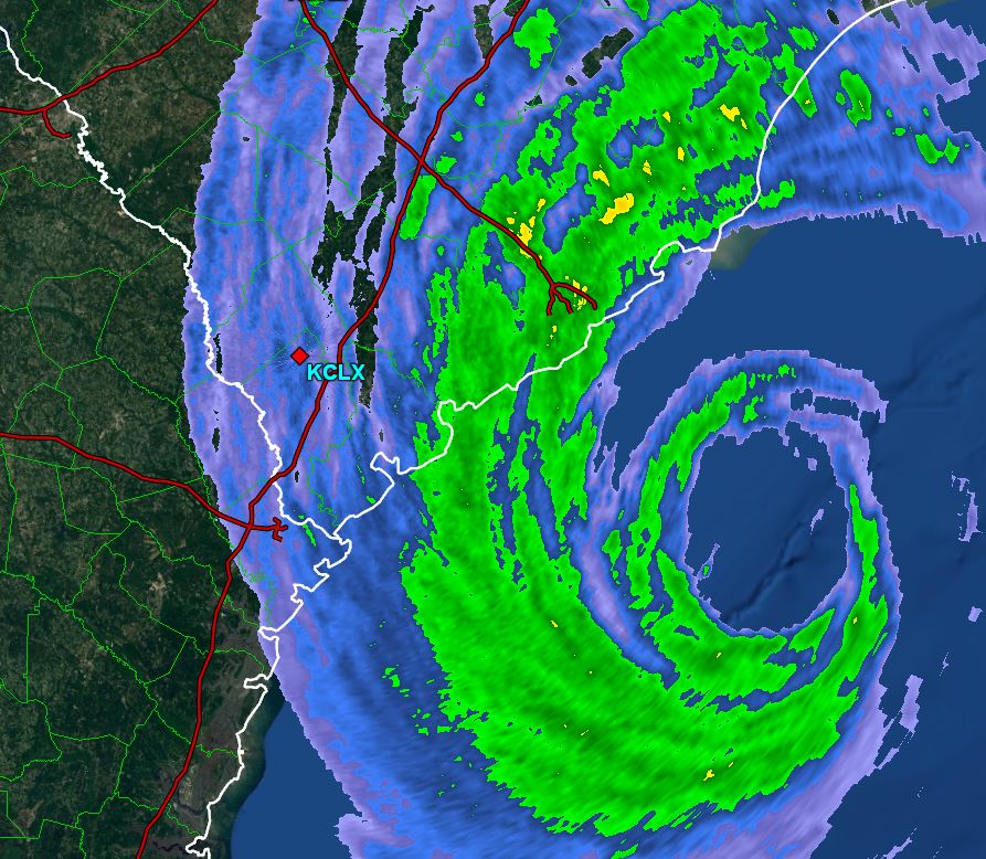
Thursday Morning Update
Dorian east of Charleston
The Weather Situation
Near hurricane force wind gusts have been measured at the Charleston, SC airport. Pressure of Dorian remains steady from the readings that were received yesterday evening, indicating little change in intensity. Currently, several tornado warning are in effect on the coast of South Carolina associated with a rainband from Dorian. Thankfully the strongest part of Dorian is over the open waters well east of South Carolina.
For more frequent updates: Twitter:
https://twitter.com/richjohnsonwx
Current Tropical Weather
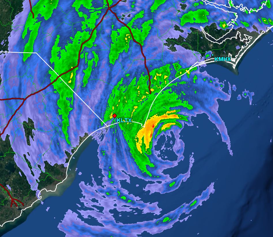
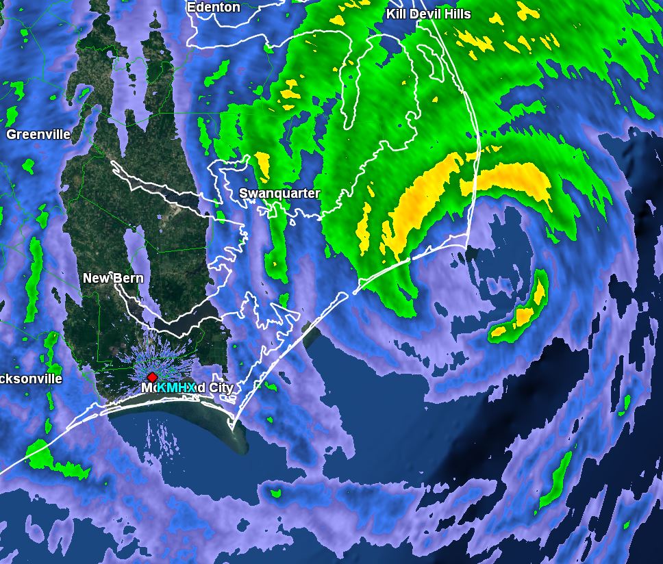
As of 8:00 AM EDT Dorian was centered at 32.1 N / 79.3 W or 70 miles SSE of Charleston, SC / 170 SSW of Wilmington, NC. It was moving NNE at 8 mph. Top sustained winds are estimated at 115 mph. Pressure was estimated at 959 MB.
Tropical Weather Forecast:
Dorian will be just east of South Carolina today. Tonight into the first half of Friday it will be moving along the coast of eastern North Carolina. Stay vigilant of any additional changes. Any slight change to the west could bring significantly worse conditions inland. Rainfall of 10"+, isolated tornadoes, storm surge of 4-7 ft and hurricane force winds can be expected on the South and North Carolina coasts.
Tropicast: IR Satellite
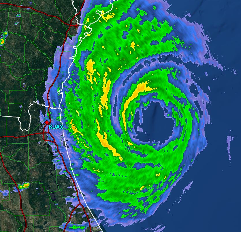
 Tropicast: Radar Thursday 7:40 AM EDT
Re: Dorian
Posted: Thu Sep 05, 2019 11:25 am
by Tropical Inspector
Thursday Midday Update
Dorian producing tornadoes
The Weather Situation
Several tornadoes were reported with Dorian. One wedge waterspout was observed offshore of Emerald Isle, NC.
For more frequent updates: Twitter:
https://twitter.com/richjohnsonwx
Current Tropical Weather
As of 12:00 PM EDT Dorian was centered at 32.6 N / 79.1 W or 45 miles ESE of Charleston, SC / 135 SSW of Wilmington, NC. It was moving NNE at 8 mph. Top sustained winds are estimated at 110 mph. Pressure was estimated at 958 MB.
Tropical Weather Forecast:
Dorian is forecast to move near the North Carolina coast tonight and near Cape Lookout to Cape Hatteras tomorrow morning. Stay vigilant of any additional changes. Any slight change to the west could bring significantly worse conditions inland. Rainfall of 10"+, isolated tornadoes, storm surge of 4-7 ft and hurricane force winds can be expected on the South and North Carolina coasts.
Tropicast: Visible Satellite
 Tropicast: Radar Thursday 12:25 PM EDT
Re: Dorian
Posted: Thu Sep 05, 2019 9:29 pm
by Tropical Inspector
Thursday Night Update
Dorian offshore of Cape Fear
The Weather Situation
Pressure has changed little today on Dorian. With that being said it moved directly of a buoy south of Wilmington. Winds were than than what as to be expected. Top sustained winds IMO are around 85 mph with some gusts 100-105 mph. Continued weakening can be expected.
For more frequent updates: Twitter:
https://twitter.com/richjohnsonwx
Current Tropical Weather
As of 10:00 PM EDT Dorian was centered at 33.6 N / 77.7 W or 40 miles south of Wilmington, NC. It was moving northeast at 13 mph. Top sustained winds are estimated at 100 mph. Pressure was estimated at 958 MB.
Tropical Weather Forecast:
Dorian will move off the Cape Hatteras coast by midday Friday. It will be well offshore of Boston Saturday afternoon.
Tropicast: IR Satellite
 Tropicast: Radar Thursday 10:15 PM EDT
Re: Dorian
Posted: Fri Sep 06, 2019 8:23 am
by Tropical Inspector
Friday Morning Update
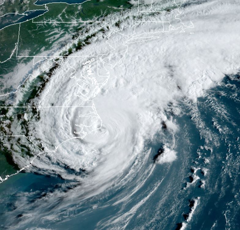
Dorian recently made landfall over Cape Hatteras
The Weather Situation
Rainfall estimates have been in the 5-10" amounts across eastern North Carolina. Overall, most of eastern NC faired well. There were a number of tornadoes, one over Emerald Isle which caused significant damage. Winds did not live up to the 90 mph sustained winds. IMO I believe that this was a 75 mph hurricane with gusts to 90 mph. The strongest wind seen has been 89 mph despite the eyewall moving over the Outer Banks. Winds will rapidly diminish over the next several hours and water levels return to normal.
For more frequent updates: Twitter:
https://twitter.com/richjohnsonwx
Current Tropical Weather
As of 9:00 AM EDT Dorian was centered at 35.3 N / 75.5 W or 5 miles NE of Cape Hatteras, NC. It was moving northeast at 14 mph. Top sustained winds are estimated at 90 mph. Pressure was estimated at 956 MB.
Tropical Weather Forecast:
Dorian is moving northeast of eastern NC and will move offshore toward Nova Scotia the next 1-2 days.
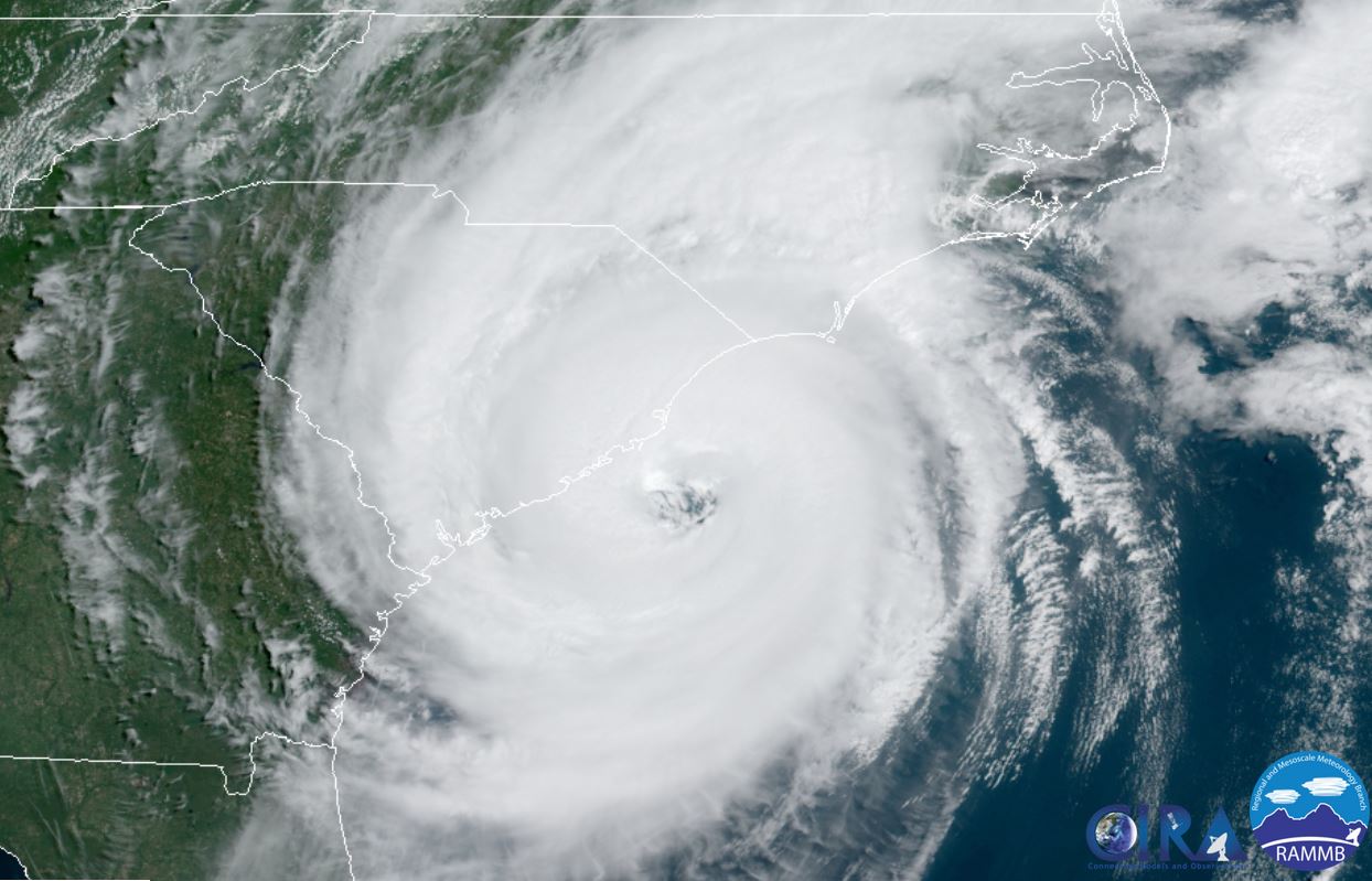
Tropicast: Visible Satellite
 Tropicast: Radar Friday 7:30 AM EDT
 Tropicast: Radar Friday 8:30 AM EDT
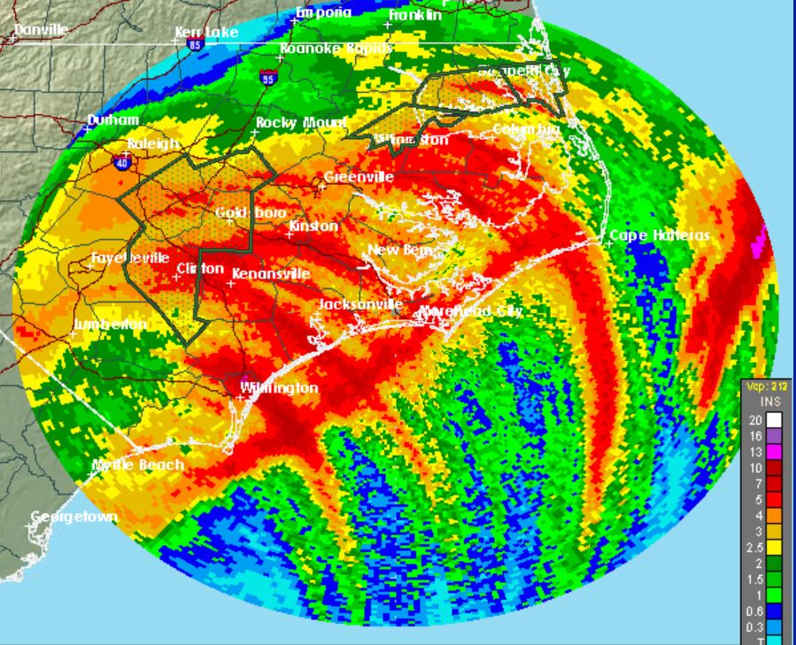
 Tropicast: Radar Rainfall estimate Friday 7AM EDt