Friday Morning Update
Florence makes landfall
The Weather Situation
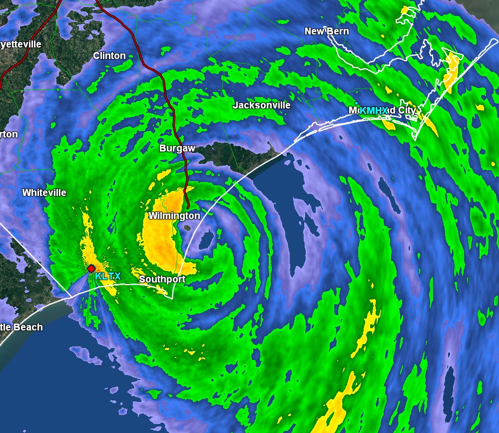
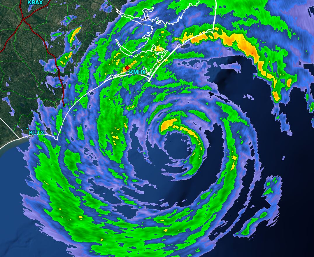
The eye of Florence made landfall near Wrightsville beach in the Wilmington, NC area a short while ago. Generally, wind gusts in the range of 90-105 mph have been seen on the coast since last night. Florence is a cat 1 hurricane and the effects would have been much, much worse if it came in as a cat 3/4 as once officially predicted.
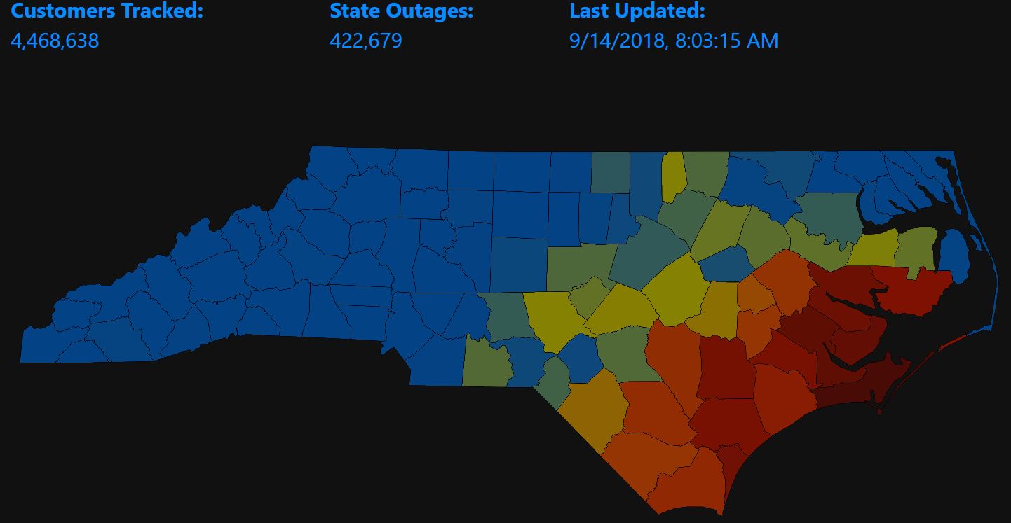
Damage reports are sketchy at this time since strong winds and heavy rainfall are still occurring as well as widespread power outages. Still power outages are not nearly as widespread as could have occurred with a much stronger hurricane. As of this morning over 400 k people are without power in North Carolina.
Tropicast: Power outages from Poweroutage.us
Coastal areas and river locations experienced storm surge, very heavy rainfall and strong winds. Damage details will not be know until authorities can assess the situation once weather conditions relax.
Rainfall with Florence is expected in the 20-40" range for the southern 1/2 of North Carolina and northern South Carolina.

Severe flooding / wind damage / storm surge could prolong problems for an extended period of time. Expect widespread power outages.
Current Tropical Weather
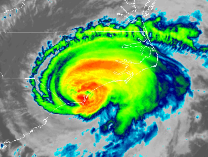
As of 8:00 AM EDT Florence was centered at 34.1 N / 77.9 W or 10 miles south of Wilmington, North Carolina. It was moving WNW at 6 mph. Top sustained winds are estimated at 90 mph. Pressure was estimated at 958 MB.
Tropical Weather Forecast:
Florence is expected to drift southwest over the coast of South Carolina during the next 24 hours before turning inland across South Carolina. It appears that the center will go back over water. It that happens weakening will not occur as quickly and some restrengthening may occur.
Remember a hurricane is not a point and effects will stretch well beyond these locations.
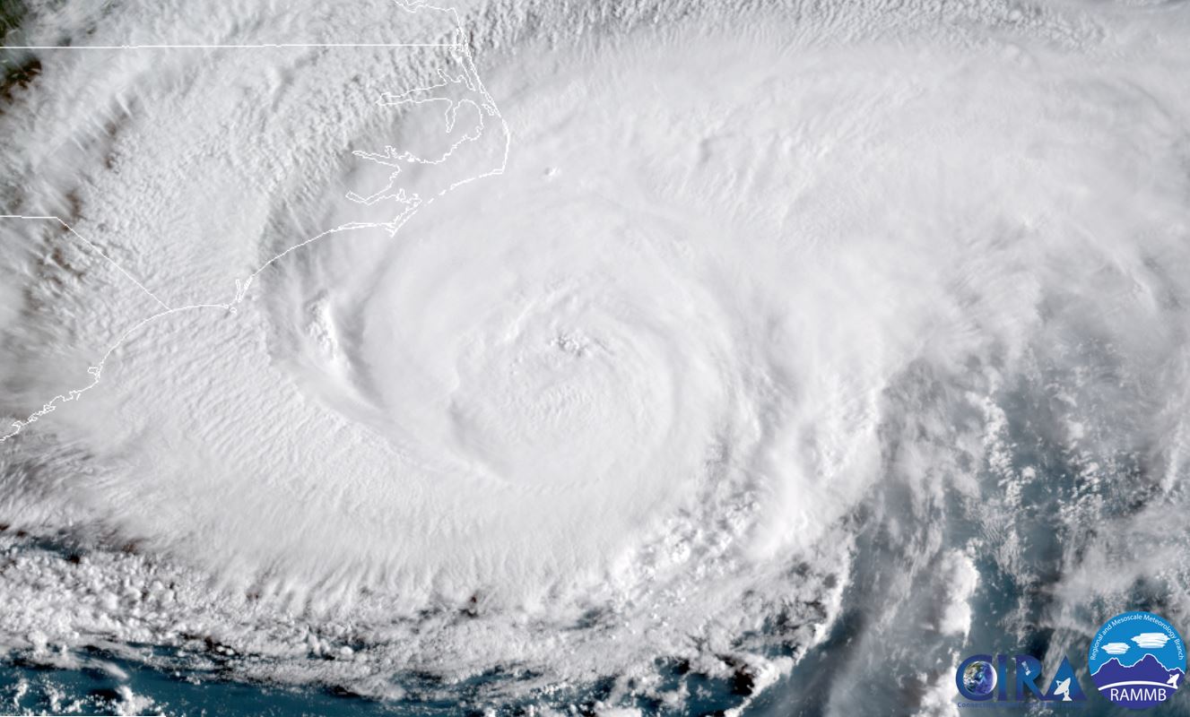
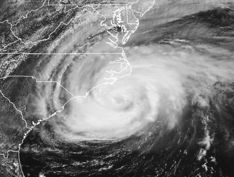
Tropicast: IR Satellite
 Tropicast: Radar at landfall @ 8 am EDT