Re: Tropical storm Bill
Posted: Sun Aug 16, 2009 10:24 am
Sunday Midday Update
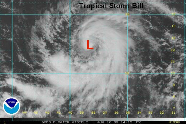
Tropical storm continues methodical strengthening
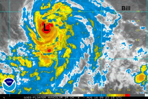
Bill continues to have increasing banding features. Convection near the center of circulation is marginal, but it looks like it is about to start wrapping into an eyewall feature. Again, excellent news is that the forecast models are starting to line up recurving Bill northeast of the Leewards by midweek. It is too early to tell if any of the bands from Bill will affect the islands.
At 11:00 am edt / ast Bill was centered near 12.1° N / 38.4° W or about 1555 miles east of the Leeward Islands. Movement is west northwest at about 16 mph. We estimate top sustained winds of 60 mph. ( Officially NHC estimates 60 mph.)
We'll keep you updated with our latest model interpretations as they come in. Next complete update will be this evening.
 This is not time to panic, but make sure that your hurricane preparedness plan is ready to go. Here are a few suggestions:
Hurricane Preparedness: http://www.tropicalweather.net/plan.htm
Preseason Hurricane Preparedness: http://www.tropicalweather.net/hurrican ... dness.html
Other Hurricane Articles: http://www.tropicalweather.net/hurricane_articles.htm
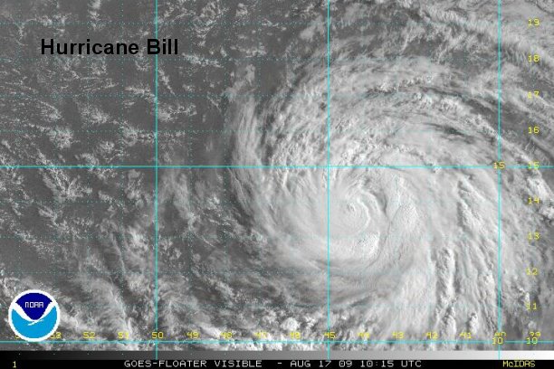
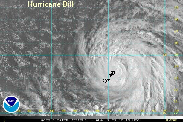
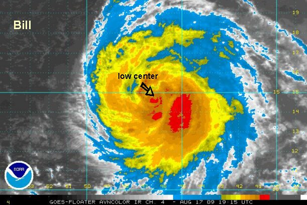
Tropicast: Atlantic Visible Floater Satellite
Tropical storm continues methodical strengthening
Bill continues to have increasing banding features. Convection near the center of circulation is marginal, but it looks like it is about to start wrapping into an eyewall feature. Again, excellent news is that the forecast models are starting to line up recurving Bill northeast of the Leewards by midweek. It is too early to tell if any of the bands from Bill will affect the islands.
At 11:00 am edt / ast Bill was centered near 12.1° N / 38.4° W or about 1555 miles east of the Leeward Islands. Movement is west northwest at about 16 mph. We estimate top sustained winds of 60 mph. ( Officially NHC estimates 60 mph.)
We'll keep you updated with our latest model interpretations as they come in. Next complete update will be this evening.
Hurricane Preparedness: http://www.tropicalweather.net/plan.htm
Preseason Hurricane Preparedness: http://www.tropicalweather.net/hurrican ... dness.html
Other Hurricane Articles: http://www.tropicalweather.net/hurricane_articles.htm
Tropicast: Atlantic Visible Floater Satellite