Tuesday Morning Update
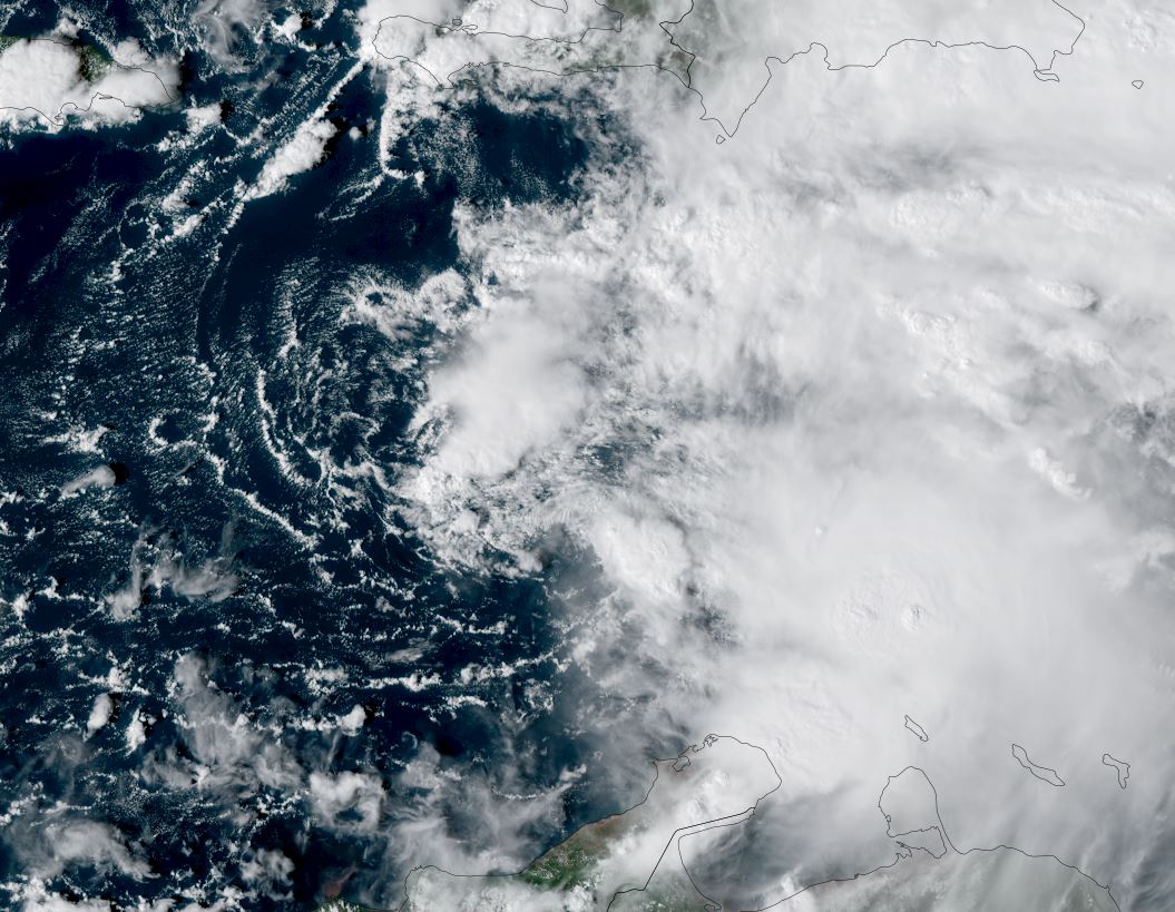
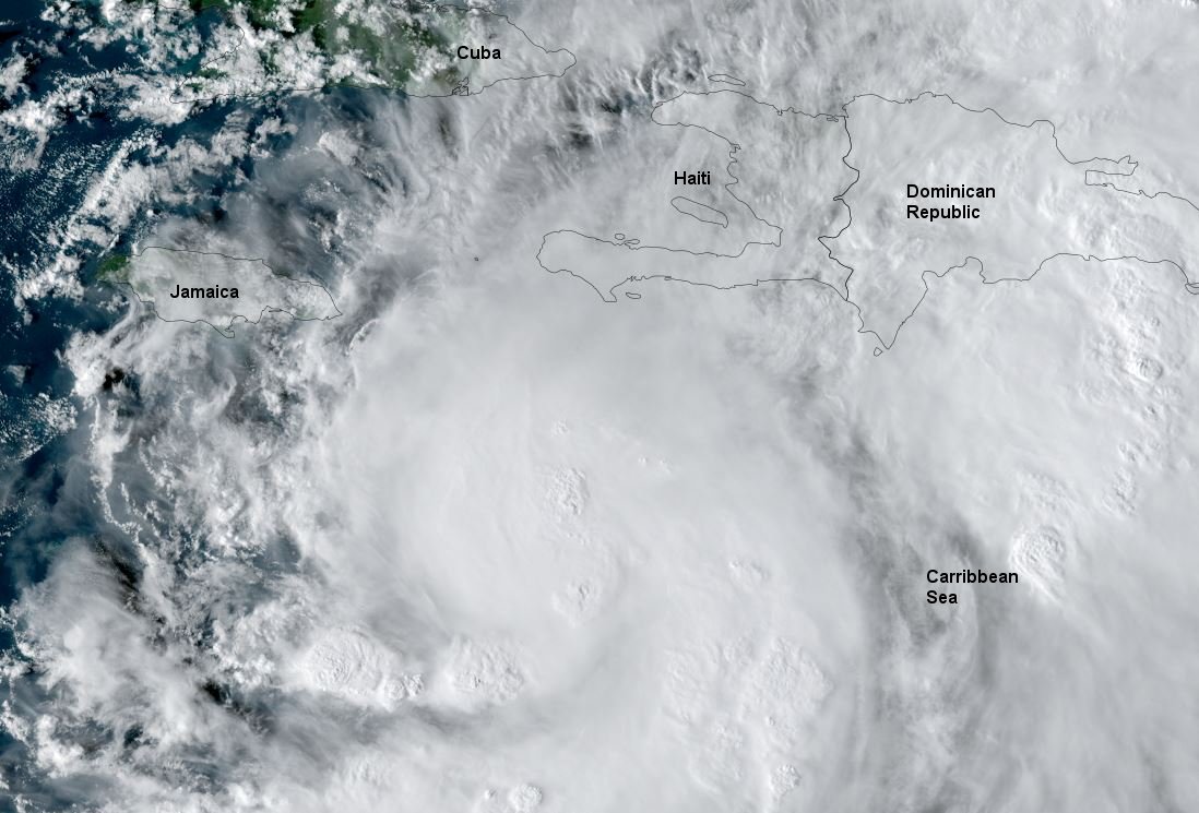
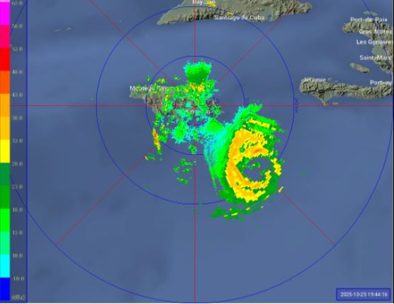
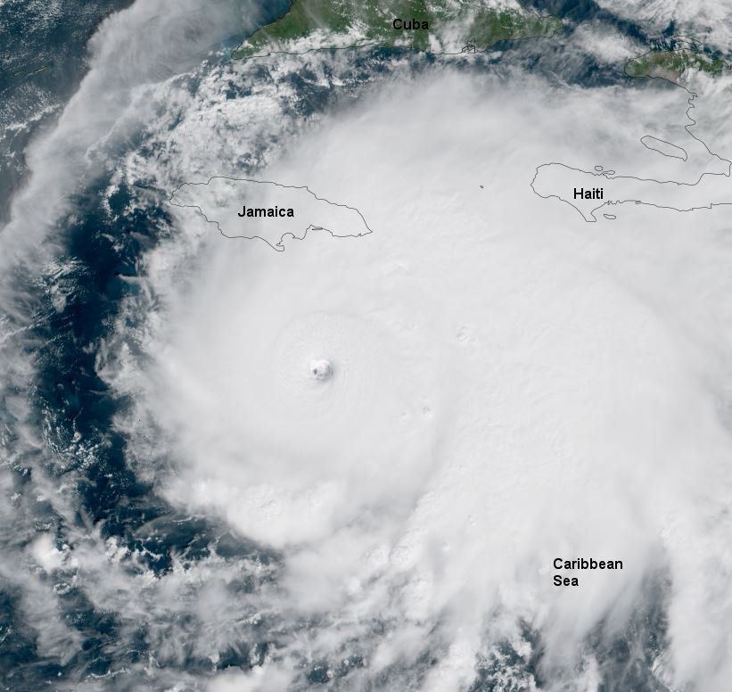
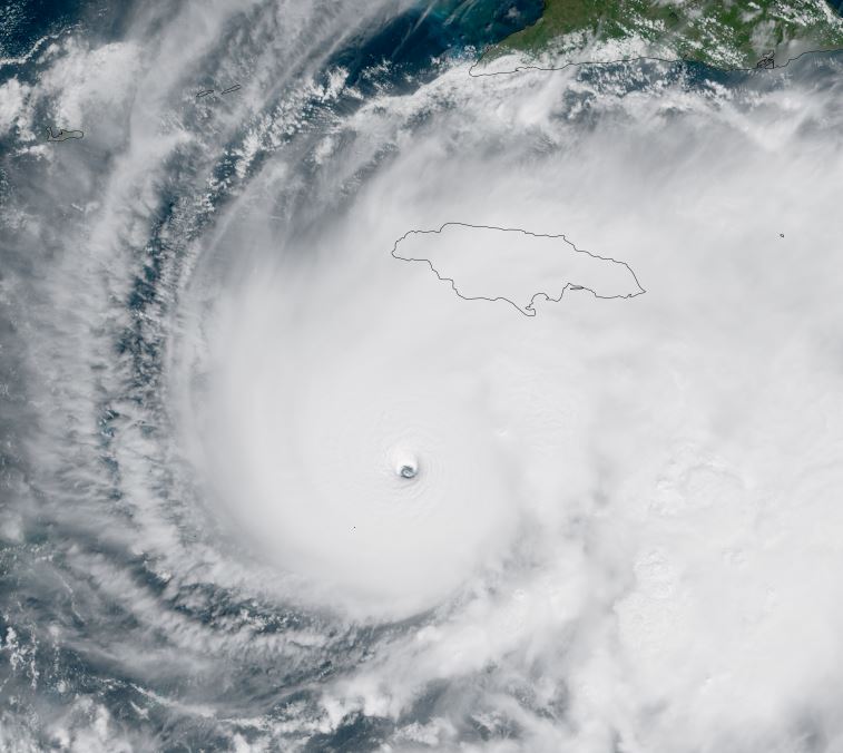
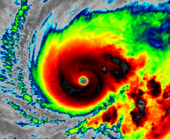
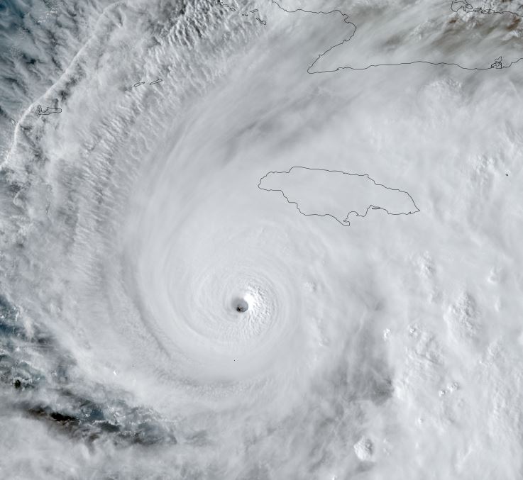
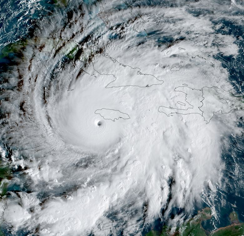
Melissa about to make landfall
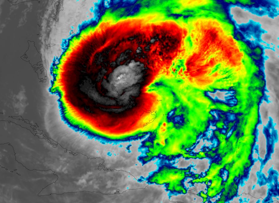
Melissa is about to make landfall on the SW / southcentral coast of Jamaica. A Hurricane Hunter aircraft measured a pressure to 893.5 mb making it one the of strongest hurricanes in the Atlantic basin on record. A wind to 206 mph was measured at 10,000 ft which adjusts to about 185 mph at the surface.
The Weather Situation
SUMMARY OF 800 AM EDT...1200 UTC...INFORMATION
----------------------------------------------
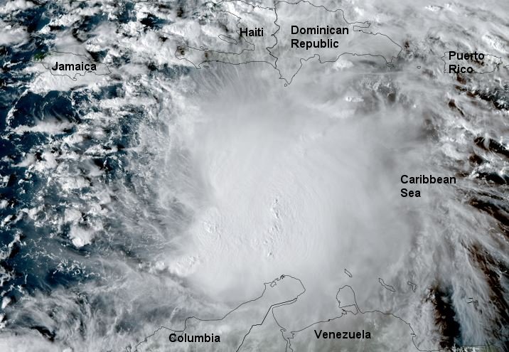
LOCATION...17.5N 78.1W
ABOUT 55 MI...90 KM SSE OF NEGRIL JAMAICA
ABOUT 265 MI...430 KM SW OF GUANTANAMO CUBA
MAXIMUM SUSTAINED WINDS...175 MPH...280 KM/H
PRESENT MOVEMENT...NNE OR 20 DEGREES AT 7 MPH...11 KM/H
MINIMUM CENTRAL PRESSURE...901 MB...26.61 INCHES
SUMMARY OF 900 AM EDT...1300 UTC...INFORMATION
----------------------------------------------
LOCATION...17.6N 78.1W
ABOUT 50 MI...80 KM SSE OF NEGRIL JAMAICA
ABOUT 260 MI...420 KM SW OF GUANTANAMO CUBA
MAXIMUM SUSTAINED WINDS...180 MPH...290 KM/H
PRESENT MOVEMENT...NNE OR 20 DEGREES AT 7 MPH...11 KM/H
MINIMUM CENTRAL PRESSURE...896 MB...26.47 INCHES
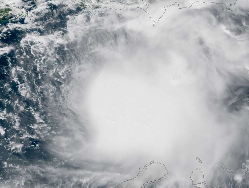
SUMMARY OF 1000 AM EDT...1400 UTC...INFORMATION
----------------------------------------------
LOCATION...17.7N 78.1W
ABOUT 45 MI...70 KM SSE OF NEGRIL JAMAICA
ABOUT 255 MI...410 KM SW OF GUANTANAMO CUBA
MAXIMUM SUSTAINED WINDS...185 MPH...295 KM/H
PRESENT MOVEMENT...NNE OR 20 DEGREES AT 7 MPH...11 KM/H
MINIMUM CENTRAL PRESSURE...892 MB...26.34 INCHES
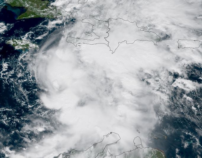
SUMMARY OF 1100 AM EDT...1500 UTC...INFORMATION
-----------------------------------------------
LOCATION...17.9N 77.9W
ABOUT 40 MI...60 KM SE OF NEGRIL JAMAICA
ABOUT 235 MI...380 KM SW OF GUANTANAMO CUBA
MAXIMUM SUSTAINED WINDS...185 MPH...295 KM/H
PRESENT MOVEMENT...NNE OR 25 DEGREES AT 9 MPH...15 KM/H
MINIMUM CENTRAL PRESSURE...892 MB...26.34 INCHES
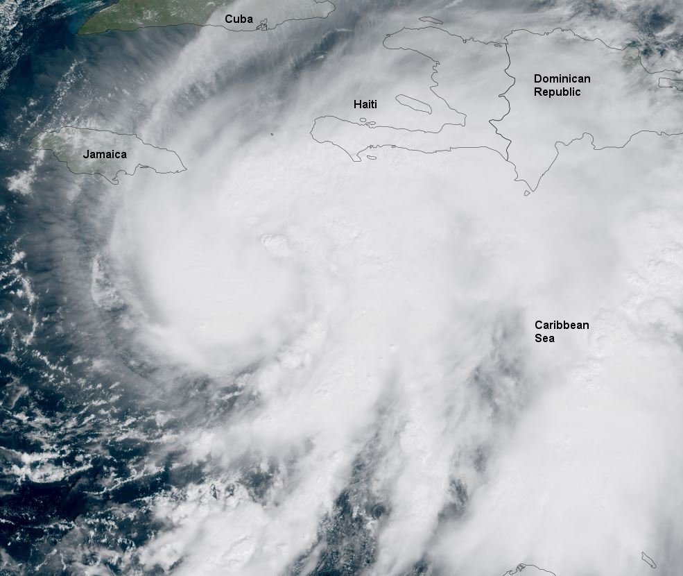
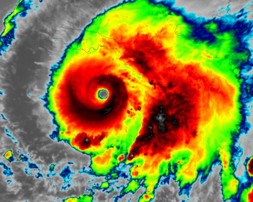
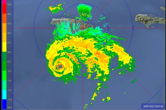
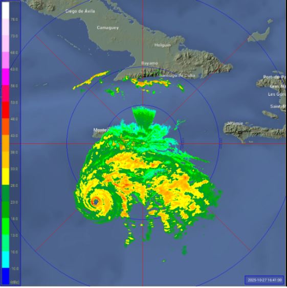
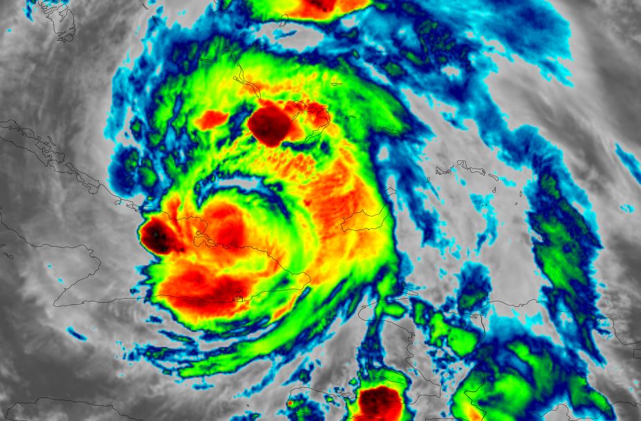
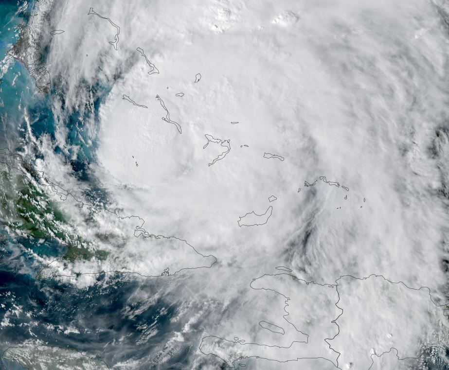
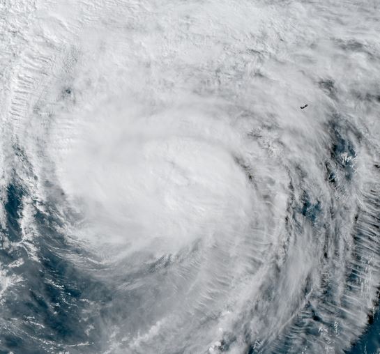
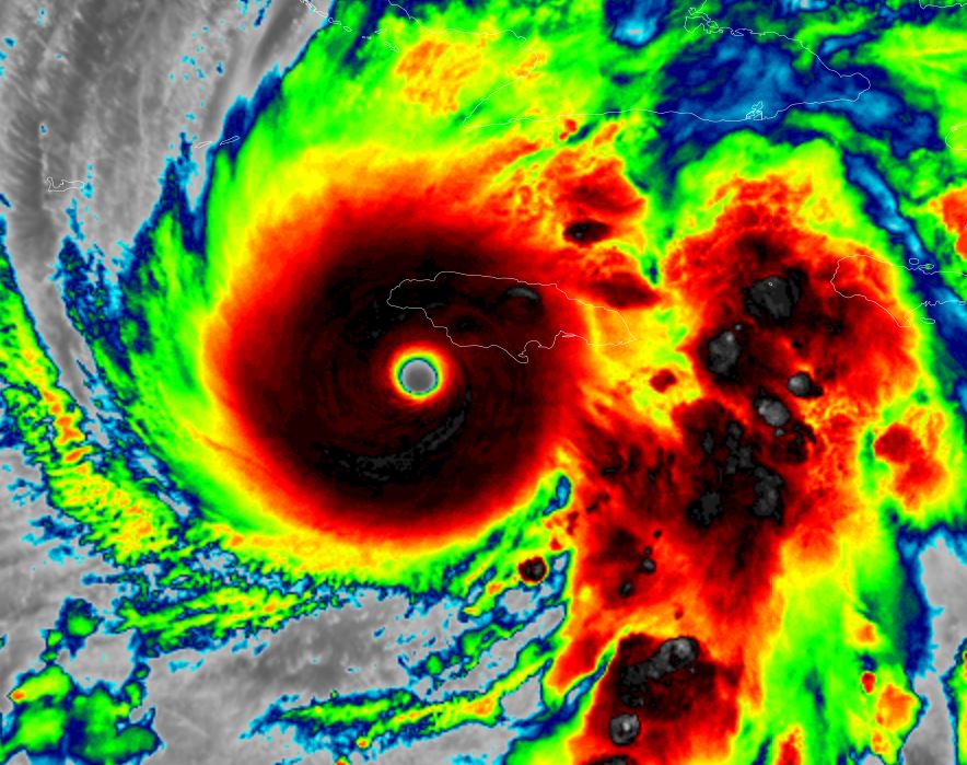
Tropicast: RAMMB/CIRA slider GOES 19 Visible Satellite
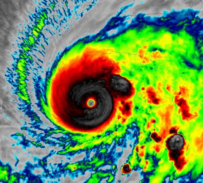
 RAMMB/CIRA slider GOES 19 IR Satellite
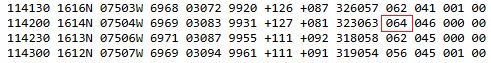
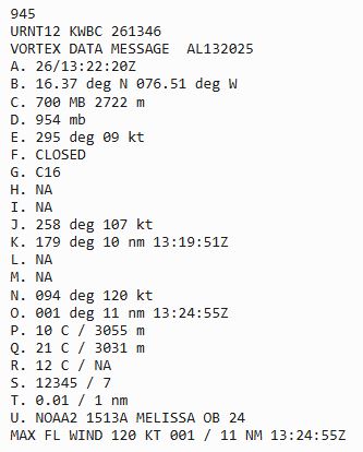
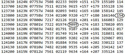
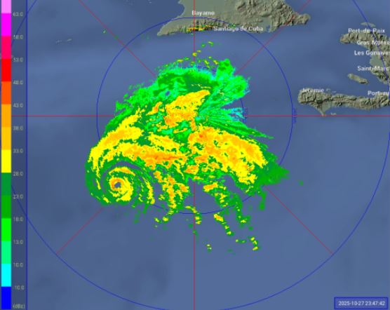
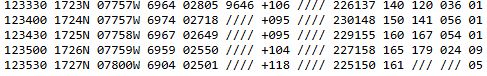
 Recon report 153 kts 10,000 ft
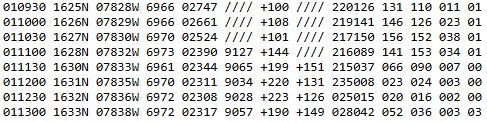 Recon report 164 kts 10,000 ft
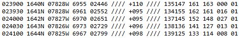 Recon report 179 kts 10,000 ft
 Tropical Weather Forecast:
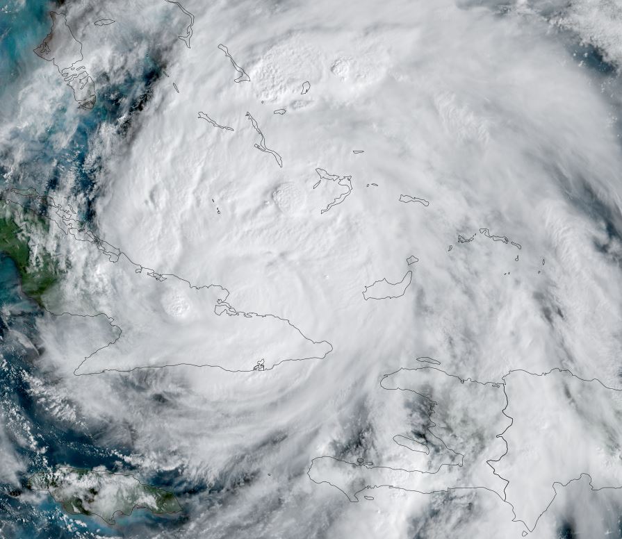
The next landfall will be over far eastern Cuba is expected late this evening. Melissa will pass through the SE Bahamas and near / just west of the Turks and Caicos on Wednesday as predicted by the current models.
Storm surge, especially on the south coast of Jamaica and SE coast of Cuba, with strong, catastrophic damaging winds and devastating rainfall of
2-3 FEET is likely in Jamaica and SE Cuba. Heavy rainfall with additional amounts of 6-12" is possible over the SW Dominican Republic and SW Haiti. Flash flooding, river flooding and landslides are all possible.

Interests in Haiti, the Dominican Republic, Jamaica, eastern Cuba, the SE Bahamas and the Turks and Caicos should stay updated with the latest information on Melissa.