Ivo

Post Reply
User avatar
Tropical Inspector
Site Admin
Site Admin
Posts: 3743
Joined: Tue Feb 20, 2007 2:28 pm
Antispam: no
Location: Under a palm tree
Contact:

Ivo

Post by Tropical Inspector »

Thursday Afternoon Update

Ivo strengthening some
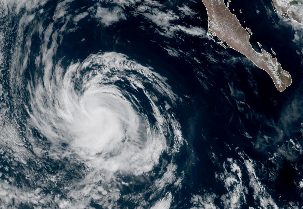
Ivo has strengthened some today west of western Mexico. Conditions are favorable for additional strengthening to hurricane strength. Winds aloft around a high pressure system over northern Mexico will steer it away from Baja. It has a small core which may allow for strengthening more quickly than larger tropical cyclones. This will be monitored closely by NHC. At this time Ivo is close enough to the west central coast to cause heavy rainfall and local flash flooding.

The Weather Situation
SUMMARY OF 300 PM CST...2100 UTC...INFORMATION
----------------------------------------------
LOCATION...18.8N 105.8W
ABOUT 410 MI...660 KM WNW OF ACAPULCO MEXICO
ABOUT 385 MI...625 KM SE OF THE SOUTHERN TIP OF BAJA CALIFORNIA
MAXIMUM SUSTAINED WINDS...60 MPH...95 KM/H
PRESENT MOVEMENT...NW OR 305 DEGREES AT 21 MPH...33 KM/H
MINIMUM CENTRAL PRESSURE...1001 MB...29.56 INCHES

Tropicast: Visible RAMMB Cira-Slider Thursday Late Afternoon
Image

Tropical Weather Forecast:
Ivo is forecast to strengthen and then be pulled west away from western Mexico and Cabo. It will gradually weaken in several days over cooler water well west of Cabo.
Rich Johnson
LinkedIn: https://www.linkedin.com/in/richjohnsonmeteorologist/
AMS Certified Broadcast Meteorologist (CBM) - Hurricane Expert
User avatar
Tropical Inspector
Site Admin
Site Admin
Posts: 3743
Joined: Tue Feb 20, 2007 2:28 pm
Antispam: no
Location: Under a palm tree
Contact:

Re: Ivo

Post by Tropical Inspector »

Friday Afternoon Update

Ivo staying south of Cabo
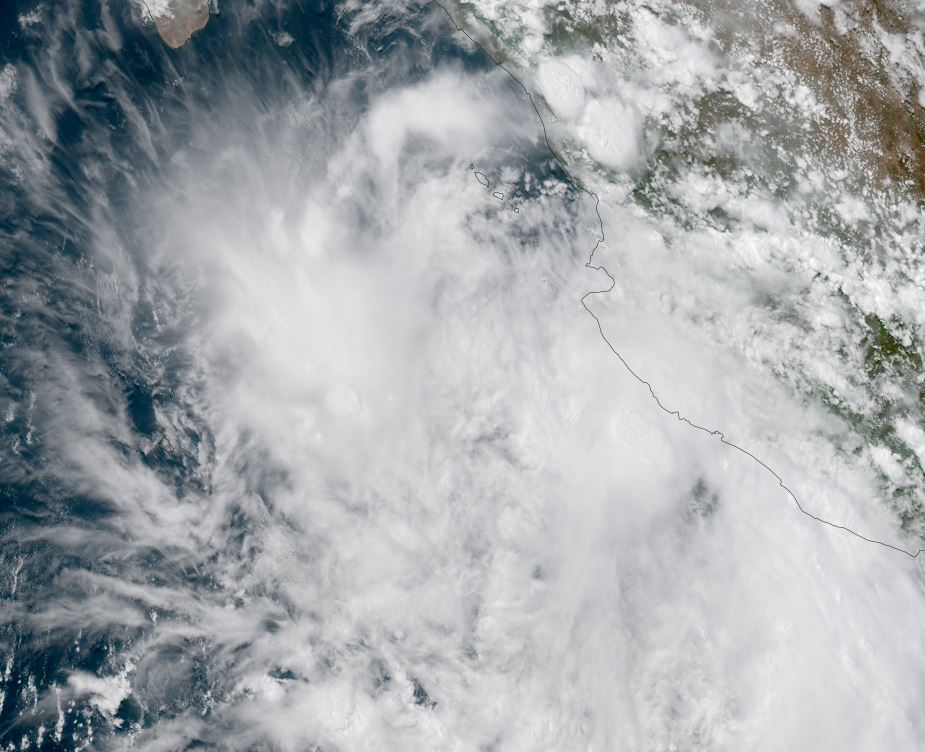
Ivo has strengthened a bit today with a few showers near Cabo and over the western coast of Mexico near Cabo Corrientes. The heaviest showers are offshore of Cabo Corrientes and south of Cabo.

The Weather Situation
SUMMARY OF 200 PM MST...2100 UTC...INFORMATION
----------------------------------------------
LOCATION...20.4N 111.2W
ABOUT 190 MI...310 KM SSW OF THE SOUTHERN TIP OF BAJA CALIFORNIA
MAXIMUM SUSTAINED WINDS...65 MPH...100 KM/H
PRESENT MOVEMENT...W OR 275 DEGREES AT 13 MPH...20 KM/H
MINIMUM CENTRAL PRESSURE...999 MB...29.50 INCHES

Tropicast: Visible RAMMB Cira-Slider Friday Late Afternoon
Image

Tropical Weather Forecast:
Ivo is forecast to gradually weaken in several days over cooler water well west of Cabo.
Rich Johnson
LinkedIn: https://www.linkedin.com/in/richjohnsonmeteorologist/
AMS Certified Broadcast Meteorologist (CBM) - Hurricane Expert
User avatar
Tropical Inspector
Site Admin
Site Admin
Posts: 3743
Joined: Tue Feb 20, 2007 2:28 pm
Antispam: no
Location: Under a palm tree
Contact:

Re: Ivo

Post by Tropical Inspector »

Sunday Late Afternoon Update

Ivo a minimal tropical storm
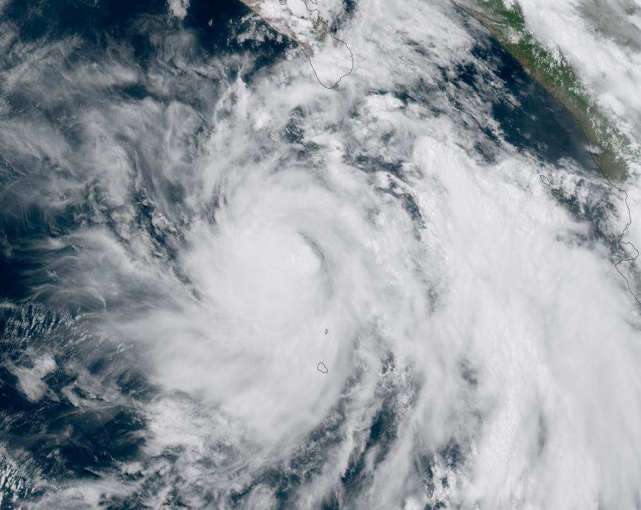
Some deep convection is holding on near and to the SW of the center of circulation.

The Weather Situation
SUMMARY OF 200 PM PDT...2100 UTC...INFORMATION
----------------------------------------------
LOCATION...22.1N 117.2W
ABOUT 470 MI...755 KM W OF THE SOUTHERN TIP OF BAJA CALIFORNIA
MAXIMUM SUSTAINED WINDS...40 MPH...65 KM/H
PRESENT MOVEMENT...WNW OR 285 DEGREES AT 12 MPH...19 KM/H
MINIMUM CENTRAL PRESSURE...1006 MB...29.71 INCHES

Tropicast: Visible RAMMB Cira-Slider Sunday Late Afternoon
Image

Tropical Weather Forecast:
Ivo continues to move west away from Mexico and will be a depression soon as it further weakens.

NHC Advisory
https://www.nhc.noaa.gov/text/refresh/M ... 031.shtml?

NHC Track
https://www.nhc.noaa.gov/refresh/graphi ... e#contents
Rich Johnson
LinkedIn: https://www.linkedin.com/in/richjohnsonmeteorologist/
AMS Certified Broadcast Meteorologist (CBM) - Hurricane Expert
Post Reply

Return to “2025 Eastern / Central Pacific Hurricane Updates”

Who is online

Users browsing this forum: No registered users and 0 guests