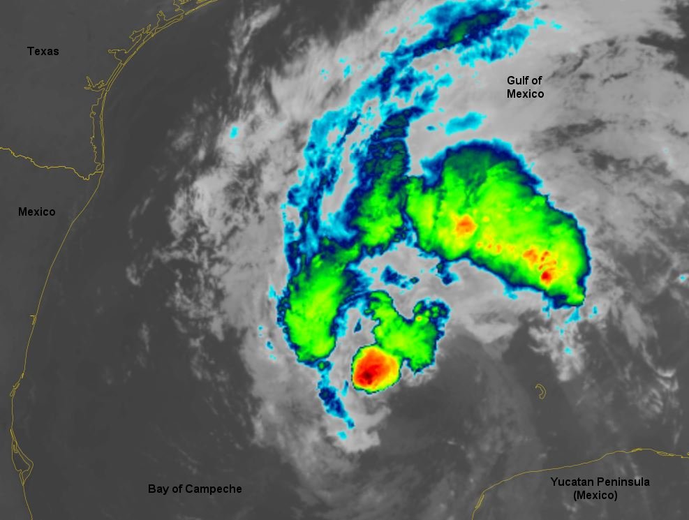
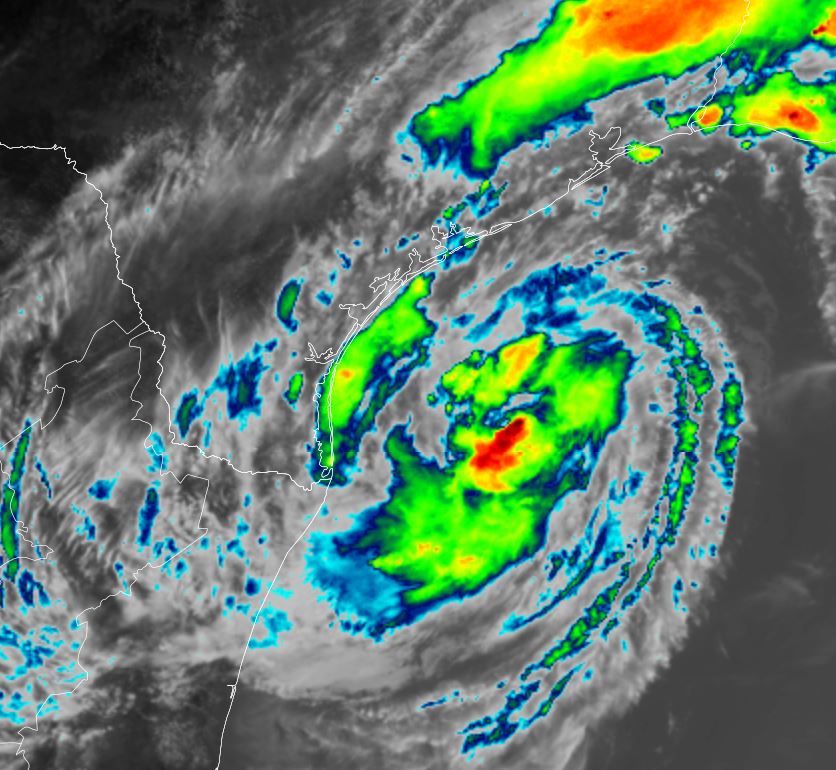
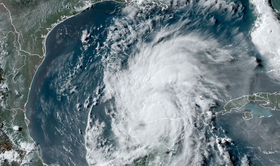
Beryl in the Gulf
Beryl crossed the Yucatan peninsula today and made its way into the southern Gulf. It appears to be farther north than models anticipated. Most of the deep convection has dissipated, but restrengthening is expected as the low level circulation remains intact.
The Weather Situation
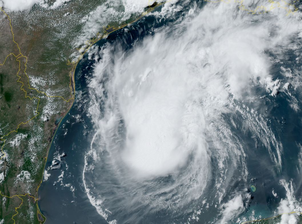
SUMMARY OF 700 PM CDT...0000 UTC...INFORMATION
----------------------------------------------
LOCATION...21.3N 89.7W
ABOUT 0 MI...0 KM E OF PROGRESO MEXICO
ABOUT 580 MI...935 KM ESE OF BROWNSVILLE TEXAS
MAXIMUM SUSTAINED WINDS...65 MPH...100 KM/H
PRESENT MOVEMENT...WNW OR 295 DEGREES AT 15 MPH...24 KM/H
MINIMUM CENTRAL PRESSURE...994 MB...29.35 INCHES
Tropicast: Visible Satellite
Tropical Weather Forecast:
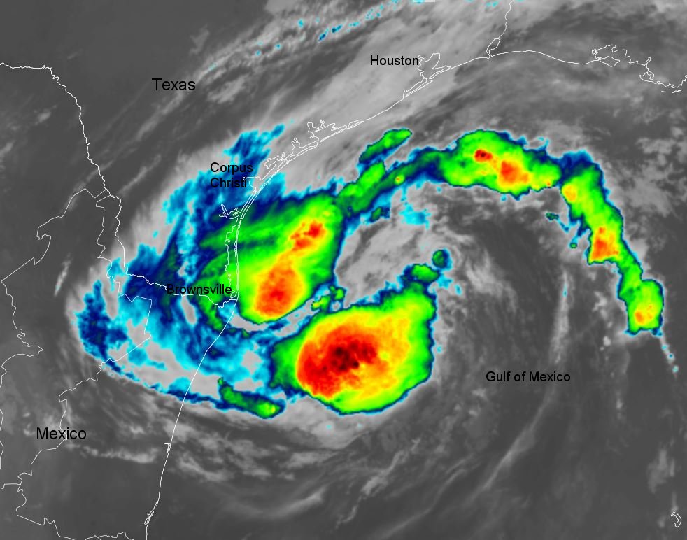
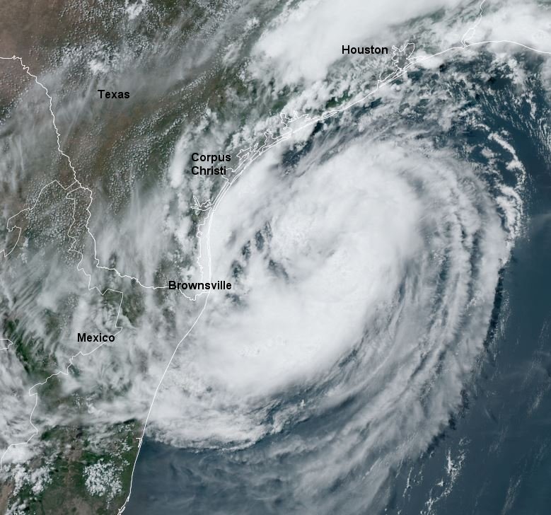
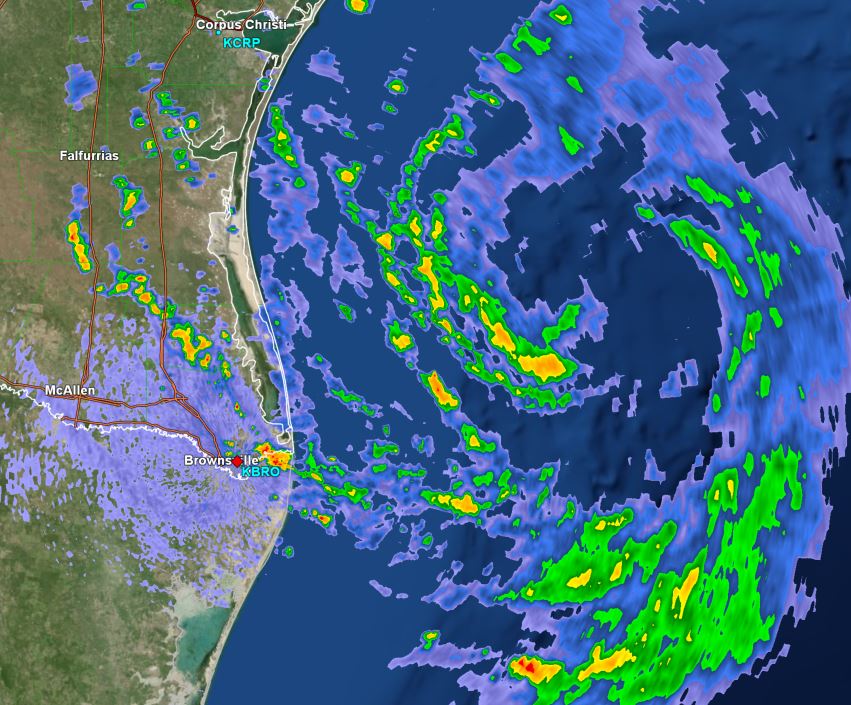
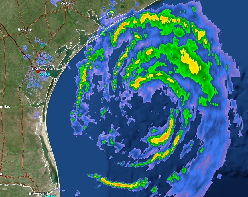
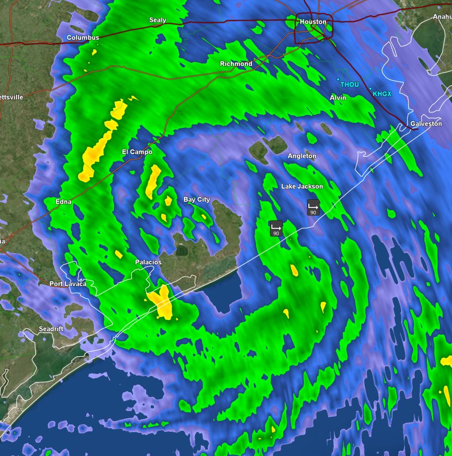
Beryl track has shifted northward. It is now expected to cross the southern Gulf and move northwest toward the central Texas coast. Interests on all of the western Gulf coast should follow the progress of Beryl as the model may shift further. At this time landfall is expected Sunday night or now possibly Monday if it moves farther northward, likely regaining hurricane strength.