Hilary heading toward west central Baja
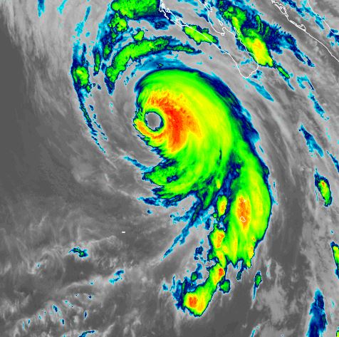
Outer rain bands from Hilary are moving over Los Cabos. Satellite imagery shows the strongest part of the eyewall on the SE side of the circulation.
The western Baja will see storm surge, hurricane force winds, flash flooding and mudslides. See the official NHC advisory for the details of these hazards.
The Weather Situation
SUMMARY OF 600 PM MDT...0000 UTC...INFORMATION
----------------------------------------------
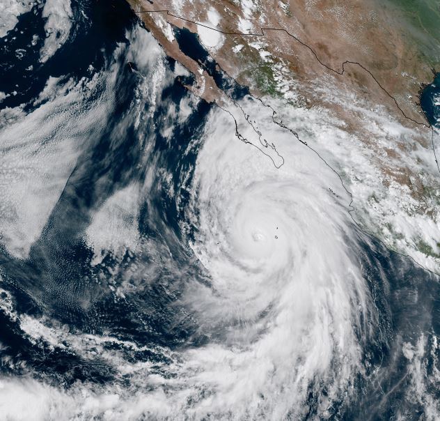
LOCATION...19.1N 112.4W
ABOUT 95 MI...150 KM WNW OF SOCORRO ISLAND
ABOUT 310 MI...495 KM SSW OF CABO SAN LUCAS MEXICO
MAXIMUM SUSTAINED WINDS...130 MPH...215 KM/H
PRESENT MOVEMENT...NW OR 325 DEGREES AT 12 MPH...19 KM/H
MINIMUM CENTRAL PRESSURE...948 MB...28.00 INCHES
Tropicast: Visible satellite Friday afternoon 3 pm pdt
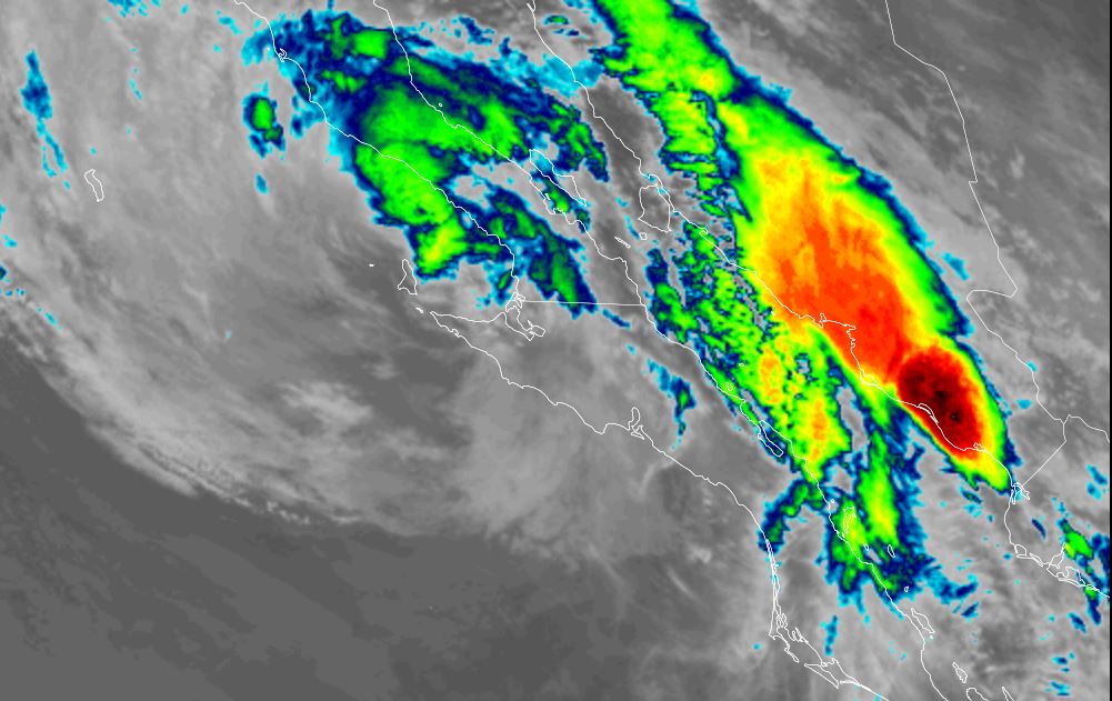
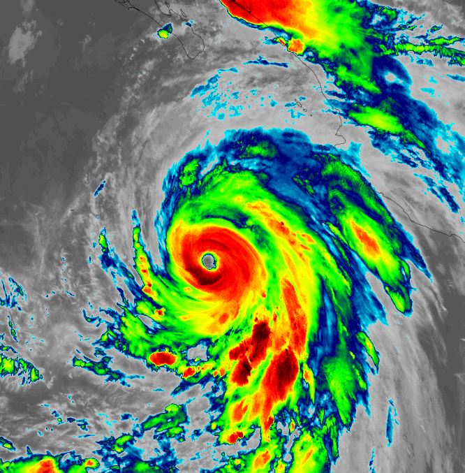
Tropicast: IR satellite Thursday night 1 am pdt
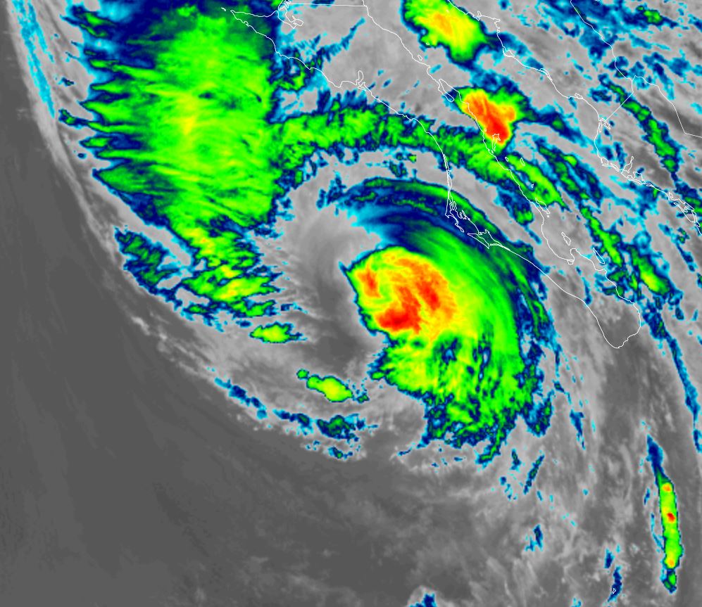
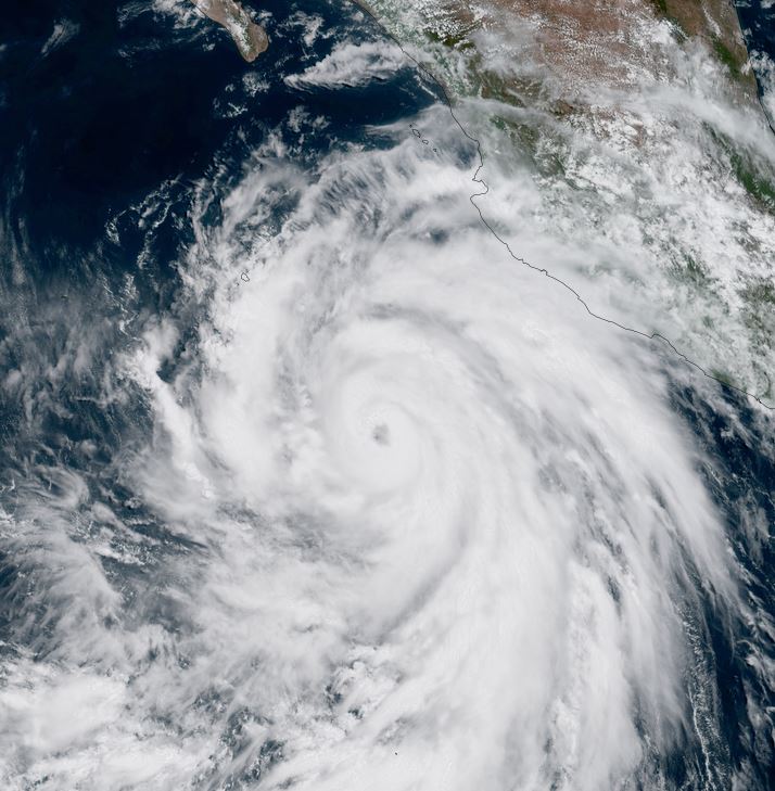
Tropicast: Visible satellite Thursday afternoon 12:30 pm pdt
Tropical Weather Forecast:
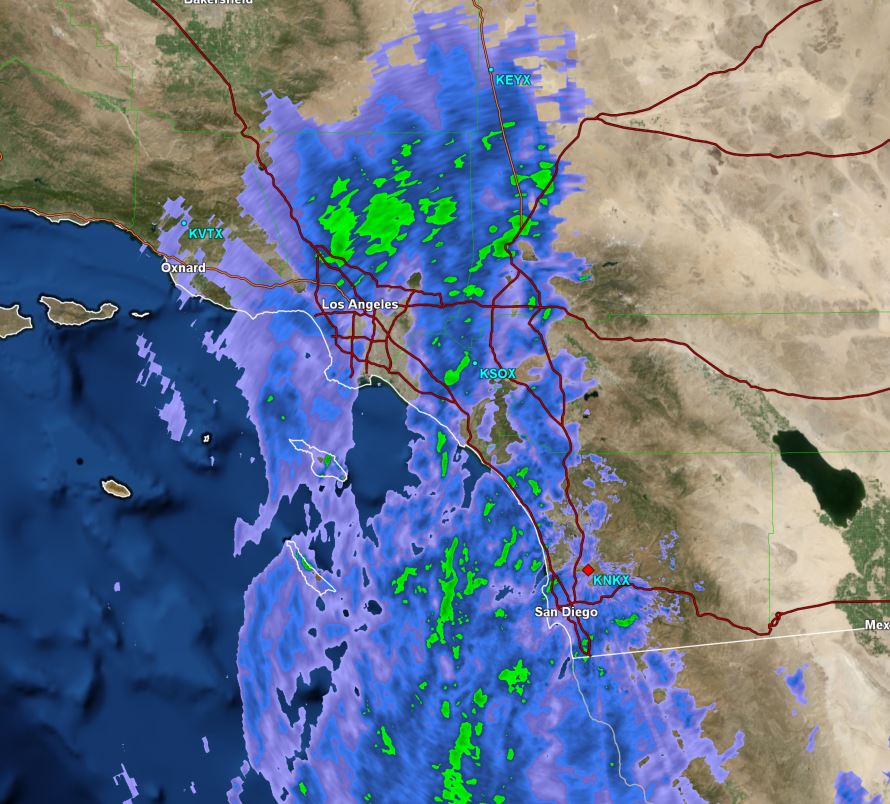
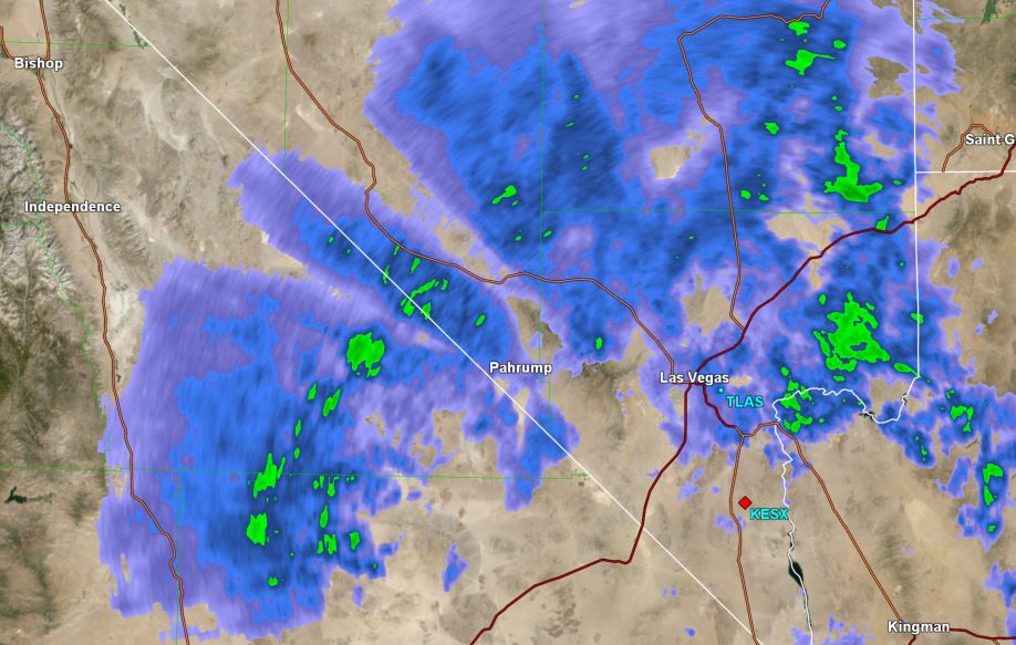
Hilary will be a hurricane as it affects the west central coast of the Baja later in the day Saturday into Sunday morning. It will continue northward over southern California Sunday night into Monday morning. The greatest threat to southern California will be heavy rainfall with flash flooding and mudslides.