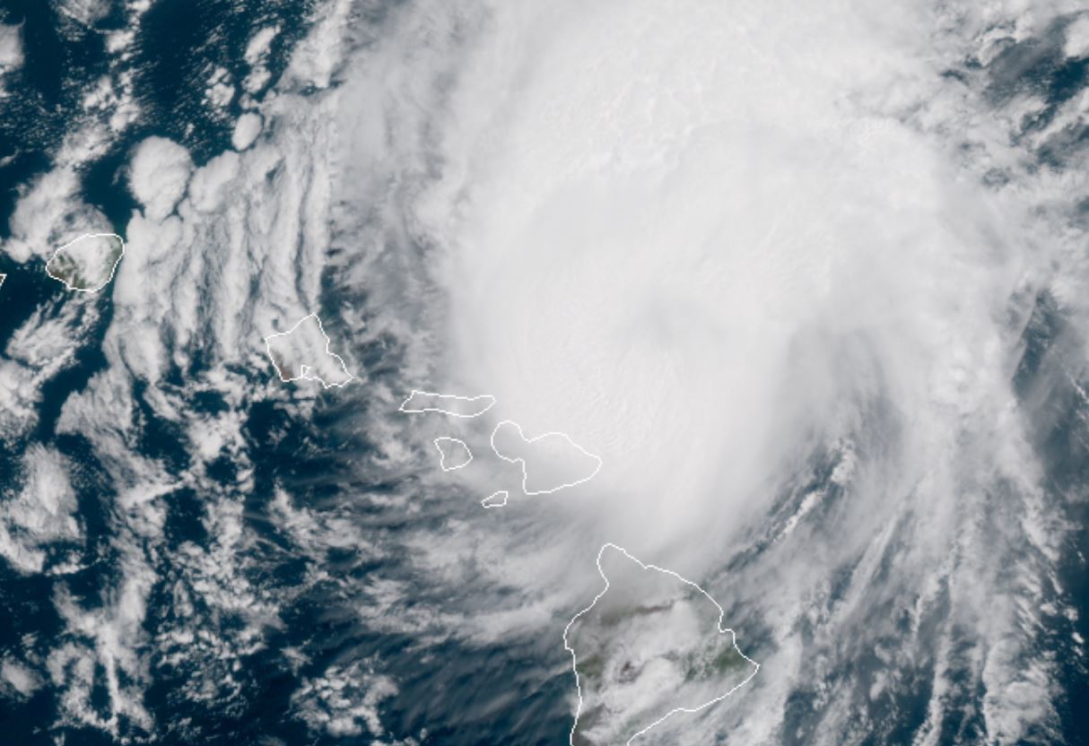
Sunday Morning Update
Douglas to pass close to central Hawaii today
The Weather Situation
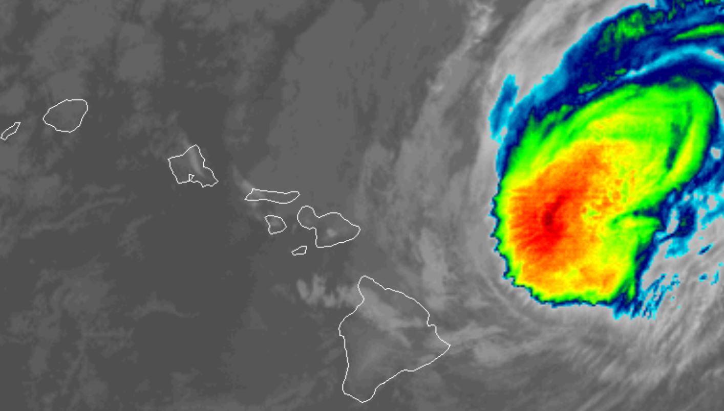
Douglas is still a category 1 hurricane despite being sheared. Recon has found winds to about 90 mph.
For more frequent updates: Twitter: https://twitter.com/richjohnsonwx
Current tropical weather
As of 2:00 AM HST Hurricane Douglas was centered at 20.5 N / 153.6 W or 190 miles east of Kahului, Hawaii. It was moving WNW at 16 mph. Officially top sustained winds are estimated at 90 mph. Pressure was estimated at 983 hPa (mb).
Tropical Weather Forecast:
Douglas will pass near or just north of the central Hawaiian Islands late today into this evening (Hawaiian time). It is possible that it will still be a minimal hurricane, but the hurricane force winds may stay a little north of the islands. High surf, gusty winds and squally weather will be possibly in the central and western islands as it passes.
Tropicast: Vis Satellite - several days ago
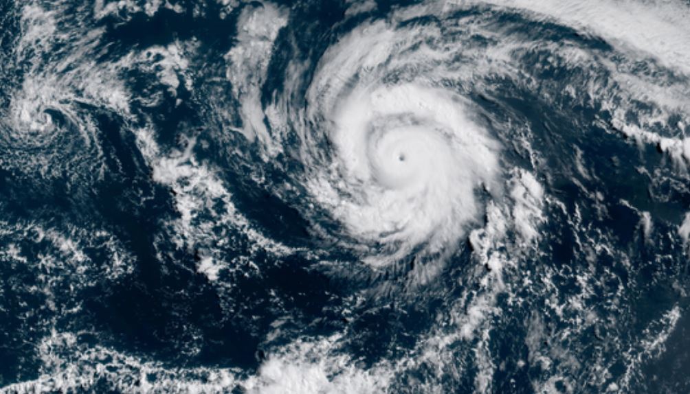
Tropicast: Vis Satellite - few days ago
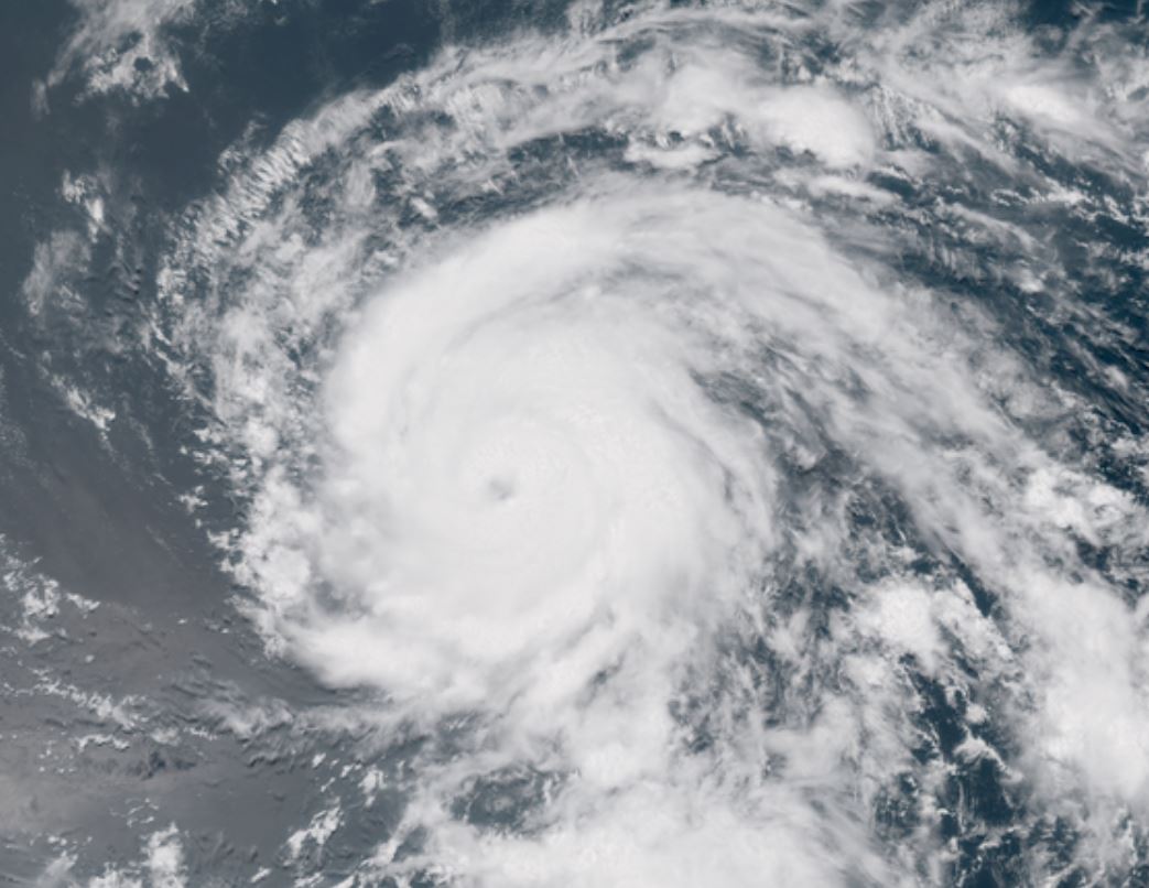
Tropicast: IR Satellite - Sunday Morning
Douglas
Moderator: Florida Beach Gal
- Tropical Inspector
- Site Admin
- Posts: 3630
- Joined: Tue Feb 20, 2007 2:28 pm
- Antispam: no
- Location: Under a palm tree
- Contact:
Douglas
Rich Johnson
Twitter: https://twitter.com/richjohnsonwx
Certified Broadcast Meteorologist - Hurricane Expert
Twitter: https://twitter.com/richjohnsonwx
Certified Broadcast Meteorologist - Hurricane Expert
- Tropical Inspector
- Site Admin
- Posts: 3630
- Joined: Tue Feb 20, 2007 2:28 pm
- Antispam: no
- Location: Under a palm tree
- Contact:
Re: Douglas
Sunday Evening Update
Douglas passing north of Hawaii
The Weather Situation
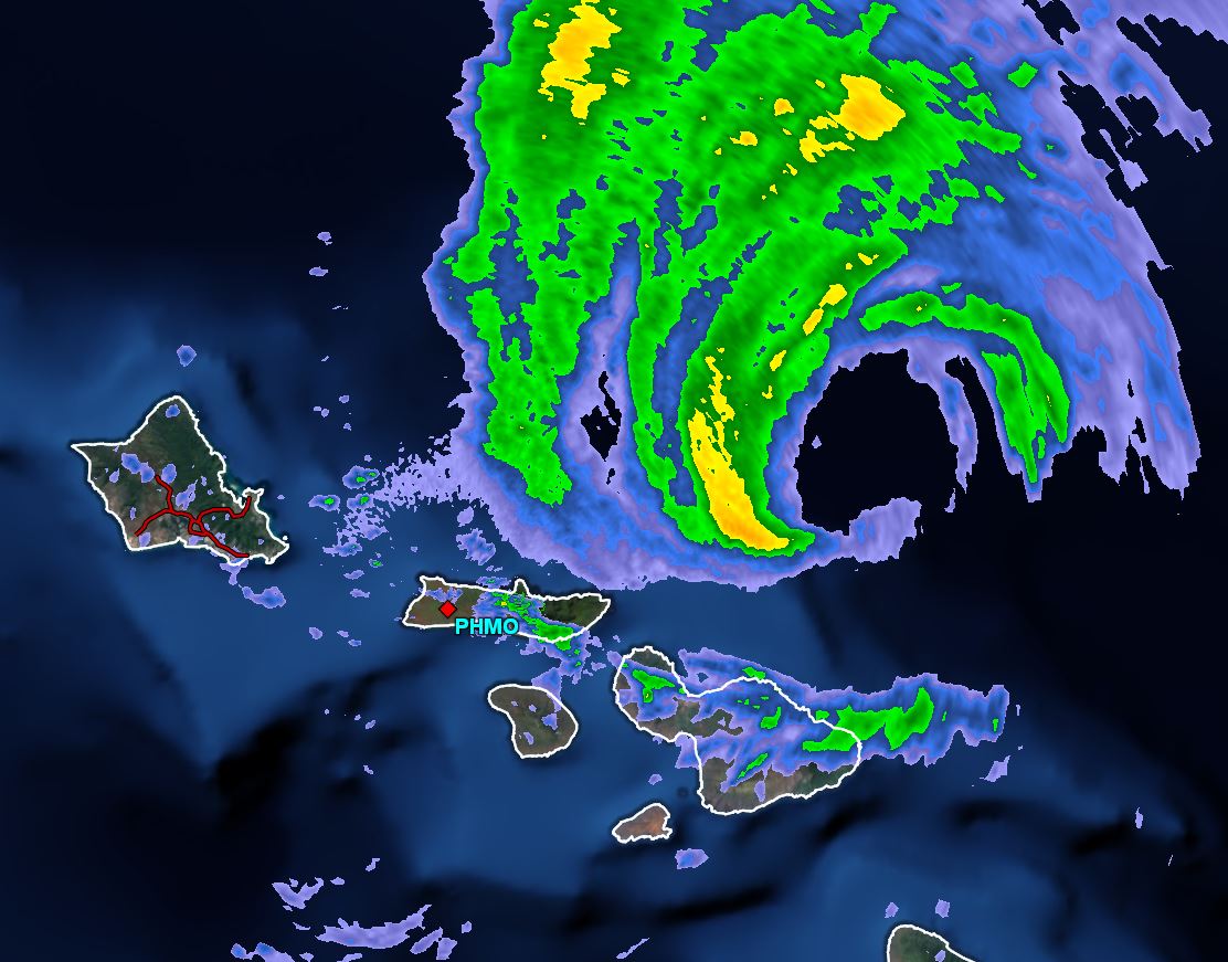
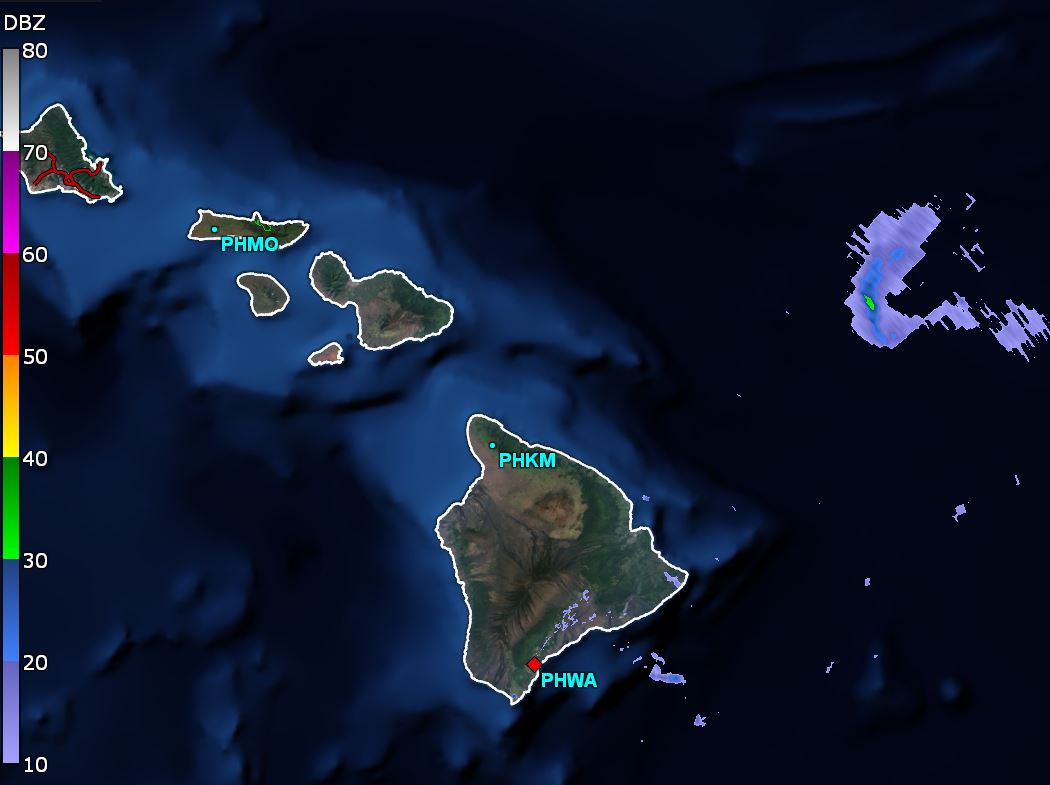
The eye of hurricane Douglas is passing just north of the central Hawaiian Islands. High surf is the main concern as well as heavy rain with squall bands. The strongest winds may barely stay north of the Islands.
For more frequent updates: Twitter: https://twitter.com/richjohnsonwx
Current tropical weather
As of 11:00 AM HST Hurricane Douglas was centered at 21.2 N / 155.7 W or 140 miles east of Honolulu, Hawaii. It was moving WNW at 16 mph. Officially top sustained winds are estimated at 85 mph. Pressure was estimated at 987 hPa (mb).
Tropical Weather Forecast:
Douglas will likely continue just north of the central and western islands this evening and overnight.
Tropicast: Vis Satellite - several days ago
[color=greenTropicast: Radar[/color]
Rich Johnson
Twitter: https://twitter.com/richjohnsonwx
Certified Broadcast Meteorologist - Hurricane Expert
Twitter: https://twitter.com/richjohnsonwx
Certified Broadcast Meteorologist - Hurricane Expert
Who is online
Users browsing this forum: No registered users and 0 guests