Wednesday Afternoon Update
Adrian earliest in EPAC
The Weather Situation
Tropical Storm Adrian was classified on the evening of May 9th. This makes it the earliest forming tropical storm in the eastern Pacific during the satellite era.
Current Tropical Weather
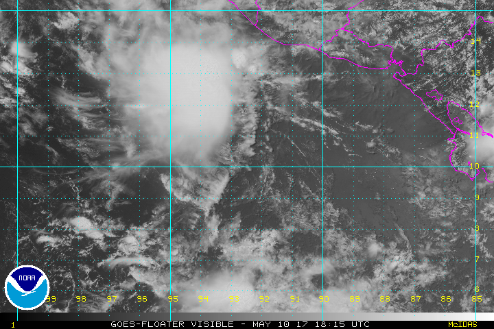
As of 10 AM CDT Tropical Storm Adrian was centered at 10.4 N / 92.7 W or 435 miles SSE of Salina Cruz, Mexico. It was moving NW at 7 mph. Top sustained winds are estimated at 45 mph. Pressure was estimated at 1004 mb.
Tropical Weather Forecast:
Adrian will likely strengthen to a hurricane this weekend south of southern Mexico. Models differ after this point. Some keep it offshore early next week and others weaken it as it moves into southern Mexico.
Tropicast: Visible Satellite
Adrian
- Tropical Inspector
- Site Admin
- Posts: 3658
- Joined: Tue Feb 20, 2007 2:28 pm
- Antispam: no
- Location: Under a palm tree
- Contact:
Adrian
Rich Johnson
Twitter: https://twitter.com/richjohnsonwx
Certified Broadcast Meteorologist - Hurricane Expert
Twitter: https://twitter.com/richjohnsonwx
Certified Broadcast Meteorologist - Hurricane Expert
- Tropical Inspector
- Site Admin
- Posts: 3658
- Joined: Tue Feb 20, 2007 2:28 pm
- Antispam: no
- Location: Under a palm tree
- Contact:
Re: Adrian
So much for Adrian becoming a hurricane. It survived one day before being downgraded to a depression again. Strong SE wind shear tore Adrian apart. It is disconcerting that the models did not pick this up well.
Rich Johnson
Twitter: https://twitter.com/richjohnsonwx
Certified Broadcast Meteorologist - Hurricane Expert
Twitter: https://twitter.com/richjohnsonwx
Certified Broadcast Meteorologist - Hurricane Expert
Who is online
Users browsing this forum: No registered users and 1 guest