Wednesday Afternoon Update
Barry forms in southern Bay of Campeche
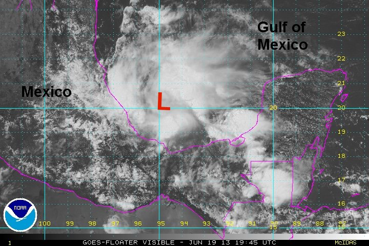
Satellite imagery, buoy reports and recon have confirmed that Barry has formed. TD 2 moved far enough from land that it was able to regenerate after its landfall into Belize and the Mexican Yucatan. Deep convection is impressive in all quadrants around the center of circulation. Barry could have strengthened substantially if not for the impending landfall in a matter of slightly more than 12 hours.
There may be some power outages near the landfall location as winds gust to more than 50 mph.
As of 3 pm cdt Barry was centered at 20.3 N / 94.7 W or about 100 nm ne of Veracruz Mexico. It was moving wnw at about 10 mph. Top sustained winds estimated at 40 mph ( 40 mph NHC advisory). Pressure was estimated at 1006 mb.
Forecast models take Barry into Mexico by Thursday morning. Heavy rainfall will be the primary concern.
Tropicast: Visible Floater Satellite
Barry
- Tropical Inspector
- Site Admin
- Posts: 3686
- Joined: Tue Feb 20, 2007 2:28 pm
- Antispam: no
- Location: Under a palm tree
- Contact:
Barry
Rich Johnson
Twitter: https://twitter.com/richjohnsonwx
Certified Broadcast Meteorologist - Hurricane Expert
Twitter: https://twitter.com/richjohnsonwx
Certified Broadcast Meteorologist - Hurricane Expert
- Tropical Inspector
- Site Admin
- Posts: 3686
- Joined: Tue Feb 20, 2007 2:28 pm
- Antispam: no
- Location: Under a palm tree
- Contact:
Re: Barry
Thursday Morning Update
Barry moving inland north of Veracruz
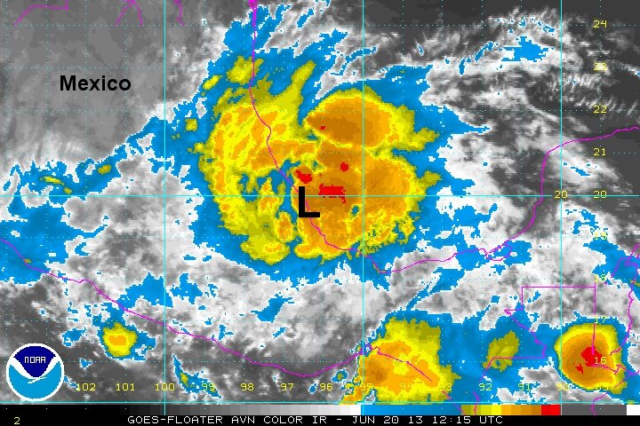
Tropical storm Barry is on the coast of Mexico. There was no appreciable change in intensity since its formation yesterday afternoon. A large area of convection was able to spread far from the center bringing heavy rain well away from the landfall position. Barry will continue to bring heavy rainfall to Mexico with the threat of flash flooding.
As of 7 am cdt Barry was centered at 19.6 N / 96.4 W or about 30 miles nw of Veracruz, Mexico. It was moving west at about 3 mph. Top sustained winds estimated at 45 mph ( 45 mph NHC advisory). Pressure was estimated at 1004 mb.
Forecast models weaken Barry over the next 1-2 days into central Mexico.
Tropicast: Visible Floater Satellite
Rich Johnson
Twitter: https://twitter.com/richjohnsonwx
Certified Broadcast Meteorologist - Hurricane Expert
Twitter: https://twitter.com/richjohnsonwx
Certified Broadcast Meteorologist - Hurricane Expert
Who is online
Users browsing this forum: No registered users and 0 guests