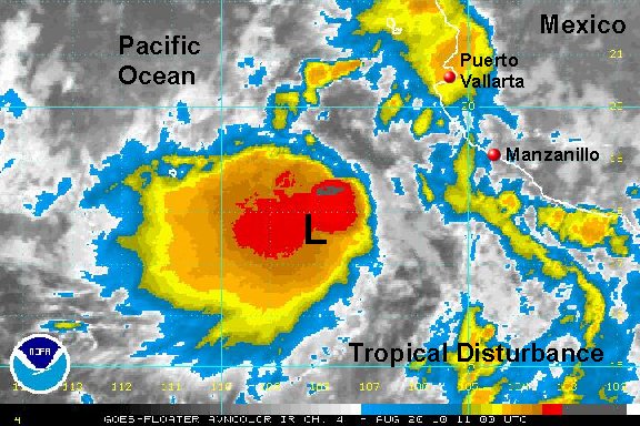
New disturbance has organized overnight
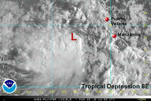
A tropical disturbance has strengthened overnight and is likely now a tropical depression. We will be able to tell more with the first visible satellite images. A large burst of deep convection is associated with the low. Impacts to the resorts should be minimal since the low is already well offshore.
As of 8:00 am edt / 5:00 am pdt the tropical disturbance was centered near 17.5°N / 108.2 °W or roughly about 260 miles west southwest of Manzanillo, Mexico. Movement is to the west northwest at about 10 mph. Top sustatined winds are estimated at 30 mph.
Forecast models take this system away from the western coast of Mexico and south of Cabo San Lucas.
Tropicast: Pacific Floater I.R. Satellite