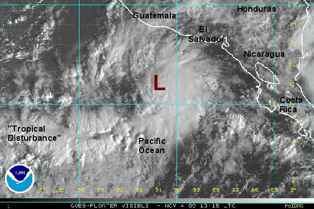
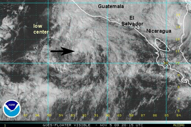
New disturbance quickly organizing
A tropical disturbance has rapidly formed in the monsoon trough over the past 24 hours. Deep convection is increasing and it appears that a circulation at the surface has closed off. We now believe that this feature is a tropical depression.
As of 9:00 am edt / 8:00 am cdt the disturbance was centered near 11.0° N / 91.0° W or about 280 miles west southwest of the coast of Nicaragua. Top sustained winds are estimated at 30 mph. The disturbance is nearly stationary.
Forecast models are confused at this time. They develop a low and eventually take it parallel up the west coast of Mexico (offshore) in several days. The models don't understand that a seperate system is off of the eastern side of Nicaragua too. Either the Caribbean low will cross over as this one weakens or this is the actual system to move up the coast.
Tropicast : Pacific Floater Visible Satellite