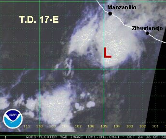
17-E

Tropicial cyclone archives of the 2008 eastern and central Pacific hurricane season
Post Reply
User avatar
Tropical Inspector
Site Admin
Site Admin
Posts: 3626
Joined: Tue Feb 20, 2007 2:28 pm
Antispam: no
Location: Under a palm tree
Contact:

17-E

Post by Tropical Inspector »

Thursday Afternoon Update
17-E strengthening

We have been following a disturbance west of Mexico for about two or three days now. It looked to actually have reached tropical depression status yesterday. It has continued organizing and tropical depression 17-E looks to now be tropical storm Polo. We expect that the National Hurricane Center will upgrade to Polo at 2 pm pdt.

17-E is centered near 14.5 N 104.8 or about 315 miles south of Manzanillo. It is moving nne at around 13 mph. We estimate that top sustained winds are now 45 mph. (Our estimate is that this is tropical storm Polo). Some high and mid level clouds are moving onto the coast near Manzanillo.

The strong southerly shear may rip the deep convection from the center of circulation which would weaken T.D. 17-E. We will watch this closely since it is heading toward the Mexican coast. It the convection is removed from the center of circulation, the steering flow will take it more west, away from Mexico.

TropicalWeather.net's Tropical Pic
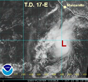
Image
Rich Johnson
Twitter: https://twitter.com/richjohnsonwx
Certified Broadcast Meteorologist - Hurricane Expert
User avatar
Tropical Inspector
Site Admin
Site Admin
Posts: 3626
Joined: Tue Feb 20, 2007 2:28 pm
Antispam: no
Location: Under a palm tree
Contact:

Post by Tropical Inspector »

Friday Early AM Update
17-E continues north

Tropical depression 17-E is centered near 16.0 N /104.8 W or about 220 miles south of Manzanillo. It is moving just east of due north. It is very difficult to tell if the mid level circulation is starting to seperate from the surface circulation. Either way, convection is approaching the coast between Zihuatanejo and Manzanillo. Locally heavy rainfall is possible is some totals of 1-3".

We still believe that T.D. 17-E was a tropical storm for about 12 hours. It appears to have weakened some and is probably in the 35-40 mph range.

The main effect from T.D. 17-E will be heavy rain with the possibility of flash flooding.

TropicalWeather.net's Tropical Pic
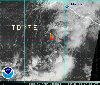
Image
Rich Johnson
Twitter: https://twitter.com/richjohnsonwx
Certified Broadcast Meteorologist - Hurricane Expert
User avatar
Tropical Inspector
Site Admin
Site Admin
Posts: 3626
Joined: Tue Feb 20, 2007 2:28 pm
Antispam: no
Location: Under a palm tree
Contact:

Post by Tropical Inspector »

Friday Afternoon Update
17-E is disorganized

Tropical depression 17-E continues to deteriorate since late last night. The circulation center has lost most of its convection.

The center is more than 250 miles southwest of Manzanillo and is now moving northwest.

Rainfall continues on the coast and isolated rainfall totals of 5" or more is possible. The potential for flash flooding and mudslides continues into western Mexico.

This will be our last update on 17-E unless reorganization takes place.

TropicalWeather.net's Tropical Pic
Image
Rich Johnson
Twitter: https://twitter.com/richjohnsonwx
Certified Broadcast Meteorologist - Hurricane Expert
Post Reply

Return to “2008 Eastern / Central Pacific Hurricane Season Archives”

Who is online

Users browsing this forum: No registered users and 0 guests