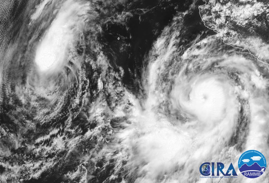
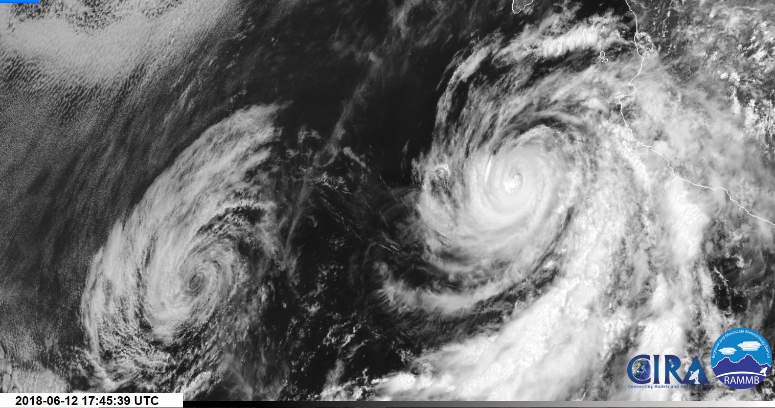
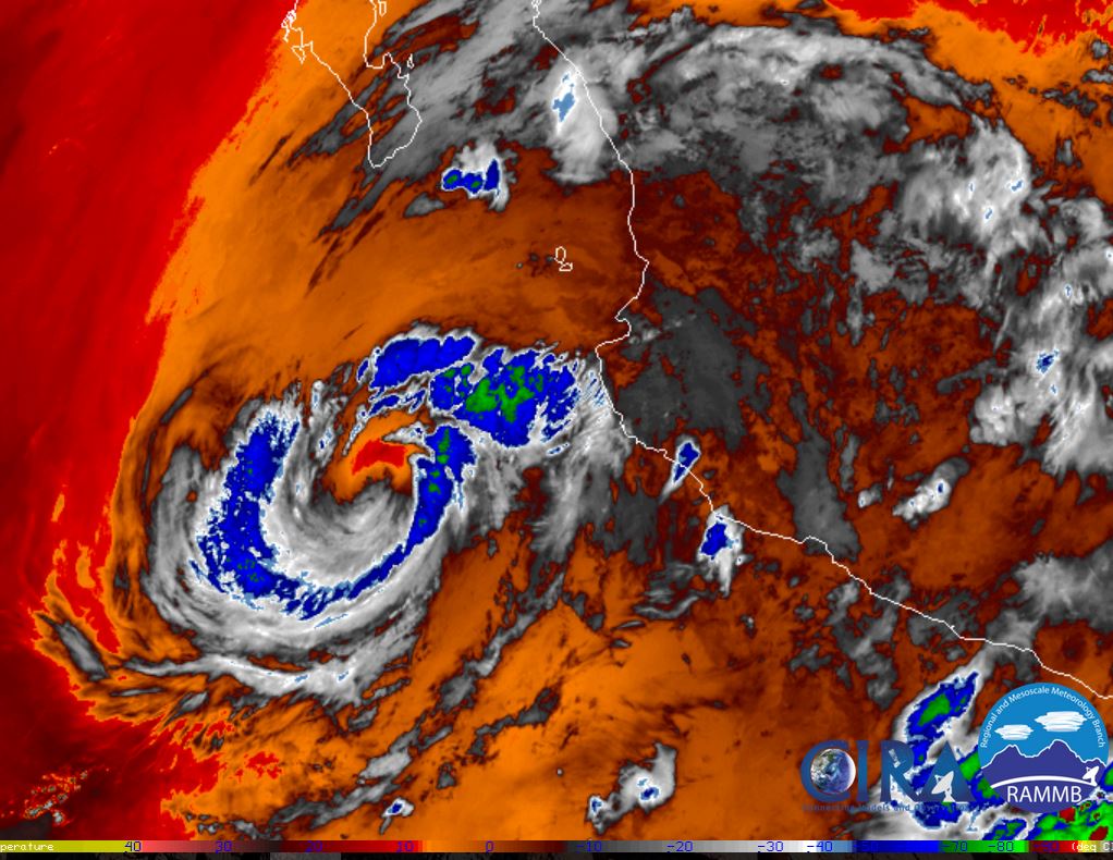
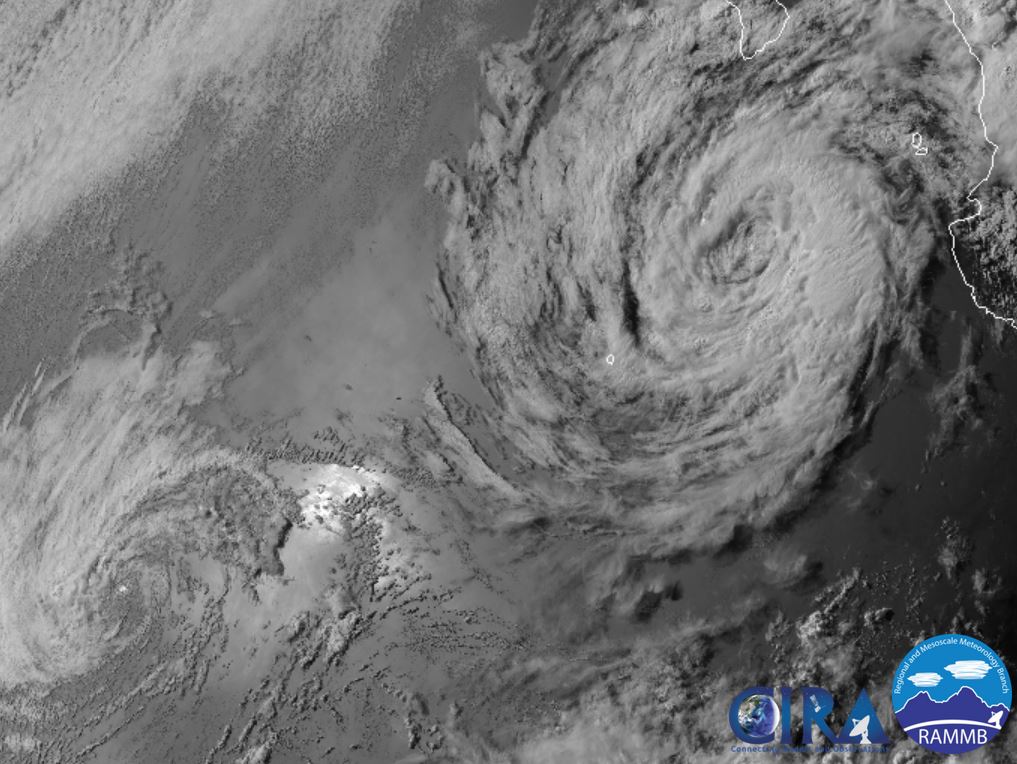
Bud

Tropical cyclone archives of the 2018 eastern and central Pacific hurricane season
Post Reply
User avatar
Tropical Inspector
Site Admin
Site Admin
Posts: 3581
Joined: Tue Feb 20, 2007 2:28 pm
Antispam: no
Location: Under a palm tree
Contact:

Bud

Post by Tropical Inspector »

Sunday Evening Update

Bud strengthening

The Weather Situation
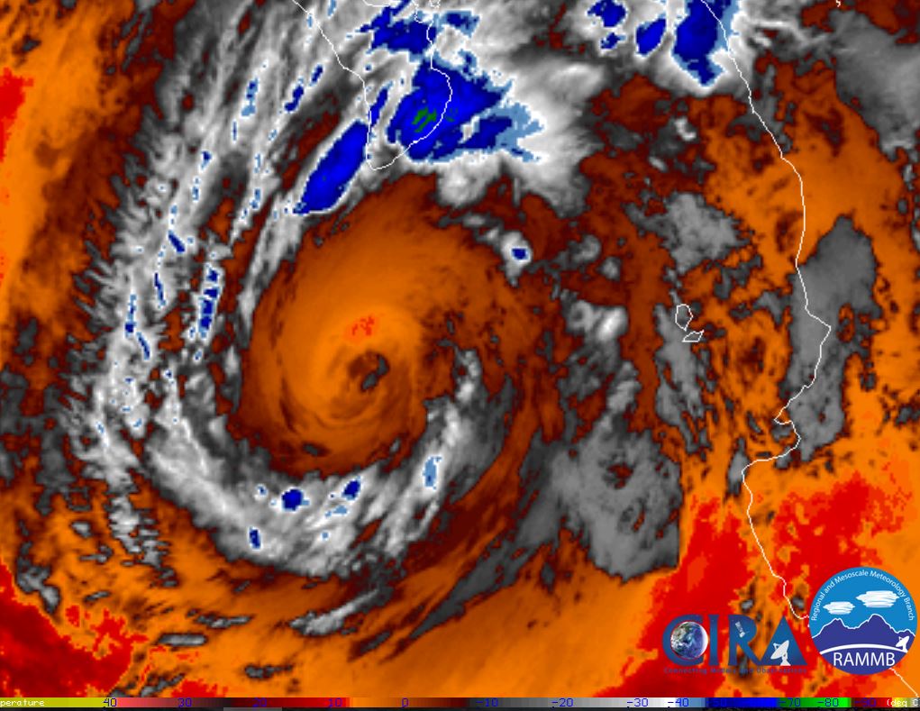
Satellite imagery show that Bud is organizing and possibly entering a rapidly deepening phase. A distinct "doughnut" is now apparent and Bud may gain strength rapidly tonight.

Current Tropical Weather
As of 4 PM CDT Hurricane Bud was centered at 15.3 N / 104.2 W or 255 miles south of Manzanillo, Mexico. It was moving NW at 9 mph. Top sustained winds are estimated at 75 mph. Pressure was estimated at 987 mb.

Tropical Weather Forecast:
Bud should parallel the Mexican coast well offshore the next several days. Strengthening to major hurricane strength is possible.

Tropicast: Visible Satellite
Image
Rich Johnson
Twitter: https://twitter.com/richjohnsonwx
Certified Broadcast Meteorologist - Hurricane Expert
User avatar
Tropical Inspector
Site Admin
Site Admin
Posts: 3581
Joined: Tue Feb 20, 2007 2:28 pm
Antispam: no
Location: Under a palm tree
Contact:

Re: Bud

Post by Tropical Inspector »

Tuesday Afternoon Update

Bud just under max strength

The Weather Situation
Bud has achieved category 4 strength this morning. It will be on a weakening trend as it moves over colder water on its path to the southern Baja by Thursday evening. The main effects will be high seas and rough surf on the western Mexican coast and possibly some gusty winds and heavy rainfall over the southern Baja.

It also has a very small core at this time, so the main effects are being experienced in a small area.

Current Tropical Weather
As of 9 AM MDT ( 11 AM EDT) Hurricane Bud was centered at 18.4 N / 108.4 W or 325 miles SSE of Cabo San Lucas, Mexico. It was moving NW at 6 mph. Top sustained winds are estimated at 125 mph. Pressure was estimated at 950 mb.

Tropical Weather Forecast:
Bud will weaken as it approaches the southern Baja Thursday. Tropical storm force winds may be felt on the southern Baja during the day on Wednesday in squalls.

Tropicast: Visible Satellite
Image
Rich Johnson
Twitter: https://twitter.com/richjohnsonwx
Certified Broadcast Meteorologist - Hurricane Expert
User avatar
Tropical Inspector
Site Admin
Site Admin
Posts: 3581
Joined: Tue Feb 20, 2007 2:28 pm
Antispam: no
Location: Under a palm tree
Contact:

Re: Bud

Post by Tropical Inspector »

Wednesday Morning Update

Bud weakens rapidly

The Weather Situation
Bud has weakened as rapidly as it strengthened. It is now a tropical storm. Cold water has robbed the energy source for Bud and further weakening is anticipated. There is a possibility of a few squalls later today with winds to tropical storms force. Heavy rainfall is the main concern.

Current Tropical Weather
As of 6 AM MDT (8 AM EDT) Tropical Storm Bud was centered at 19.1 N / 108.8 W or 270 miles SSE of Cabo San Lucas, Mexico. It was moving NNW at 2 mph. Top sustained winds are estimated at 70 mph. Pressure was estimated at 990 mb.

Tropical Weather Forecast:
Bud will approach the Los Cabos area in another 36 hours by Thursday evening. It may arrive as a minimal tropical storm or tropical depression. The main threat to the Baja will be potential flash flooding.

Tropicast: IR Satellite
Image
Rich Johnson
Twitter: https://twitter.com/richjohnsonwx
Certified Broadcast Meteorologist - Hurricane Expert
User avatar
Tropical Inspector
Site Admin
Site Admin
Posts: 3581
Joined: Tue Feb 20, 2007 2:28 pm
Antispam: no
Location: Under a palm tree
Contact:

Re: Bud

Post by Tropical Inspector »

Thursday Morning Update

Bud approaching Baja

The Weather Situation
Bud's rainbands are now over the southern Baja. Winds may gust to tropical storm force today as Bud approaches Baja. Heavy rain showers remains the main concern.

Current Tropical Weather
As of 6 AM MDT (8 AM EDT) Tropical Storm Bud was centered at 21.4 N / 109.5 W or 105 miles SSE of Cabo San Lucas, Mexico. It was moving NNW at 7 mph. Top sustained winds are estimated at 45 mph. Pressure was estimated at 1000 mb.

Tropical Weather Forecast:
Bud will make landfall later this evening either as a 40 mph tropical storm or tropical depression. Heavy rainfall is still the main concern.

Tropicast: Visible Satellite Bud / Aletta Wednesday
Image

Tropicast: IR Satellite Thursday
Image
Rich Johnson
Twitter: https://twitter.com/richjohnsonwx
Certified Broadcast Meteorologist - Hurricane Expert
Post Reply

Return to “2018 Eastern / Central Pacific Hurricane Archives”

Who is online

Users browsing this forum: No registered users and 2 guests