Page 1 of 1
Gordon
Posted: Sun Sep 02, 2018 4:35 pm
by Tropical Inspector
Sunday Evening Update
TD 7 forms north of Cuba
The Weather Situation
TD 7 will become better organized as it enters the SE Gulf of Mexico. Heavy showers over the Bahamas will spread across south Florida during the next 24 hours.
Current Tropical Weather
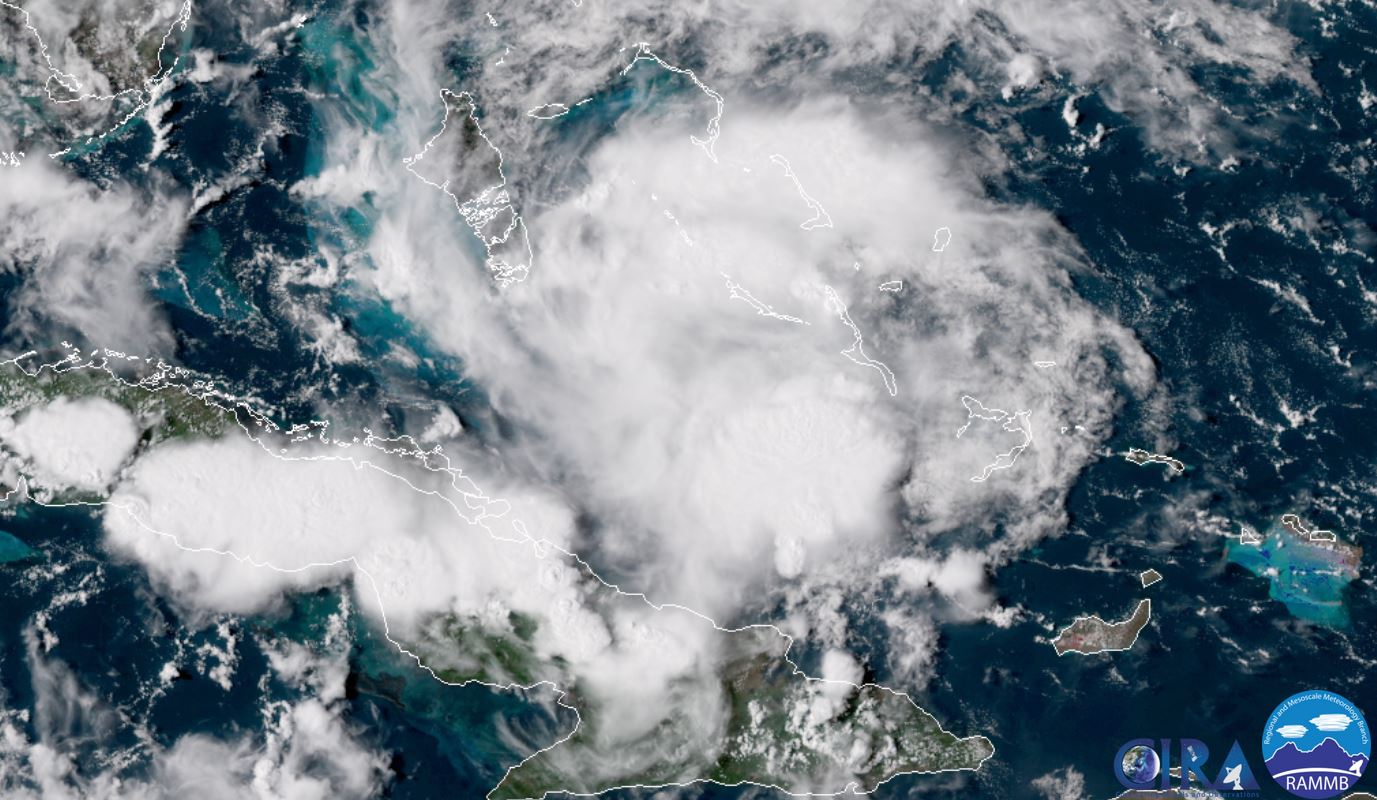
As of 5:00 PM EDT TD 7 was centered at 22.7 N / 77.3 W or 275 miles ESE of Marathon, FL in the Keys. It was moving WNW at 15 mph. Top sustained winds are estimated at 30 mph. Pressure was estimated at 1012 MB.
Tropical Weather Forecast:
TD 7 is forecast to become a tropical storm and move into the eastern Gulf then toward the northern Gulf by later Tuesday or early Wednesday.
Tropicast: Visible Satellite
Re: Gordon
Posted: Mon Sep 03, 2018 1:16 pm
by Tropical Inspector
Monday Afternoon Update
Gordon forms
The Weather Situation
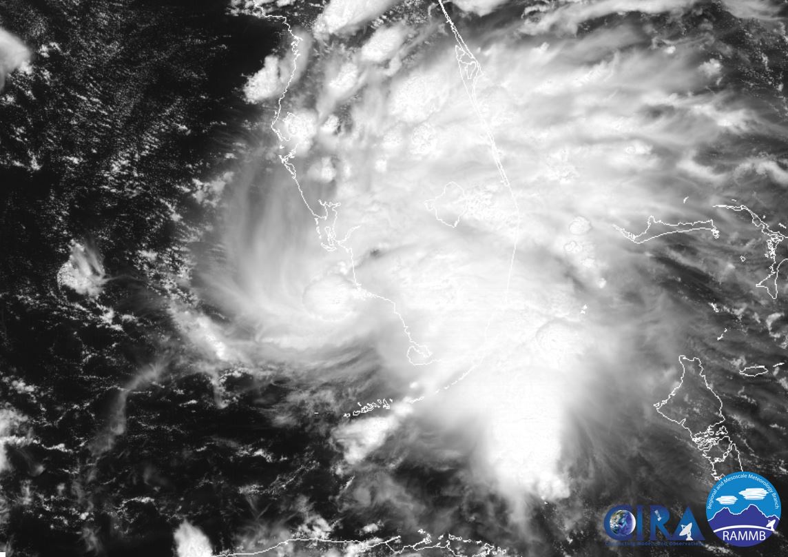
TD 7 has been upgraded to Tropical Storm Gordon this morning. It is bringing heavy showers to the Florida peninsula, Orlando southward. The heaviest rainfall is over south Florida.
Current Tropical Weather
As of 2:00 PM EDT Gordon was centered at 25.8 N / 81.9 W or 15 miles WSW of Marco Island, Florida. It was moving WNW at 16 mph. Top sustained winds are estimated at 50 mph. Pressure was estimated at 1007 MB.
Tropical Weather Forecast:
Gordon is forecast to move toward the coast of Louisiana or Mississippi by later Tuesday.
Tropicast: Visible Satellite
 Tropicast: Radar
Re: Gordon
Posted: Tue Sep 04, 2018 2:16 pm
by Tropical Inspector
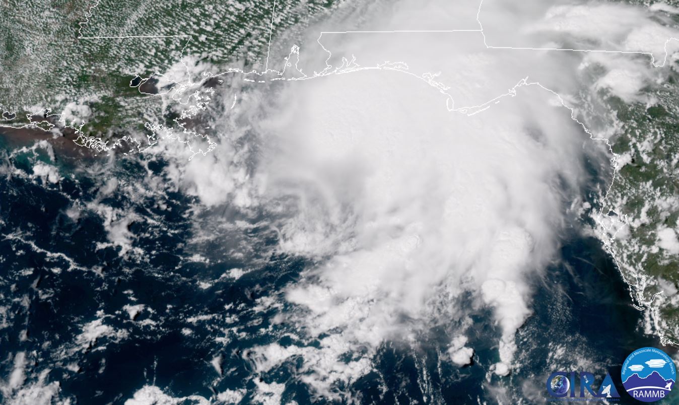
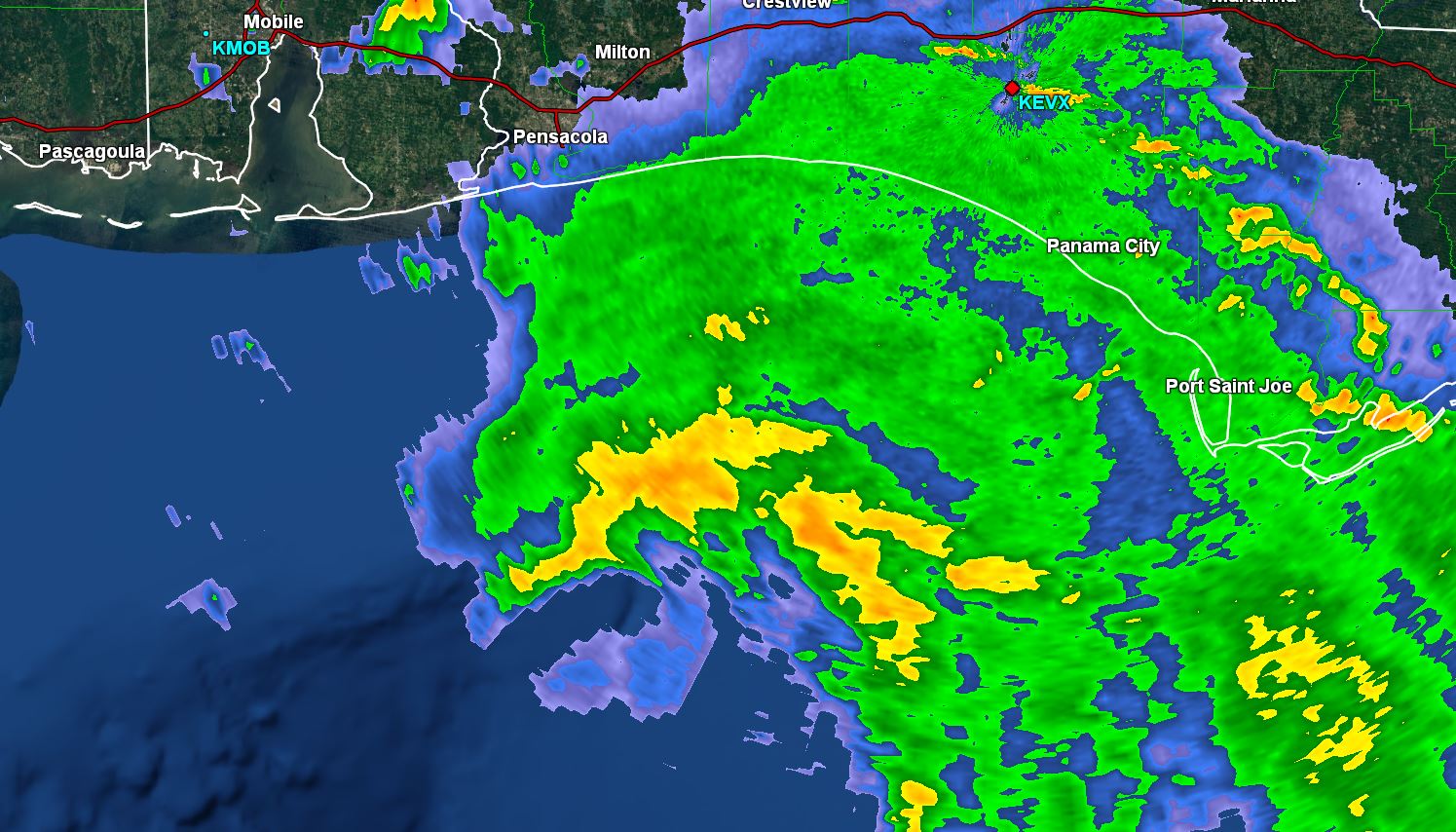
Tuesday Afternoon Update
Gordon approaching coast
The Weather Situation
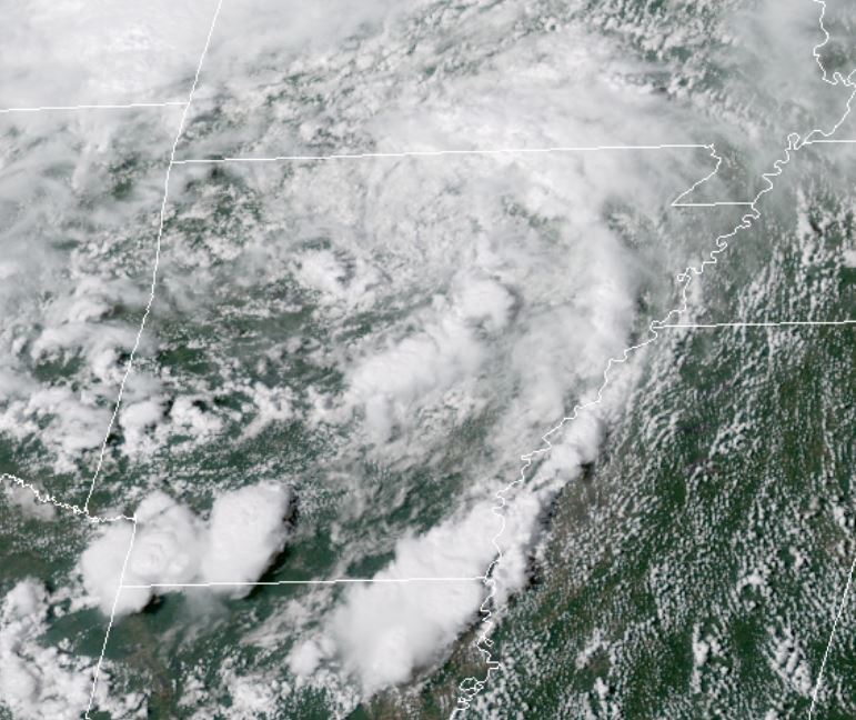
Tropical storm Gordon is struggling. IMO it is not as strong as the official NHC estimate. After studying RECON, buoy, and radar data it is apparent that the circulation center is not becoming better organized.
Current Tropical Weather
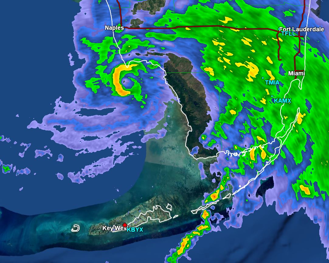
As of 2:00 PM EDT Gordon was centered at 28.9 N / 87.3 W or 130 SSE of Mobile, AL. It was moving NW at 15 mph. Top sustained winds are estimated at 65 mph. Pressure was estimated at 1001 MB.
Tropical Weather Forecast:
Gordon is moving toward the extreme NW Florida panhandle / Alabama coast. The main threat is heavy rainfall. Some storm surge and tropical storm force winds.
Tropicast: Visible Satellite
 Tropicast: Radar
Re: Gordon
Posted: Tue Sep 04, 2018 7:53 pm
by Tropical Inspector
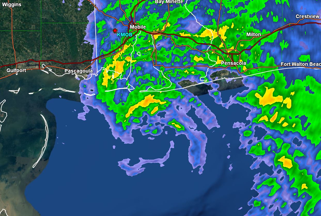
Tuesday Night Update
Gordon about to make landfall
The Weather Situation
Soap box time. Gordon is supposedly a 70 mph tropical storm. This was based on strong winds at 10 k feet seen by radar later this afternoon. Buoy's have only seen sustained winds to 50 mph and gusts to 60 mph. Coastal land reports has seen 20 mph with the semblance of pre eye wall coming ashore. In summary, Gordon is probably a 40 mph tropical storm with gusts to 50. Heavy rainfall is the main issue.
Current Tropical Weather
As of 8:00 PM EDT Gordon was centered at 29.7 N / 87.9 W or 75 miles SE of Biloxi, MS. It was moving NW at 14 mph. Top sustained winds are estimated at 50 mph (70 mph - NHC). Pressure was estimated at 999 MB.
Tropical Weather Forecast:
Gordon will make landfall near the AL / MS coast during the next few hours.
Tropicast: Radar
Re: Gordon
Posted: Wed Sep 05, 2018 1:53 pm
by Tropical Inspector
Tropicast: Gordon wind reports

Re: Gordon
Posted: Fri Sep 07, 2018 3:26 pm
by Tropical Inspector
Tropicast: Gordon still over Arkansas