Page 1 of 1
Ophelia
Posted: Mon Oct 09, 2017 7:05 am
by Tropical Inspector
Monday Morning UpdateTD 17 ClassifiedThe Weather SituationDeep convection is building near and northeast of the center of circulation. TD 17 is fighting SW wind shear, but looks to develop into a storm possibly by later today.
Current Tropical WeatherAs of 5:00 AM AST TD 17 was centered at 31.1 N / 39.9 W or 875 miles WSW of the Azores. It was moving north at 3 mph. Top sustained winds are estimated at 35 mph. Pressure was estimated at 1008 MB.
Tropical Weather Forecast:TD 17 will meander SW of the Azores and gradually strengthen. It is no threat to land.
Tropicast: Visible Satellite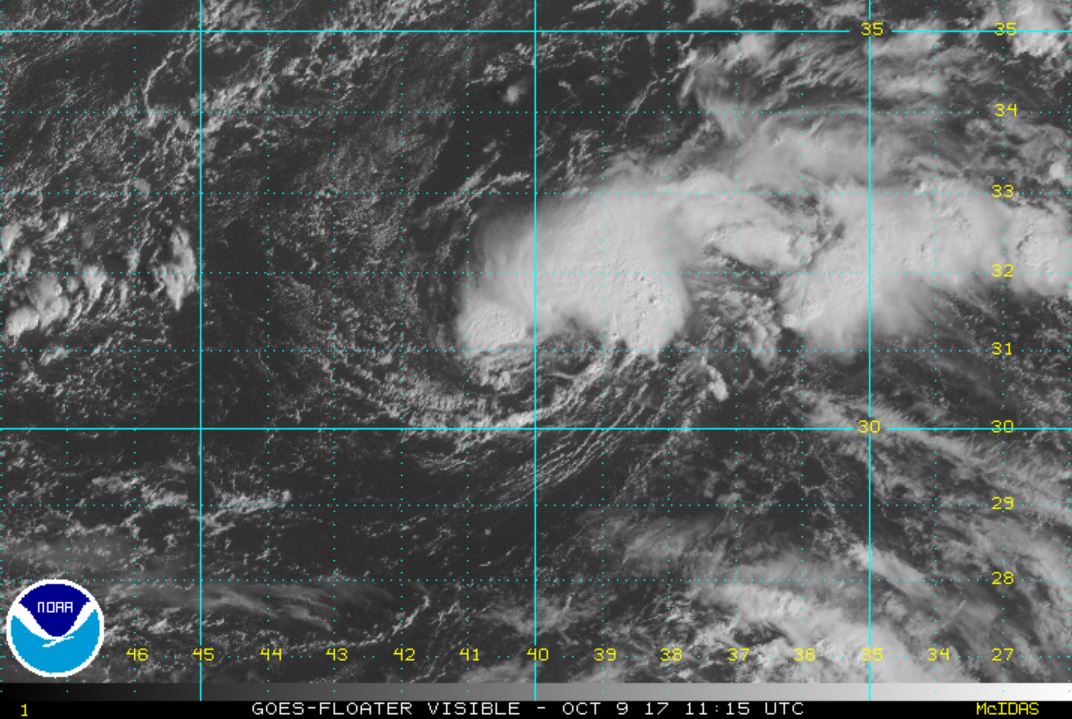
Re: Ophelia
Posted: Mon Oct 09, 2017 2:07 pm
by Tropical Inspector
Monday Afternoon UpdateThe Weather SituationNHC classified TD 17 as a 40 mph tropical storm Ophelia as the cloud structure is more improved. Actually there are little changes since this morning IMO.
Tropicast: Visible Satellite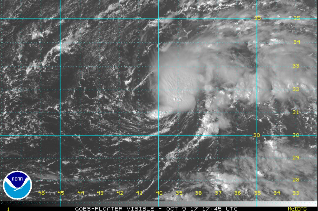
Re: Ophelia
Posted: Tue Oct 10, 2017 7:59 am
by Tropical Inspector
Tuesday Morning UpdateOphelia organizingThe Weather SituationSatellite imagery shows that wind shear has relaxed over Ophelia. It has an easily discernible center of circulation which may become the eye if strengthening continues.
Current Tropical WeatherAs of 5:00 AM AST Ophelia was centered at 31.9 N / 38.8 W or 790 miles WSW of the Azores. It was moving SE at 3 mph. Top sustained winds are estimated at 50 mph. Pressure was estimated at 1002 MB.
Tropical Weather Forecast:Ophelia will be forced south by a building high then move east / northeast toward Europe in the westerlies. It is no threat to Europe at this time.
Tropicast: Visible Satellite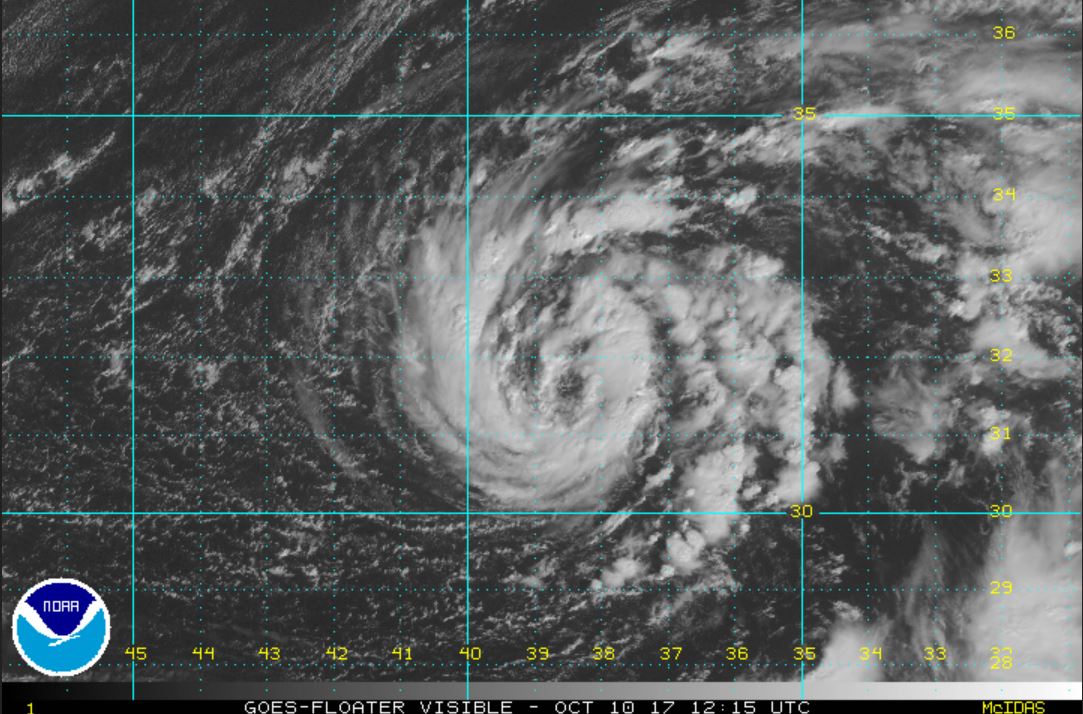
Re: Ophelia
Posted: Wed Oct 11, 2017 8:12 am
by Tropical Inspector
Wednesday Morning Update
Ophelia still organizing
The Weather Situation
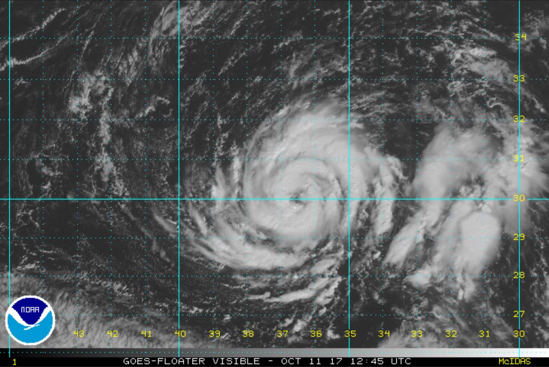
Satellite imagery shows impressive banding and it is only a matter of time before Ophelia is classified as the next hurricane. The only inhibiting factor is sea surface temps of 26 C which is a little cool.
Current Tropical Weather
As of 5:00 AM AST Ophelia was centered at 30.2 N / 37.0 W or 785 miles SW of the Azores. It was moving SE at 6 mph. Top sustained winds are estimated at 65 mph. Pressure was estimated at 996 MB.
Tropical Weather Forecast:
Ophelia will be forced south by a building high then move east / northeast toward Europe in the westerlies. It is no threat to Europe at this time.
Tropicast: Visible Satellite
Re: Ophelia
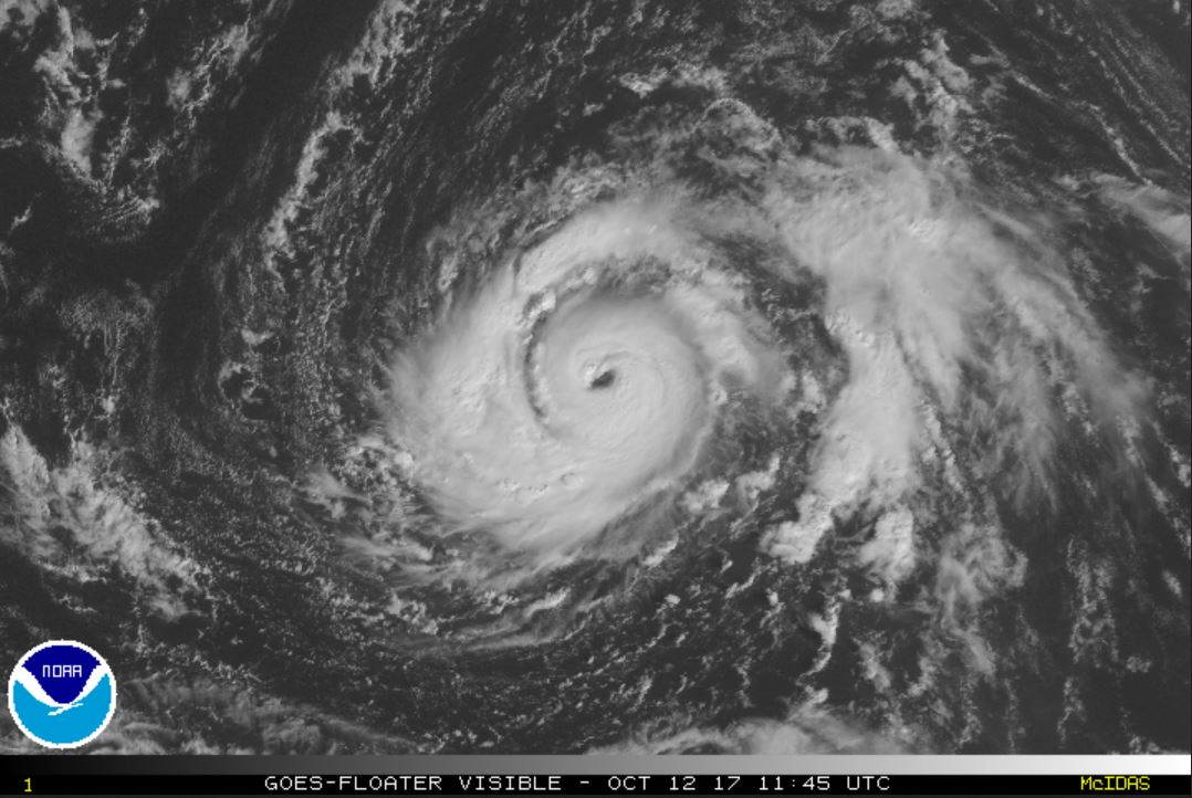
Posted: Thu Oct 12, 2017 7:43 am
by Tropical Inspector
Thursday Morning Update
Ophelia a hurricane
The Weather Situation
As expected, Ophelia was classified as a hurricane yesterday afternoon. Deep convection is strongest east of the center.
Current Tropical Weather
As of 5:00 AM AST Ophelia was centered at 30.3 N / 35.6 W or 725 miles SW of the Azores. It was moving NE at 6 mph. Top sustained winds are estimated at 85 mph. Pressure was estimated at 986 MB.
Tropical Weather Forecast:
Ophelia will move northeast toward Europe in the westerlies the next several days. It will bypass the Azores to the east on Sunday and move into the British Isles early next week. It will be a north Atlantic gale as colder water will transform it into an extratropical cyclone later this weekend. Portugal may experiences some effects also.
Tropicast: Visible Satellite
Re: Ophelia
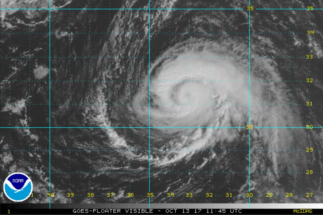
Posted: Fri Oct 13, 2017 7:15 am
by Tropical Inspector
Friday Morning Update
Ophelia looks slightly weaker
The Weather Situation
Ophelia's eye is covered by clouds now and deep convection has leveled off if not gone down a tad. It is a very small tropical cyclone, only about 350 miles wide. IMO top sustained winds are less than the official forecast, maybe significantly lower as it is over 25°C water.
Current Tropical Weather
As of 5:00 AM AST Ophelia was centered at 31.1 N / 33.9 W or 615 miles SW of the Azores. It was moving ENE at 8 mph. Top sustained winds are estimated at 105 mph. Pressure was estimated at 970 MB.
Tropical Weather Forecast:
Ophelia will move northeast toward Europe in the westerlies. It will bypass the Azores to the east on Saturday and move into Ireland Sunday night. It will be a north Atlantic gale as colder water will transform it into an extratropical cyclone later this weekend. Portugal may experiences some effects also.
Tropicast: Visible Satellite
Re: Ophelia
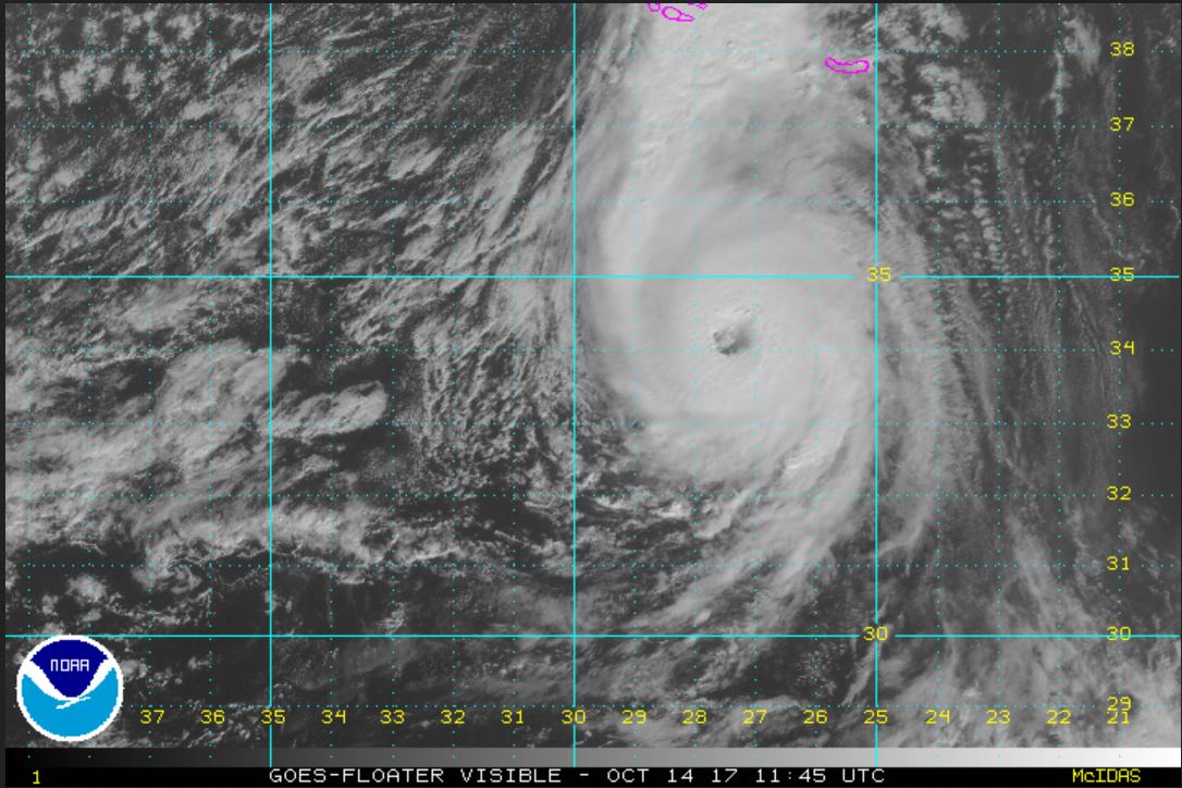
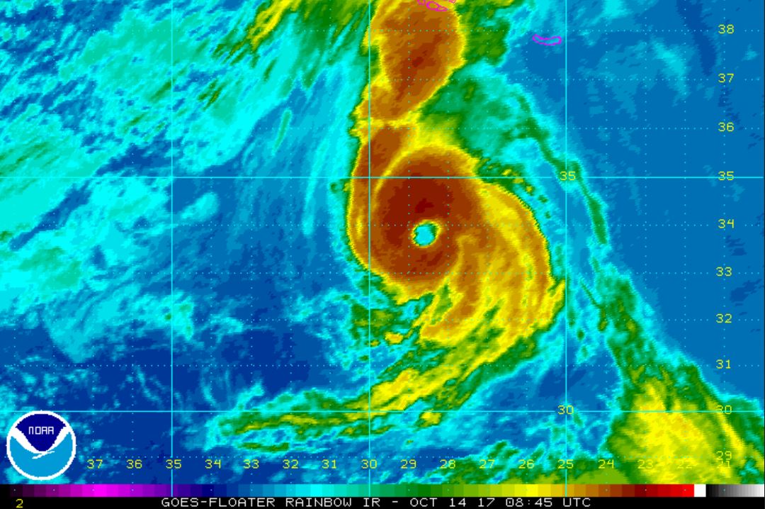
Posted: Sat Oct 14, 2017 7:05 am
by Tropical Inspector
Saturday Morning Update
Ophelia will pass SE of Azores
The Weather Situation
Ophelia is over water that is 24.5°C or about 76°F. Despite this the eye wall and over all structure of the hurricane has improved. The satellite imagery supports the 100 mph wind today. It is interesting that NHC's estimate is 5 mph less than yesterday with the improved imagery. Some rainbands are affecting the central Azores and the eastern most island will get a close brush by later today.
Current Tropical Weather
As of 5:00 AM AST Ophelia was centered at 33.9 N / 38.6 W or 295 miles SSW of the Azores. It was moving ENE at 24 mph. Top sustained winds are estimated at 100 mph. Pressure was estimated at 971 MB.
Tropical Weather Forecast:
Ophelia will bypass the Azores to the east today and move into Ireland Sunday night. It will be a north Atlantic gale as colder water will transform it into an extratropical cyclone by tomorrow. Portugal may experiences some effects also.
Tropicast: Visible Satellite
 Tropicast: IR Satellite
Re: Ophelia
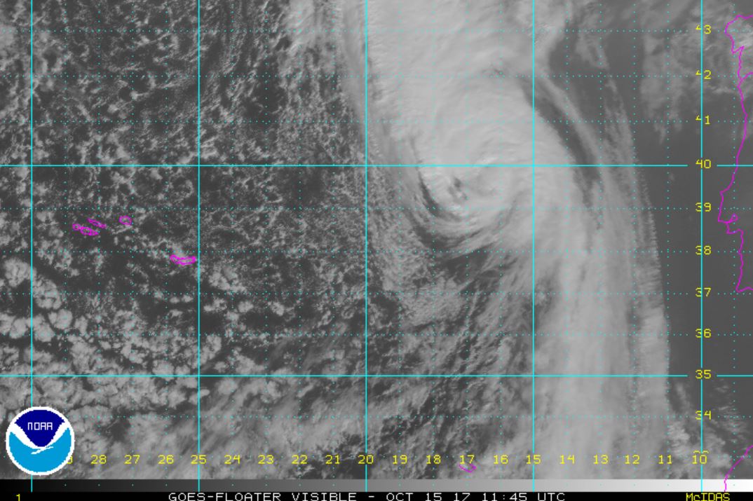
Posted: Sun Oct 15, 2017 8:05 am
by Tropical Inspector
Sunday Morning Update
Ophelia west of Portugal
The Weather Situation
Ophelia became a major hurricane at 115 mph yesterday afternoon. It is quickly transforming into an north Atlantic gale. It will bring strong winds, heavy rain and rough seas to Ireland and western England.
Current Tropical Weather
As of 5:00 AM AST Ophelia was centered at 39.0 N / 18.3 W or 965 miles SSW of Mizen Head, Ireland. It was moving NE at 35 mph. Top sustained winds are estimated at 105 mph. Pressure was estimated at 964 MB.
Tropical Weather Forecast:
Ophelia will move into Ireland tonight. It will be a north Atlantic gale as colder water will transform it into an extratropical cyclone. The Isles will see the effects later this evening and tomorrow.
Tropicast: Visible Satellite
Re: Ophelia
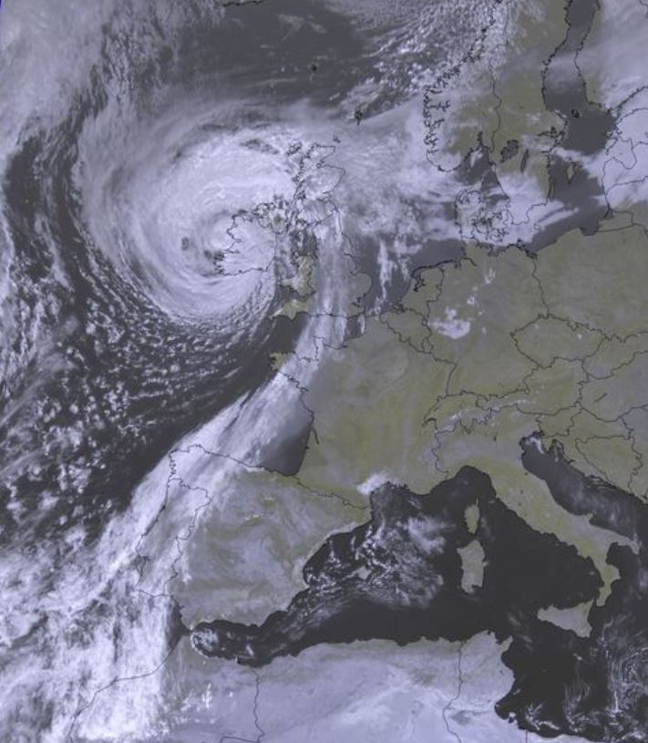
Posted: Mon Oct 16, 2017 10:14 pm
by Tropical Inspector
Tropicast: Satellite
Re: Ophelia
Posted: Thu Nov 23, 2017 1:17 pm
by Tropical Inspector
Near British Isles
97 mph wind gust at Roches point / 86 mph gust at Aberdeen
26.1 / 85.6' wave reported
Presssure 962.2 mb