Page 1 of 1
Cindy
Posted: Mon Jun 19, 2017 8:48 am
by Tropical Inspector
A tropical disturbance with a broad area of low pressure is over the south central Gulf. Satellite imagery shows the low center exposed to the west of the deep convection.
This area of low pressure is expected to organize and move toward the north central Gulf during the next few days. Interests along the Gulf coast should monitor this situation.
Re: Potential Tropical Cyclone 3
Posted: Tue Jun 20, 2017 8:24 am
by Tropical Inspector
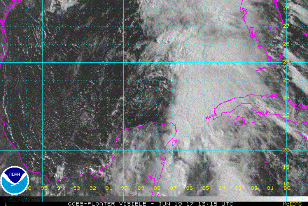
Tuesday Morning UpdateSystem still badly shearedThe Weather SituationPotential Tropical Cyclone 3 is centered in the central Gulf of Mexico this morning. Visible Satellite imagery clearly show the broad low center to the west of the deep convection. Heavy rainfall and flooding will be the main concern to the Gulf States with this system.
Current Tropical WeatherAs of 7 AM CDT Potential Tropical Cyclone 3 was centered at 25.4 N / 90.3 W or 300 miles south of Morgan City, Louisiana. It was moving NW at 9 mph. Top sustained winds are estimated at 40 mph. Pressure was estimated at 999 mb.
Tropical Weather Forecast:Potential Tropical Cyclone 3 is forecast to drift NW as it is in the middle of two high pressure centers aloft. This is resulting in generally weak steering currents. It should approach the Texas / Louisiana coast overnight Wednesday night.

Keep in mind that this is a badly sheared system. Impacts of heavy rainfall will be generally on the eastern side of the circulation where very heavy rainfall will occur. The rainfall will also proceed the landfall, don't fixate on the central position of the system.
Tropicast: Visible Satellite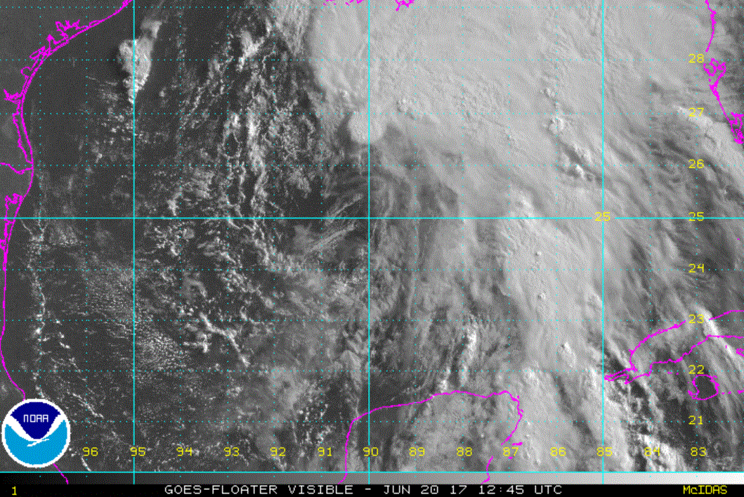
Re: Cindy
Posted: Tue Jun 20, 2017 4:40 pm
by Tropical Inspector
Tuesday Evening UpdateCindy remains shearedThe Weather SituationCindy was named early this afternoon. It may have been possibly a poor decision as the tropical cyclone has shown poor organization today. An upper trough to the west has sheared Cindy with strong southerly winds. Cindy remains a flooding threat to the Gulf coastal states regardless of its designation. Visible satellite imagery show that the center may actually be drifting east.
Current Tropical WeatherAs of 4 PM CDT Tropical Storm Cindy was centered at 25.7 N / 90.6 W or 280 miles south of Morgan City, Louisiana. It was nearly stationary. Top sustained winds are estimated at 45 mph. Pressure was estimated at 999 mb.
Tropical Weather Forecast:Cindy is still forecast to drift NW toward the Louisiana / Texas border overnight Wednesday..... if it doesn't dissipate.
Tropicast: Visible Satellite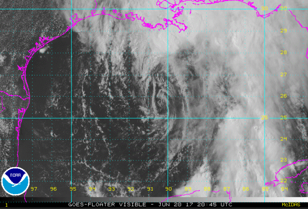
Re: Cindy
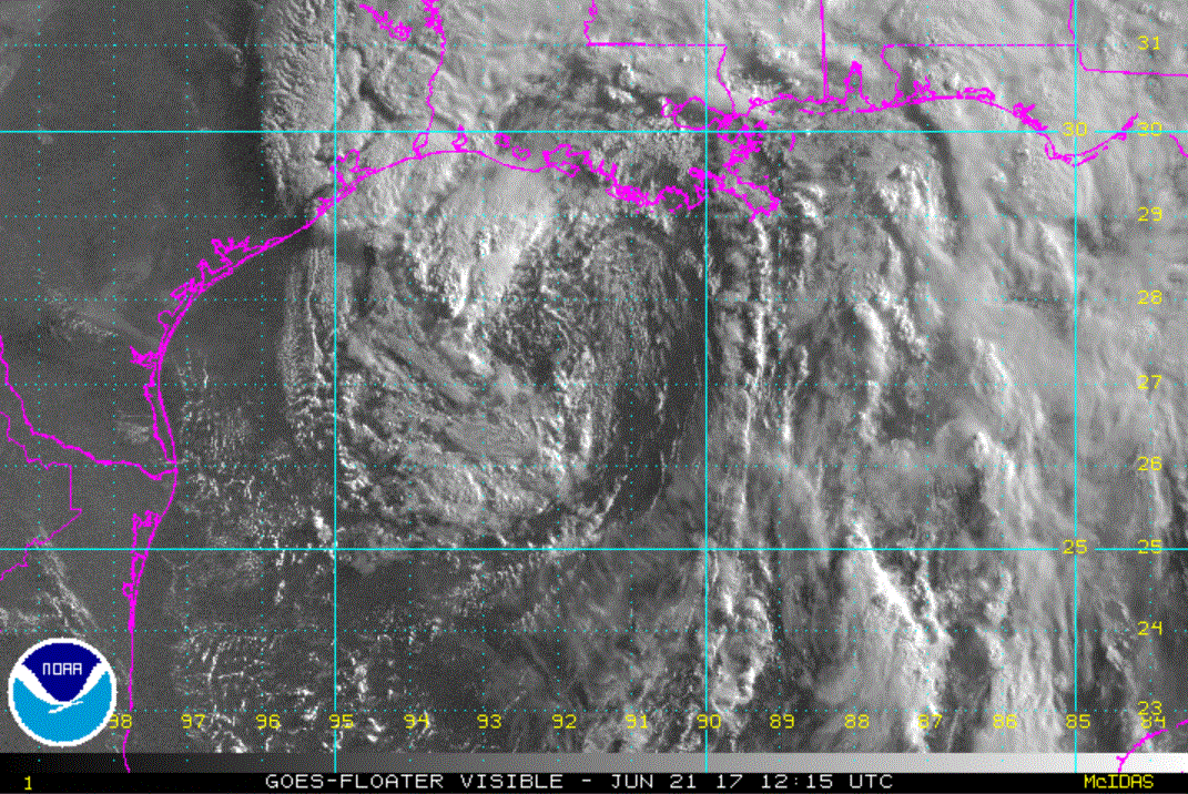
Posted: Wed Jun 21, 2017 7:45 am
by Tropical Inspector
Wednesday Morning Update
Cindy (not really) a tropical storm
The Weather Situation
A reconnaissance aircraft is investigating the circulation of Tropical Storm Cindy this morning. It will find what satellites are showing.... a weak, elongated low level circulation with deep convection mostly placed well east of the center. With ones imagination, this still may be call a sub-tropical storm. It is certainly not a tropical storm.
Winds were increased from 45 to 60 mph from winds observed from a hurricane hunter last evening. In practicality, winds are definitely lower than this with sustained winds probably closer to the original 45 mph.
Current Tropical Weather
As of 7 AM CDT Tropical Storm Cindy was centered at 27.5 N / 92.2 W or 165 miles SSW of Morgan City, Louisiana. It was moving NW at 8 mph. Top sustained winds are estimated at 60 mph. Pressure was estimated at 996 mb.
Tropical Weather Forecast:
Cindy is still forecast to drift NW toward the Louisiana / Texas border overnight tonight.
Tropicast: Visible Satellite
Re: Cindy
Posted: Wed Jun 21, 2017 5:30 pm
by Tropical Inspector
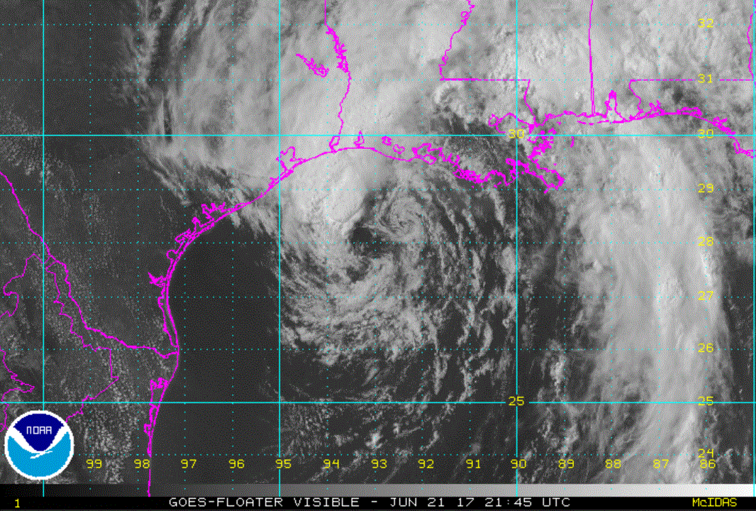
Wednesday Evening UpdateCindy has broad center / Flooding still main concernThe Weather SituationVisible satellite imagery shows a broad center with several vorticies rotating around the low center. A complex of thunderstorms continues on the NW side of the circulation.
A reconnaissance aircraft is investigating currently. It is finding little change wit the pressure still around 996 MB and surface winds of around 35 knots. The official estimate of 50 mph appears to be generous and would be found in the thunderstorm cluster NW of the center or over open water well to the east, south of the AL / FL coast.
Current Tropical WeatherAs of 4 PM CDT Tropical Storm Cindy was centered at 28.2 N / 94.2 W or 125 miles SE of Galveston, TX. It was moving NW at 9 mph. Top sustained winds are estimated at 50 mph. Pressure was estimated at 994 mb.
Tropical Weather Forecast:Cindy is still forecast to drift NW toward the Louisiana / Texas border overnight tonight.
Tropicast: Visible Satellite