Dolly

Tropical cyclone archives for the 2014 Atlantic hurricane season

Moderator: Florida Beach Gal

Post Reply
User avatar
Tropical Inspector
Site Admin
Site Admin
Posts: 3630
Joined: Tue Feb 20, 2007 2:28 pm
Antispam: no
Location: Under a palm tree
Contact:

Dolly

Post by Tropical Inspector »

Monday Night Update

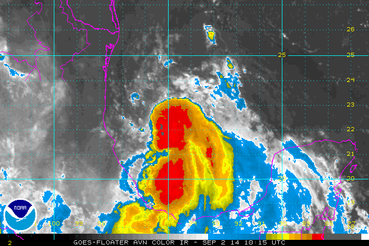
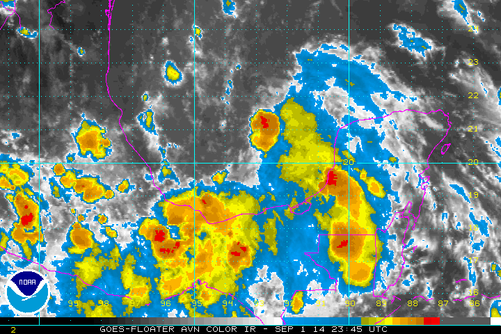
TD 5 in Bay of Campeche

Recon from this afternoon found a closed center of circulation, so TD 5 was classified. There will be only an additional 24 hours for it to strengthen before landfall. Because of this, significant strengthening is not expected - more than minimal tropical storm strength. The main effects from this system will be from heavy rainfall and the threat of flash flooding.

As of 8 pm EDT / 7 PM CDT Tropical depression 5 was centered at 20.5 N / 93.7 W or about 240 miles east of Tuxpan, Mexico. It was moving northwest at about 12 mph. Top sustained winds are estimated at 30 mph. Pressure was estimated at 1008 mb.

Forecast:
Tropical depression 5 is in the Bay of Campeche and will make landfall by Tuesday evening. It is possible that it will make tropical storm strength before landfall between Tampico and Tuxpan.

Tropicast: Atlantic IR floater satellite
Image
Rich Johnson
Twitter: https://twitter.com/richjohnsonwx
Certified Broadcast Meteorologist - Hurricane Expert
User avatar
Tropical Inspector
Site Admin
Site Admin
Posts: 3630
Joined: Tue Feb 20, 2007 2:28 pm
Antispam: no
Location: Under a palm tree
Contact:

Re: Tropical Depression 5

Post by Tropical Inspector »

Tuesday Morning Update

Dolly forms overnight

Recon found winds strong enough to classify the depression as now a tropical storm. Satellite imagery also confirms deep convection that supports this decision. Even though it is being sheared, Dolly will strengthen some more before making landfall tonight. The main effects from this system will be from heavy rainfall and the threat of flash flooding. Some localized power outages will occur where winds gust over 50 mph.

As of 5 am EDT / 7 PM CDT Dolly was centered at 22.6 N / 94.8 W or about 200 miles east of Tampico, Mexico. It was moving northwest at about 13 mph. Top sustained winds are estimated at 45 mph. Pressure was estimated at 1005 mb.

Forecast:
Dolly is in the Bay of Campeche and will make landfall by midnight near Tampico, Mexico.

Tropicast: Atlantic IR floater satellite
Image
Rich Johnson
Twitter: https://twitter.com/richjohnsonwx
Certified Broadcast Meteorologist - Hurricane Expert
User avatar
Tropical Inspector
Site Admin
Site Admin
Posts: 3630
Joined: Tue Feb 20, 2007 2:28 pm
Antispam: no
Location: Under a palm tree
Contact:

Re: Tropical Depression 5

Post by Tropical Inspector »

Tuesday Evening Update

Dolly making landfall soon

Dolly did not significantly organize today. This is good news as the threat of power outages will be diminished. Heavy rainfall and flash flooding can still be expected.

As of 5 pm EDT / 4 PM CDT Dolly centered at 22.0 N / 97.0 W or about 60 miles ESE of Tampico, Mexico. It was moving west at about 12 mph. Top sustained winds are estimated at 45 mph. Pressure was estimated at 1004 mb.

Forecast:
Dolly will weaken quickly after landfall this evening. The threat of heavy rainfall and flash flooding will continue.
Rich Johnson
Twitter: https://twitter.com/richjohnsonwx
Certified Broadcast Meteorologist - Hurricane Expert
Post Reply

Return to “2014 Atlantic Hurricane Season Archives”

Who is online

Users browsing this forum: No registered users and 1 guest