Tuesday Morning Update
Tropical depression 2 changes little overnight
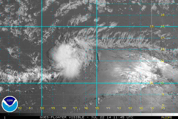
Tropical depression 2 has changed little during the overnight hours. Wind shear continues to affect the depression and the deepest convection remains on the western half of the circulation.
As of 9 am EDT / AST tropical depression 02 was centered at 12.3 N / 47.0 W or about 960 miles east of the Lesser Antilles. It was moving west at about 16 mph. Top sustained winds estimated at 35. Pressure was estimated at 1012 mb.
Forecast:
Tropical depression 2 is forecast to move west, then WNW toward the Lesser Antilles. It will face dry air and unfavorable winds for development. The system may dissipate as it reaches the Lesser Antilles in the next 2-3 days. An increase in showers is still expected.
Tropicast: Atlantic visible floater satellite
Tropical Depression 2
Moderator: Florida Beach Gal
- Tropical Inspector
- Site Admin
- Posts: 3697
- Joined: Tue Feb 20, 2007 2:28 pm
- Antispam: no
- Location: Under a palm tree
- Contact:
Tropical Depression 2
Rich Johnson
Twitter: https://twitter.com/richjohnsonwx
Certified Broadcast Meteorologist - Hurricane Expert
Twitter: https://twitter.com/richjohnsonwx
Certified Broadcast Meteorologist - Hurricane Expert
- Tropical Inspector
- Site Admin
- Posts: 3697
- Joined: Tue Feb 20, 2007 2:28 pm
- Antispam: no
- Location: Under a palm tree
- Contact:
Re: Tropical Depression 2
Wednesday Morning Update
Tropical depression 2 becoming less organized
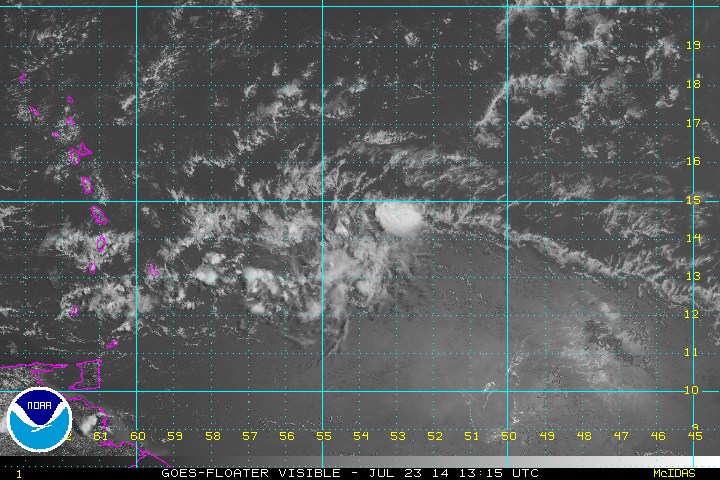
Tropical depression 2 is facing stronger wind shear as it approaches the Lesser Antilles. It is moving very fast for a tropical cyclone and will likely deteriorate into a tropical wave during the next 24 hours. Satellite imagery this morning shows deep convection on the decline which also indicates weakening.
As of 9 am EDT / AST tropical depression 02 was centered at 13.9N / 53.2 W or about 550 miles east of the Lesser Antilles. It was moving west at about 20 mph. Top sustained winds estimated at 35. Pressure was estimated at 1012 mb.
Forecast:
Tropical depression 2 is forecast to move WNW into the northern Windwards and southern Leewards overnight tonight.
Tropicast: Atlantic visible floater satellite
Rich Johnson
Twitter: https://twitter.com/richjohnsonwx
Certified Broadcast Meteorologist - Hurricane Expert
Twitter: https://twitter.com/richjohnsonwx
Certified Broadcast Meteorologist - Hurricane Expert
Who is online
Users browsing this forum: No registered users and 1 guest