Gabrielle
Posted: Thu Sep 05, 2013 8:05 am
Thursday Morning Update
Gabrielle?
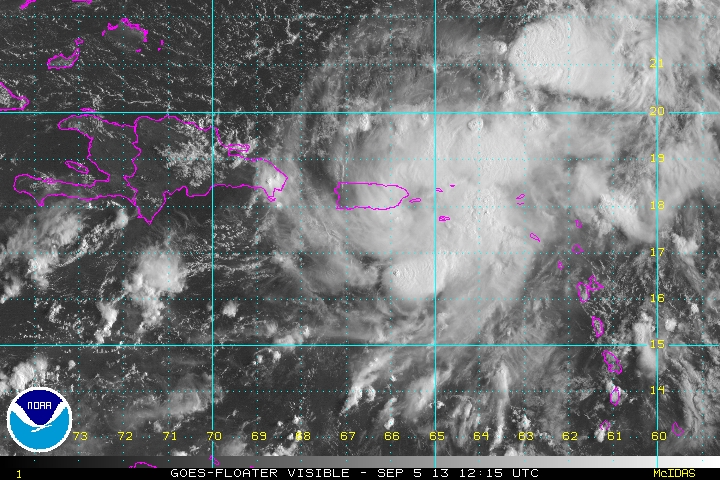
Deep convection has been looking impressive for the past few days in the northeastern Caribbean. An upper air trough north of the Caribbean coupled with a tropical wave appears to have organized the convection last night. NHC named Gabrielle last night as the IR satellite imagery showed an impressive circular structure of convection. This morning convection is collapsing near Puerto Rico and surface wind observations show little to support a 40 mph tropical storm. I do not believe that the circulation center is near the official location stated below. IMO, this feature is still a tropical depression and may become a storm north of Puerto Rico as some models suggest.
A reconnaissance aircraft will investigate later this morning so a much better understanding of this feature with be obtained.
As of 8 am ast (edt) Gabrielle was centered at 17.7 N / 67.4 W or about 65 miles wsw of the Ponce, PR. It was moving northwest at 8 mph. Top sustained winds estimated at 30 mph (40 mph NHC 8 am advisory). Pressure was estimated at 1008 mb.
Forecast models take Gabrielle northwest east of the Bahamas. The GFS model drifts it toward the Southeast coast several days from now then moves it out to sea with a cold front. Another model dissipates Gabrielle north of the Caribbean.
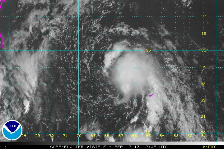
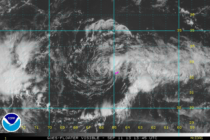
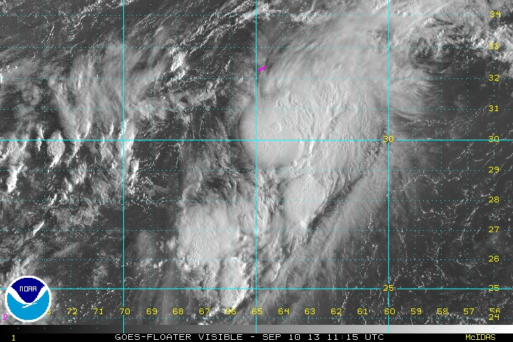
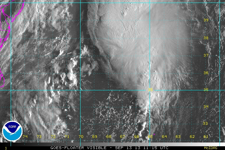
Tropicast: Visible Floater Satellite
Gabrielle?
Deep convection has been looking impressive for the past few days in the northeastern Caribbean. An upper air trough north of the Caribbean coupled with a tropical wave appears to have organized the convection last night. NHC named Gabrielle last night as the IR satellite imagery showed an impressive circular structure of convection. This morning convection is collapsing near Puerto Rico and surface wind observations show little to support a 40 mph tropical storm. I do not believe that the circulation center is near the official location stated below. IMO, this feature is still a tropical depression and may become a storm north of Puerto Rico as some models suggest.
A reconnaissance aircraft will investigate later this morning so a much better understanding of this feature with be obtained.
As of 8 am ast (edt) Gabrielle was centered at 17.7 N / 67.4 W or about 65 miles wsw of the Ponce, PR. It was moving northwest at 8 mph. Top sustained winds estimated at 30 mph (40 mph NHC 8 am advisory). Pressure was estimated at 1008 mb.
Forecast models take Gabrielle northwest east of the Bahamas. The GFS model drifts it toward the Southeast coast several days from now then moves it out to sea with a cold front. Another model dissipates Gabrielle north of the Caribbean.
Tropicast: Visible Floater Satellite