Shary
Posted: Fri Oct 29, 2010 12:16 am
Friday Morning Update
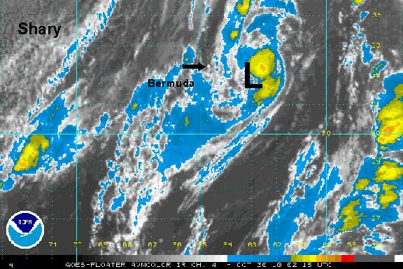
Shary classified overnight
After looking rather organized last yesterday, the hurricane center upgraded to the next tropical storm overnight. Shary is being sheard with deep convection on the western side of the circulation. Some of the showers are approaching Bermuda from the south. Shary is expected to turn north soon taking it close to Bermuda by this evening. No significant strengthening is expected as it passed near Bermuda. The greatest effects will be a period of heavy rain and gusty winds to 40-55 mph...depending on how close Shary actually comes to Bermuda.
As of 6 am edt / 6 am cdt Shary was centered near 28.6° N / 65.0° W or about 255 miles south of Bermuda. Top sustained winds are estimated at 40 mph ( NHC 5 am advisory 40 mph). Movement - northwest 18 mph. Pressure estimated at 1004 mb.
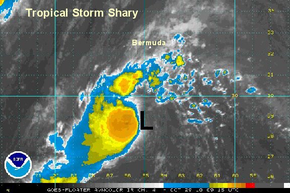
 Forecast models generally shary past Bermuda tonight and make it extratropical Saturday as it quickly moves away from Bermuda.
Tropicast: I.R. Floater Satellite
Shary classified overnight
After looking rather organized last yesterday, the hurricane center upgraded to the next tropical storm overnight. Shary is being sheard with deep convection on the western side of the circulation. Some of the showers are approaching Bermuda from the south. Shary is expected to turn north soon taking it close to Bermuda by this evening. No significant strengthening is expected as it passed near Bermuda. The greatest effects will be a period of heavy rain and gusty winds to 40-55 mph...depending on how close Shary actually comes to Bermuda.
As of 6 am edt / 6 am cdt Shary was centered near 28.6° N / 65.0° W or about 255 miles south of Bermuda. Top sustained winds are estimated at 40 mph ( NHC 5 am advisory 40 mph). Movement - northwest 18 mph. Pressure estimated at 1004 mb.
Tropicast: I.R. Floater Satellite