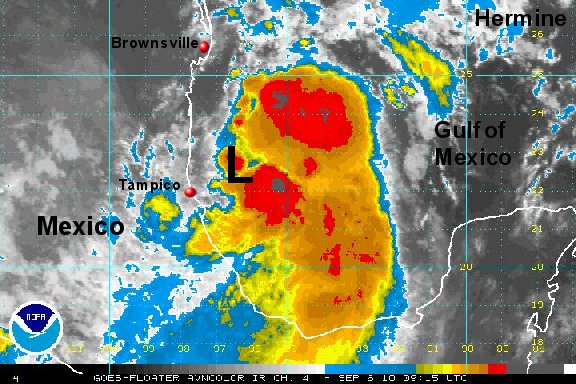
Tropical Depression 10 forming in gulf of mexico
***update....added official NHC info as td classified....
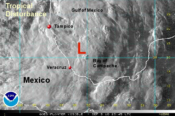
A large area of showers and storms have developed across the Bay of Campeche and southwestern Gulf of Mexico. This area of low pressure has formed on the tail end of a cold front. A surface circulation is apparent and more than enough deep convection is associated with it to classify this as the next tropical depression. There is a chance that it will become a tropical storm before making landfall in northeastern Mexico.
As of 7 pm cdt the tropical disturbance was centered roughly near 20.5 N / 95.5 W or about 200 miles southeast of Tampico, Mexico. Top sustained winds are estimated at 35 mph. Movement is northwest at about 5 mph Pressure estimated at 1003 mb.
Forecasts take this system north northwest into the northeast coast of Mexico over the next 1-2 days.
Tropicast: Visible Floater Satellite