Strong tropical wave near the Windwards ( July 19-21)

Tropical cyclone archives for the 2009 Atlantic hurricane season
Post Reply
User avatar
Tropical Inspector
Site Admin
Site Admin
Posts: 3697
Joined: Tue Feb 20, 2007 2:28 pm
Antispam: no
Location: Under a palm tree
Contact:

Strong tropical wave near the Windwards ( July 19-21)

Post by Tropical Inspector »

Sunday Evening Update

Tropical wave east of Windwards

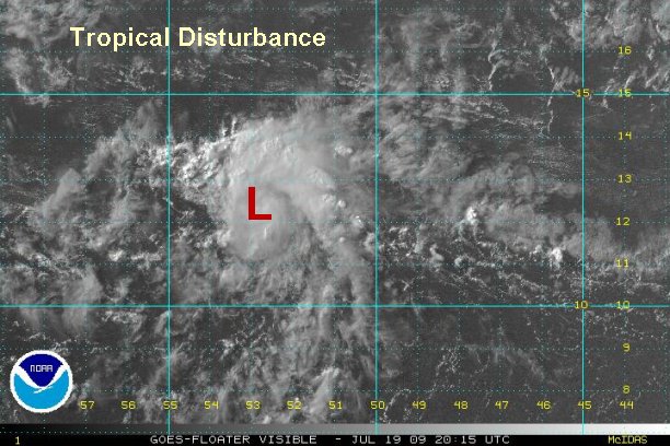
The sharp tropical wave is centered near 12.5° N / 52.5° W or about 575 miles east of the Windward islands. The wave is currently in somewhat favorable conditions, but westerlies are seen just to the west of the wave. This means that winds aloft should become more unfavorable for development soon. Forecast models show this trough lifting north in a few days, so if the wave can hold together there is some continued potential for development.

Right now, we are simply keeping an eye out for further development. The "L" on the satellite image does not denote a tropical depression but center of the wave.

Tropicast: Western Caribbean I.R. Satellite
Image
Rich Johnson
Twitter: https://twitter.com/richjohnsonwx
Certified Broadcast Meteorologist - Hurricane Expert
User avatar
Tropical Inspector
Site Admin
Site Admin
Posts: 3697
Joined: Tue Feb 20, 2007 2:28 pm
Antispam: no
Location: Under a palm tree
Contact:

Re: Strong tropical wave east of Windwards

Post by Tropical Inspector »

Monday Morning Update

Tropical wave east of Windwards

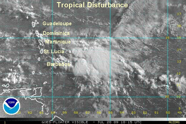
Deep convection on the tropical wave is centered from 12-14° N / 55-59° W not far east of Barbados and parts of the of the Lesser Antilles. The wave has flared up again this morning after weakening last night. The Quickscat missed the wave again, so no good data on the surface wind field is available at this time. :cry: Once more visible images come in it should help us see if a surface low is forming.

Heavy rain with flash flooding potential is possible as the wave moves through the Windwards and Leewards. At this time the heaviest precipitation is headed toward the northern windward's.

Right now, we are simply keeping an eye out for further development.

Tropicast: Western Caribbean Visible Satellite
Image
Rich Johnson
Twitter: https://twitter.com/richjohnsonwx
Certified Broadcast Meteorologist - Hurricane Expert
User avatar
Tropical Inspector
Site Admin
Site Admin
Posts: 3697
Joined: Tue Feb 20, 2007 2:28 pm
Antispam: no
Location: Under a palm tree
Contact:

Re: Strong tropical wave near the Windwards

Post by Tropical Inspector »

Monday Night Update

Tropical wave changing little

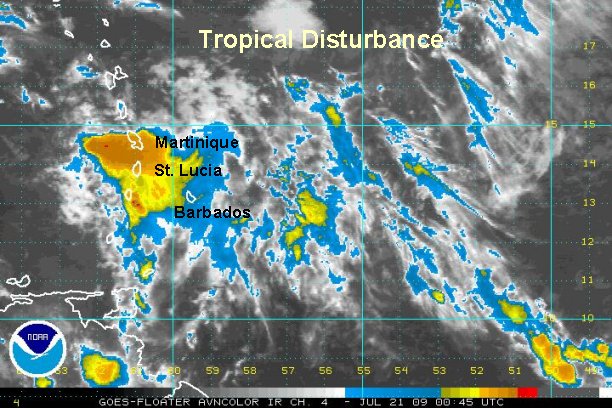
The tropical wave is now moving into the eastern Caribbean Sea with no more additional organization. The heaviest rain is moving through Martinique, St Lucia south through St. Vincent. Winds aloft continue to be unfavorable for development.

Right now, we are simply keeping an eye out for further development.

Tropicast: Western Caribbean I.R. Satellite
Image
Rich Johnson
Twitter: https://twitter.com/richjohnsonwx
Certified Broadcast Meteorologist - Hurricane Expert
User avatar
Tropical Inspector
Site Admin
Site Admin
Posts: 3697
Joined: Tue Feb 20, 2007 2:28 pm
Antispam: no
Location: Under a palm tree
Contact:

Re: Strong tropical wave near the Windwards

Post by Tropical Inspector »

The wave has moved into the central Caribbean this morning. Showers and storms associated with the tropical wave remain disorganized. This will be the last update on this wave unless development conditions change.
Rich Johnson
Twitter: https://twitter.com/richjohnsonwx
Certified Broadcast Meteorologist - Hurricane Expert
Post Reply

Return to “2009 Atlantic Hurricane Season Archives”

Who is online

Users browsing this forum: No registered users and 1 guest