|
|
Hurricane pictures / summaries 2007
Satellite images provided by NOAA / NASA / MODIS. Hurricane tracks courtesy of the National Hurricane Center.
 Click pictures for close up view Click pictures for close up view
|
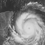
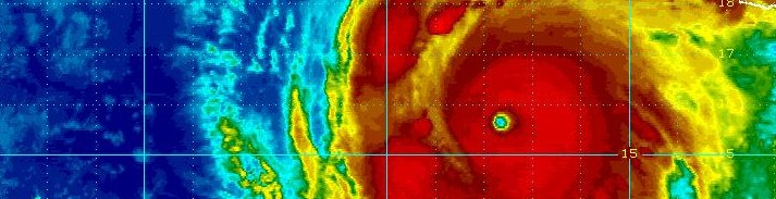
Hurricane Dean
August 20, 2007
Hurricane Dean moved through the islands near Martinique and St. Lucia. It strengthened as it moved toward Jamaica. The eye passed
just to the south of the island with the eyewall hitting the southern half of the country. Hurricane Dean moved south of the Cayman Islands
before making landfall as a category 5 hurricane near Costa Maya, Mexico. Dean reemerged in the Bay of Campeche and made a second landfall
in eastern Mexico as a minimal hurricane.
|
|
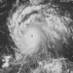
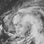
Hurricane Felix
September 2, 2007
Tropical Storm Felix moved through the southern Windward Islands with the center near Grenada. As Felix continued westward on an unusally far south track, it started to strengthen.
Felix deepened rapidly north of Aruba. Aruba, Bonaire, and Curacao had heavy rain and gusty winds. Felix's started to weaken as it continued westward. This trend stopped when the eyewall
repalcement cycle ended. Felix strengthened again several hours before landfall on the northeast coast of Nicaragua. It came ashore as a category 5 hurricane with top sustained winds of 165 mph.
|
|
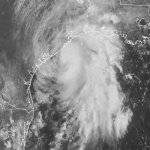
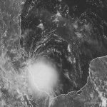
Hurricane Humberto
September 13, 2007
Hurricane Humberto experienced the fastest strengthening of a tropical cyclone from 30 knots to 75 knots. It strengthened 45 knots in 18 hours.
Just before landfall Humberto quickly developed an eyewall structure. It actually more resembled some type of mid-latitude mesoscale vortex. The
region of hurricane force winds were experienced in only a very small region where it came ashore near High Island, TX. Some places picked up large
amounts of rain, such as East Bay Bayou,TX with 14.13 inches.
|
|
Hurricane Karen
September 27, 2007
Hurricane Karen formed well east of the Lesser Antillies and dissipated as it approached within a few hundred miles of the Leewards.
Karen was upgraded to hurricane strength after a reanalysis near the end of the hurricane season. Karen threathened no land and caused no damage.
|
|
Hurricane Lorenzo
September 26, 2007
Hurricane Lorenzo formed in a similar manner like Humberto. After deep convection pulsed several times, it finally exploded just before
Lorenzo came ashore on the Mexican east coast in the vicinity of Tuxpan. Lorenzo had the same calling card with a very small center of hurricane force winds
which probably didn't exceed 20 miles in diameter. Locally heavy rain also coincided with the landfall.
|
|
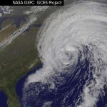
Hurricane Noel
November 2, 2007
Hurricane Noel was an extremely late forming hurricane. It started out as a low northeast of the Leeward Islands. It drifted west-southwest over the Virgin Islands and Puerto Rico bringing heavy rainfall. It started to orgainized rapidly south of Hispaniola, but as it moved north over Haiti, the circulation was disrupted. Noel struggled westward moving over Cuba. Noel continued to bring heavy rain to eastern Cuba as well as the Dominican Republic and Haiti. There were over 100 deaths reported from flooding on Hispaniola, most in the D.R. where 30" of rain was estimated.
Noel began to organize as it moved through the Bahamas and became a hurricane briefly north of the Bahamas before becoming extratropical. Noel moved north rapidly making landfall on the southwestern tip of Nova Scotia. Peak winds gusts were 72 mph at Nantucket,MA. Over 100 reports of tree and power line damage was reported, mostly in eastern Massachusettes. Rainfall amounts were in the 2-4 inch range on Cape Cod with 4.00 being reported at South Yarmouth, MA.
|
Hurricane pictures and summaries main page.
|
|
|
)
)
)
)
)
)
)
)
)
)
)
)